![]()
![]()
![]()
![]()
![]()

|
|
|
|
River Grove Sanctuary San Jacinto, California
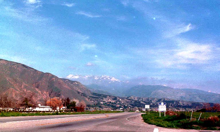
Approaching the River Grove Sanctuary heading east on the Ramona Expressway at San Jacinto Avenue, north of the city of San Jacinto California. Directly ahead is snow capped Mount San Jacinto shrouded in clouds. Photographed at the beginning of March 2001 about 4 pm on 35 mm film with a normal 50 mm lens, and using a low resolution negative scan from Wal-Mart via web to a 57 KB JPEG file.
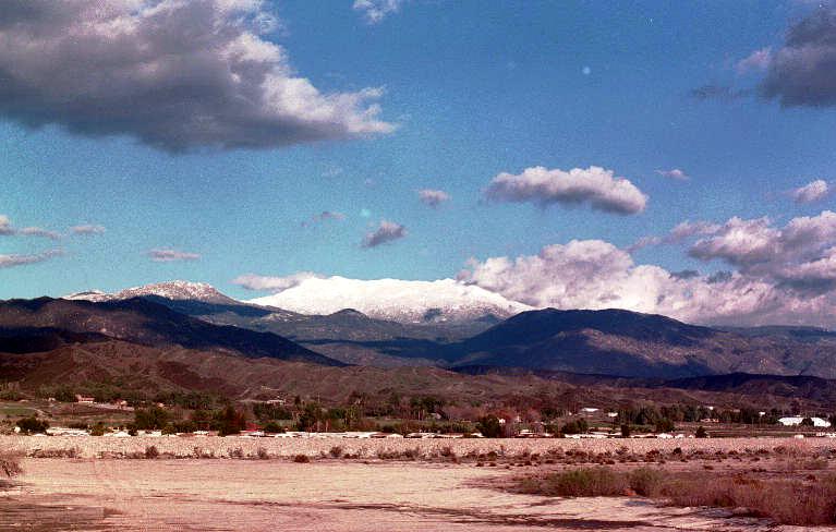
Snow capped Mount San Jacinto a little further east along the Ramona Expressway on the bridge to the Soboba Native American Reservation. Photographed about the beginning of March 2001 about 4 pm, on 35 mm film with a 50 mm lens and negative scanned to a 62 KB JPEG file. Palm Springs and the low desert is immediately on the other side of 10,804 foot high Mount San Jacinto, with a very steep descent into the desert. On this side of the mountain we are at 1500 feet elevation while the Palm Springs side is about 400 feet elevation. With water, agriculture is productive on both sides, however suburban sprawl is considered more profitable and displaces the agriculture and the remaining wilderness. Population growth throughout the United States and perhaps anywhere is undoubtedly considered essential to fuel expansion and profits. We are of course working at restoring the original forests and incorporating food producing plants based on rain fall, not aqueducts, for the survival of all threatened species. Numerous birds also migrate through this area and can utilize water, trees and protection to provide for their annual journeys. (62 KB JPEG file)
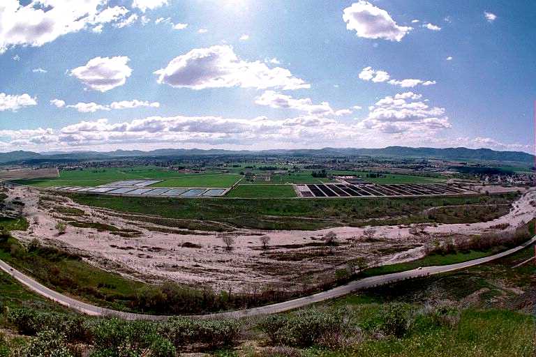
120 degree wide angle view of the San Jacinto valley facing southwest. Photographed March 12, 2001 from the foothills of the San Jacinto Mountains at an elevation of approximately 2,300 feet, or 800 feet above the valley floor of 1,500 feet, using a 35 mm Pentax ZX-M with a Pentax Fish-Eye 17mm f:4 lens (180 degrees diagonal) using Kirkland color negative 200 film, from a Fuji Film CD to a 64 KB JPEG scan. Gillman Hot Springs or Soboba Road is in the foreground, to the left or east leading to the Soboba Indian Reservation and Casino, to the right or west to the Scientology media production center, then to the 60 freeway which connects Los Angeles to Palm Springs then further east to Phoenix Arizona. South or above the road is the San Jacinto River which flows during rains, then to the left are percolation ponds of the water district used to partially recharge the water table and provides some interest to migrating water fowl. The rectangular plots to the right are nursery production facilities and in the center is the River Grove Sanctuary. Further in the distance is the town of San Jacinto then the town of Hemet and to the far right is Mount San Jacinto College. Over the distant hills to the right is the city of Riverside and a large University of California Campus with the largest agricultural and botanical facilities in southern California along with excellent science and research libraries.
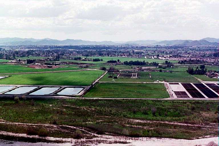
View of the San Jacinto valley and River Grove facing southwest, March 12, 2001, from an elevation of approximately 800 feet above the valley on the foothills of the San Jacinto Mountains, with the San Jacinto River in the foreground, and photographed with a standard 50 mm lens (converted to a 61 KB JPEG file).
|
Send mail to [email protected] with
questions or comments about this web site.
|