
Welcome to the Rising Dawn Weyr Map pages.
Please click on any of the links below to explore our Weyr.
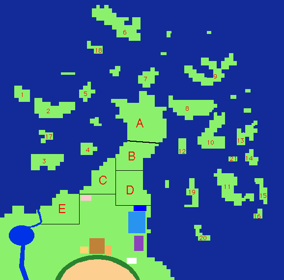
This is a map of the area controlled by Rising Dawn Weyr. On the mainland, area A is the beast pens and stables, B is the General Workers' Living Area, C is the Crafters' Living Area, D is the Dragonriders' Living Area, and E is the Crafters' Working Area. The curved line represents the wall of the extinct volcano that makes up the Rising Dawn Hatching Grounds. This crater has been eroded away over many Turns and is no longer circular in shape. The gold box is the kitchens, the bronze box is the Dining Hall, the tiny brown box is the conference hall, the light blue box is the dragon infirmary, the darker blue box is the human infirmary, the purple box is the Weyrling barracks, and the white box is the Candidate barracks. The Weyrleader's official office is in the back of the conference hall, and the Weyrlingmaster and Candidate Master offices are in their respective barracks.
 To the Misc. Information Index
 To the Home page