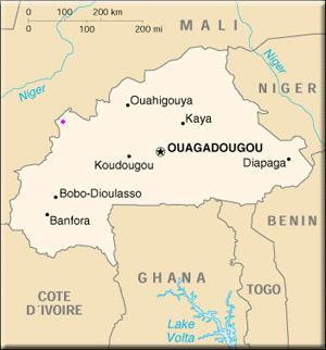
Burkina Faso is a small country about half the size of France and situated in the heart of West Africa. Whilst the Niger River istself does not flow through the country -- the interior delta of the Niger skirts in an arc round the north and east of Burkina -- several of the Niger's small tribuataries, like the Sirba and the Tapoa, do rise up in Burkina Faso's high plateaux before flowing in an easterly direction
Burkina Faso is a landlocked country situated in the heart of the Sahelian region, more than 500 km north of the Gulf of Guinea. As its economy depends largely on the import and export of transportable goods to and from Europe by boat, the Burkinab� are obliged to travel southwards to ports of neighboring countries, like Abidjan in C�te d'Ivoire, Tema in Ghana, Lom� in Togo, and Cotonou in the Republic of Benin.
Sandwiched between the humid, southern countries (C�te d'Ivoire, Ghana, Togo and Benin) and the Sahelo-Saharan countries in the north (Niger and Mali), Burkina Faso is comprised of often very flat, sometimes monotonous savanna. As most of the country lacks in any real high grounds, Burkina Faso has always served as an easy passage between the region bordering the Niger River where the major empires like the Mali and Songhai empires developed, and the small southern kingdoms in the tropical forests or along the Atlantic coast, like the Ashanti kingdom in Ghana, the Dan-H�m� kindom in Benin, and the Sanwi kingdom in C�te d'Ivoire.
Numerous migratory groups of all origins have thus passed through and sometimes even settled in Burkina Faso, for example the Mossi, originally from Ghana and perhaps before that from Lake Chad, the Mande (Marka, Samo, Bisa, Samoro, etc.) from Mali, and the Fulani and Tuaregs who, even today, continue their eternal nomadic migrations.

