GPS and Map reading
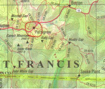
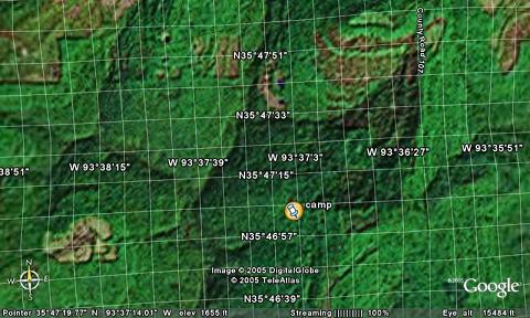
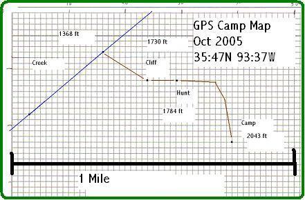
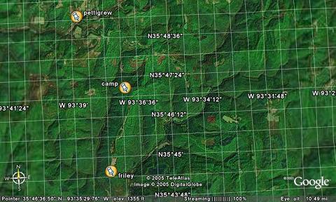
Red dots near 'C' in Francis is closed to my Gps points from camp.
This topo map is scanned from DeLORME Arkansas Atlas and Gazetteer.
Converting my deer camp GPS Lat and Long map points and Determining the Distance between 2 of my GPS map points was easy using:
http://www.wcrl.ars.usda.gov/cec/java/lat-long.htm
Graphing my GPS lat and long map points was easy. I found computer graph paper at:
http://www.mathematicshelpcentral.com/graph_paper.htm
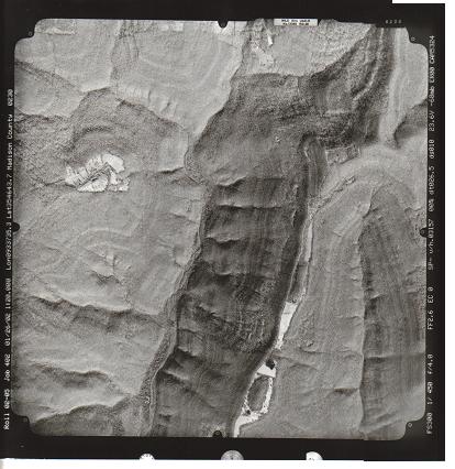
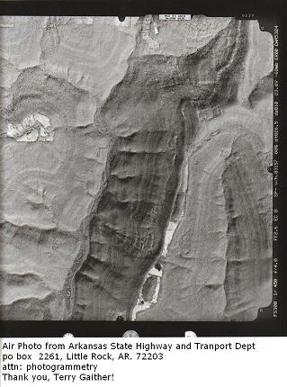
An other map idea is:
Geodetic systems or geodetic datums are used in geodesy, navigation, surveying by cartographers and satellite navigation systems to translate positions indicated on their products to their real position on earth. The systems are needed because the earth is not a perfect sphere. Examples of map datums are:
WGS 84, 72, 64 and 60 of the World Geodetic System
NAD83, the North American Datum which is very similar to WGS84
NAD27, the older North American Datum, of which NAD83 was basically a readjustment [1] OSGB36 of the Ordnance Survey of Great Britain ED50 : the European Datum
The difference in co-ordinates between datums is commonly referred to as datum shift. The datum shift between two particular datums can vary from one place to another within one country or region, and can be anything from zero to hundreds of metres (or several kilometres for some remote islands). The North Pole, South Pole and Equator may be assumed to be in different positions on different datums, so True North may be very slightly different. Different datums use different estimates for the precise shape and size of the Earth (reference ellipsoids).
The difference between WGS84 and OSGB36 is up to 140 metres / 450 feet, which for some navigational purposes is an insignificant error. For most applications, such as surveying and dive site location for SCUBA divers, 140 metres is an unacceptably large error.
The main reason that there are a number of datums is that before the advent of GPS positioning, national map making organisations did not have a common surveying reference point and only produced maps for their locality.
So, I have topo maps, road maps and GPS on different datums?
Be careful to check or you will be a datum dummy!
Info from: http://en.wikipedia.org/wiki/Map_datum
An other map source is:
http://terraserver-usa.com/