
|
|
|
Access InformationThe Bay Trail around the Port of Redwood City is a somewhat isolated segment. There are no off-road trails connecting it with the Bay Trail segments to the east and west. From Bayfront Park in Menlo City, the proposed Bay Trail follows along Haven Avenue. This is primarily an old industrial area, with no views of the Bay. There are no bike lanes on 2-lane Haven Avenue. Haven turns into East Bayshore Road, which follows along several mobile home parks, a junkyard, and some commercial office buildings. A tall soundwall separates the road from Hwy 101. There is a bike path only along the north side of the road, but it ends when the road turns to the right to meet Seaport Blvd. At the intersection of Seaport Blvd. and East Bayshore Road, the Bay Trail begins. It runs along Seaport Blvd. You can reach Seaport Blvd. directly by taking the Seaport Blvd. exit from Hwy 101. Unfortunately, there is no convenient parking at the start of the trail.There is plenty of parking in the marina area. You can cross Seaport Blvd. and go to the Redwood City boat ramps at Chesapeake Drive or farther along to the Redwood City Marina at Seaport Court. If you continue on Seaport Blvd., you come to Pacific Shores Center. There are several large parking lots for visitors and trail users. The Bay Trail runs along the edge of the center and ends on Westpoint Slough near Redwood Creek. Since parking is limited at East Bayshore Road and no parking is allowed on Seaport Blvd., it's best to park either at the boat ramps, the marina, or the visitor's lots at Pacific Shores Center to enjoy this section of the Bay Trail. |
|
Description
and Views
The sections below describe
the following trail sections: Seaport Blvd
from its start at East Bayshore Road to Pacific Shores Center; the
trails and parklands at Pacific
Shores Center itself, the trails and parks along the waterfront at
the Port of Redwood City and marina; and
the trail along Redwood Creek around Seaport
Centre. The mileage
readings below were taken using a GPS receiver. Your mileage may vary. |
|
Seaport Blvd.This trip begins at the start of the trail at the intersection of East Bayshore Road and Seaport Blvd.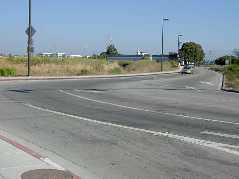 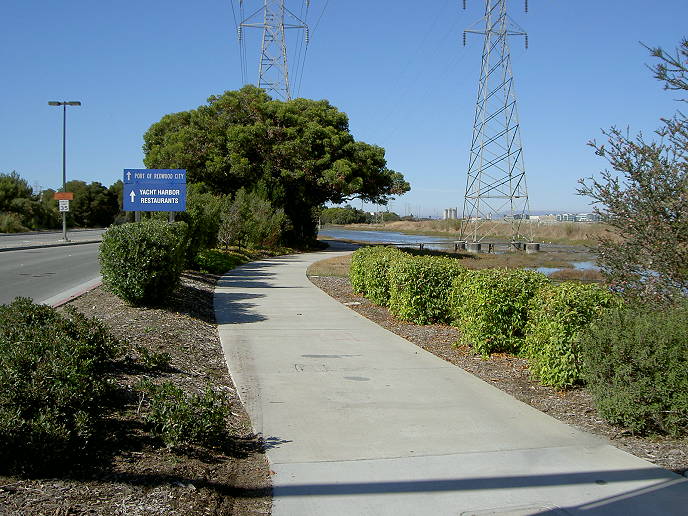 This
is the start of the trail,
which
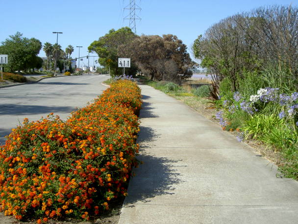
is a wide concrete sidewalk running next to Seaport Blvd. To
the right, you can see the corner of a large salt pond. If the Bay
Trail someday goes along the edge of the salt pond, you should be able
to take it all the way to Bayfront Park
in Menlo Park.
 The trail runs next to a marsh, with power towers 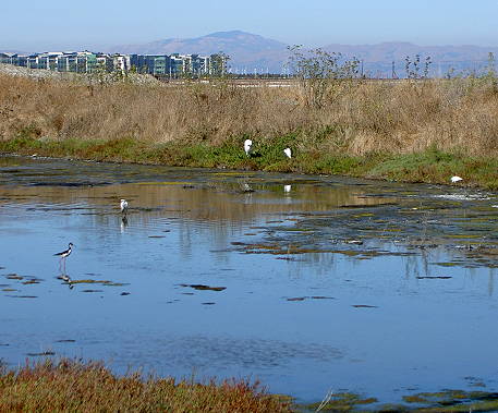 Birds in the marsh by the trail: 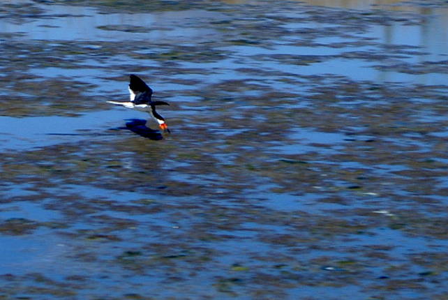 A skimmer feeding in the marsh 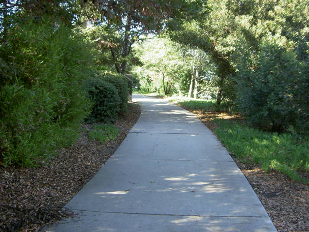 The trail is landscaped. This is a
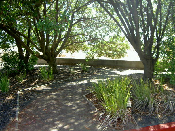
shady part. The trail reaches an
intersection with Chesapeake Drive 0.4 miles from the start. You can
cross at the signal and
follow Chesapeake Drive to reach the boat docks.
 The trail approaches the
intersection of Seaport Blvd. and Seaport Court. There is a signal
here, 0.7 miles from the start of the trail.
Cross at the signal to reach the marina. Also, Seaport Blvd.
splits into 2 parallel roads. The main road on the east goes to Pacific
Shores
Center. The trail continues on running next to this road. The frontage
road on
the west allows access to the port facilities and a small park (see
below).
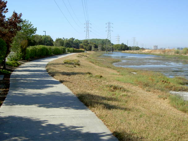
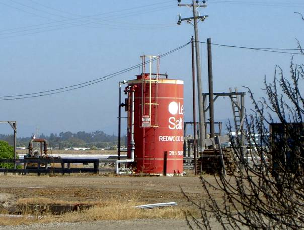 The salt ponds east of the trail
were originally owned by the Leslie Salt Company. There is a large tank
here that looks like a container of salt.
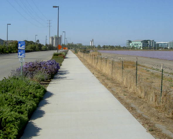 This is a view looking up the trail, which runs next to Seaport Blvd., with salt ponds on the right. 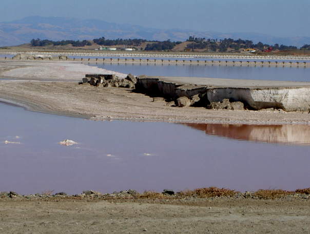 This is a view east across the
salt
ponds of the hills at Menlo Park's Bayfront Park, the next off-road
section of the Bay Trail to the southeast.
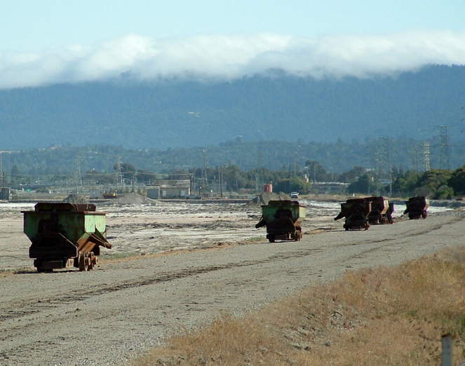 The appearance of the salt ponds
changes
with the seasons. After the salt is dried, it is scraped off the
drying
beds and loaded into rail cars like these above for processing.
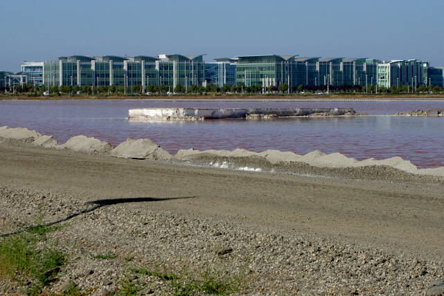 This is a view northeast across the salt ponds to Pacific Shores Center. |
|
|
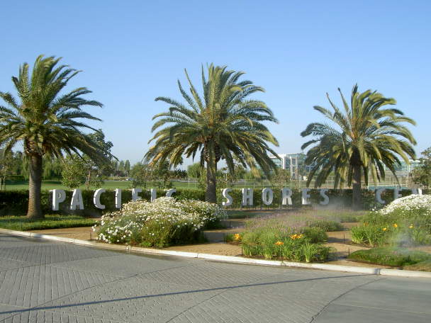
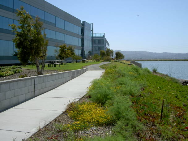
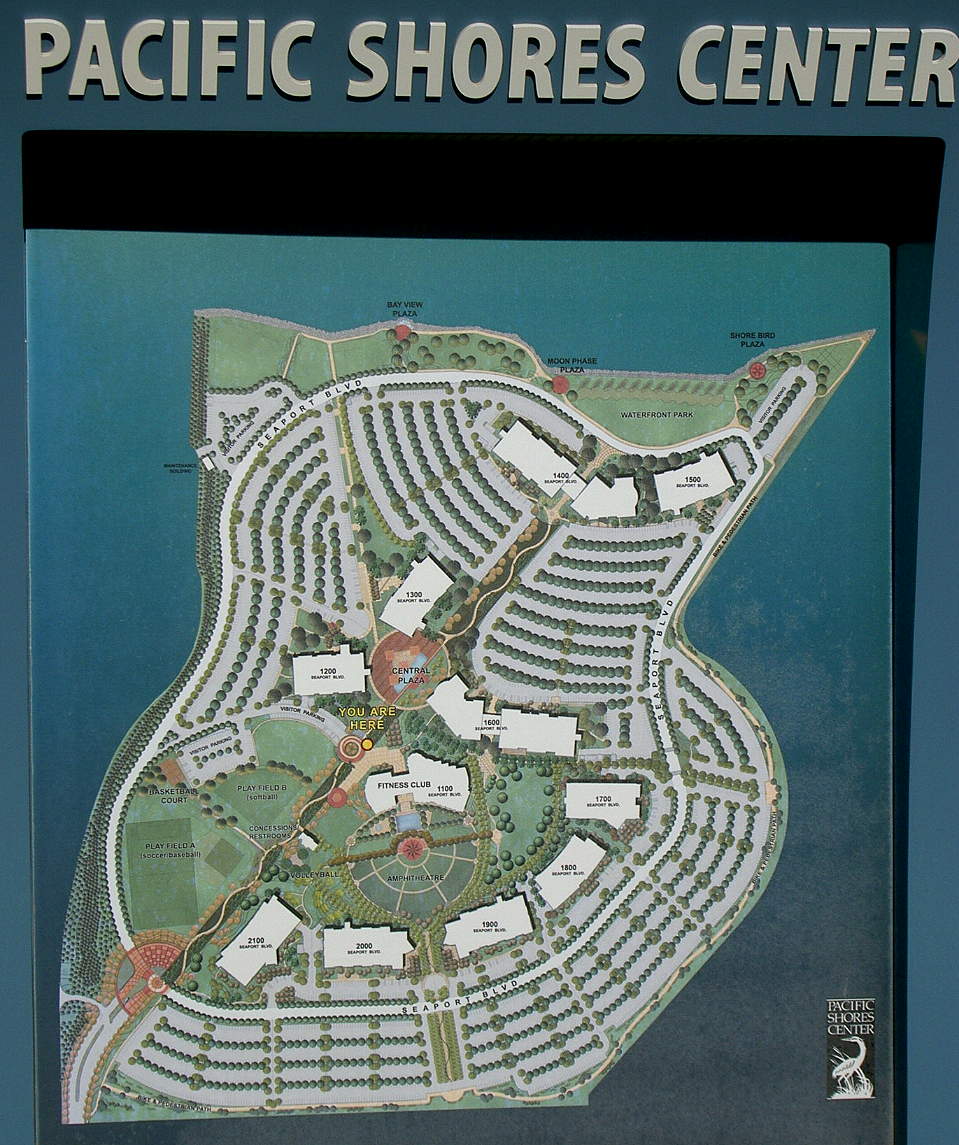
Pacific Shores Center is a large
industrial park at the end of Seaport Blvd., 1.3 miles from the start
of the trail. The buildings house a number of high-tech businesses,
including a well-known computer animation company. There are extensive
recreational facilities in the middle of the complex. A public trail
runs around the
perimeter of the center and leads to a park along Westpont Slough. (See
here for a map of the center.)
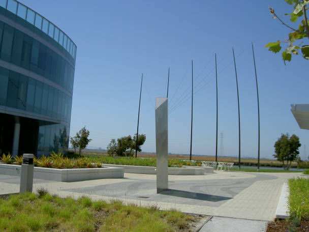
 Pacific Shores Center Entrance 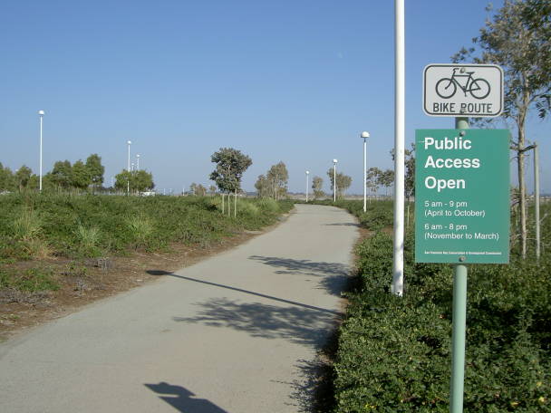 Start of the trail around the perimeter of Pacific Shores Center 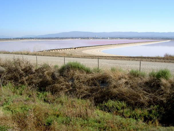 View of the salt pond from the trail 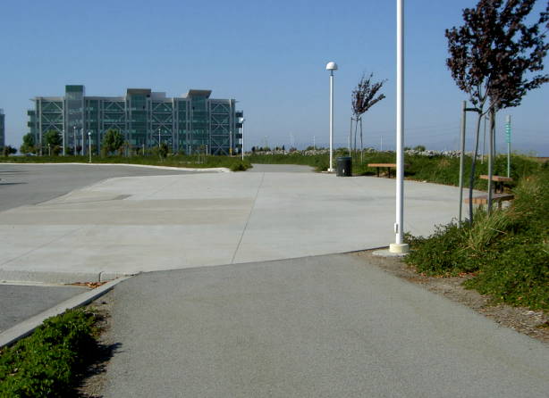 Along the trail are rest areas, like this, with benches. 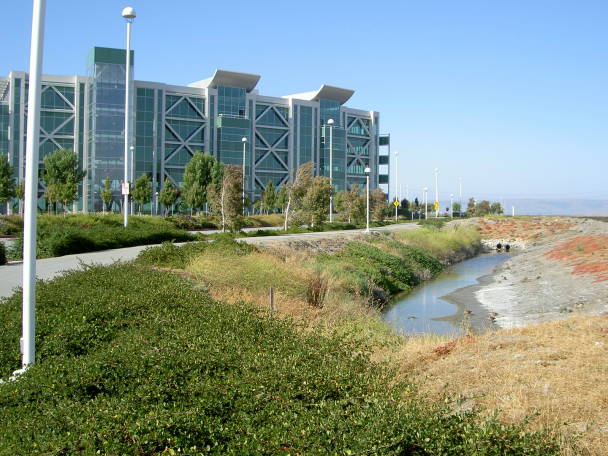 The trail turns and runs next to a drainage channel. At the end is a large visitor's parking lot. 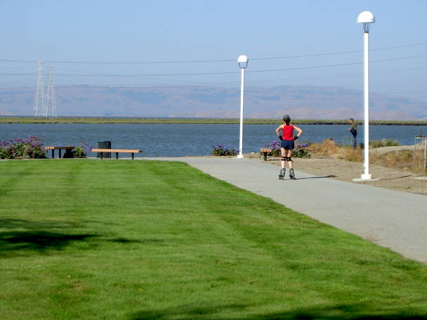 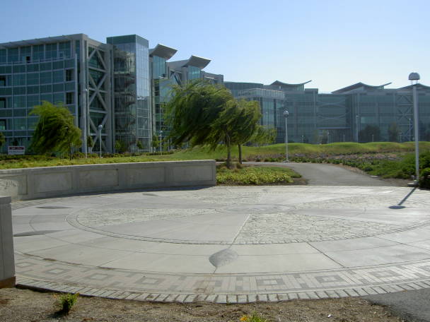 There are 3 plazas along the waterfront. This one is called Shore Bird Plaza. 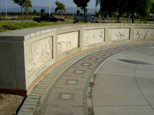 Along the wall are relief sculptures of shore birds. 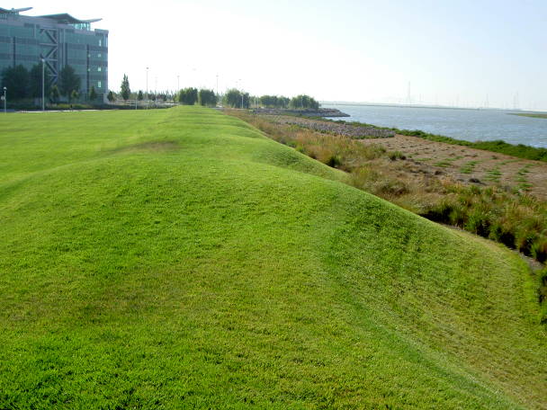 There is a large lawn with wavelike berms west of Shore Bird Plaza. 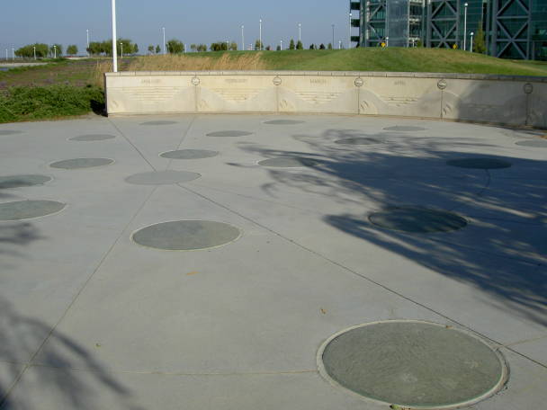 This is Moon Phase Plaza, showing phases of the moon 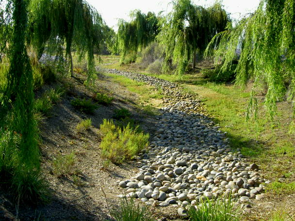 Running through part of the park is an area landscaped to look like a meandering creek bed. 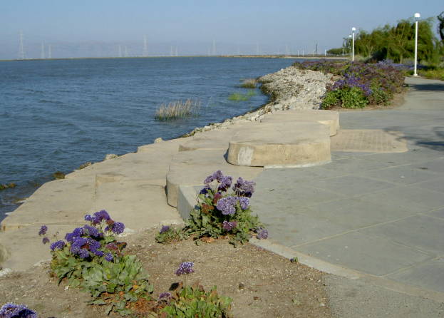 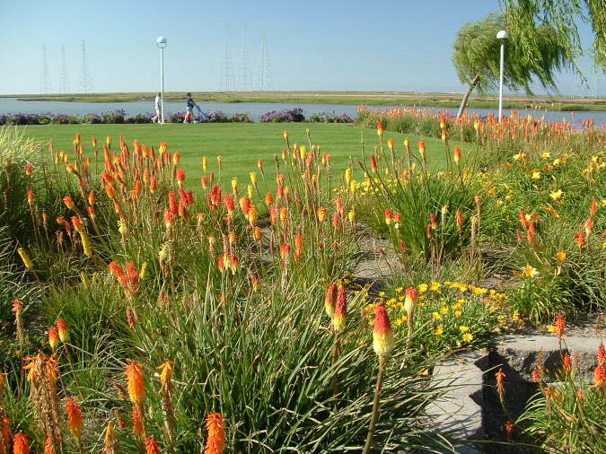 There is a large lawn at the west end of the park, surrounded by gardens 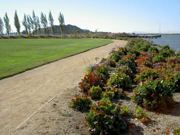 The trail turns into a smooth gravel surface 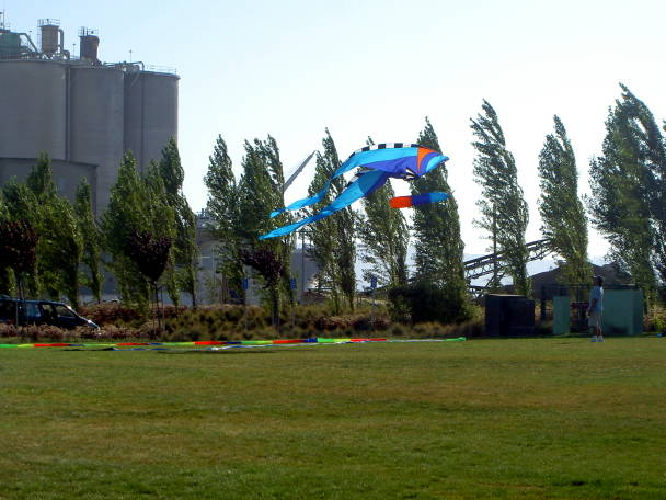 The lawn is a popular place for
kite-flying. Behind it are bulk-processing facilities at the port.
There is a large visitor's parking lot next to the lawn.
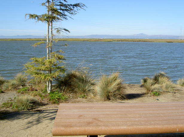 At the end of the trail, 2.6 miles
from the start, is a picnic table, overlooking Westpoint Slough
and Greco Island. You can see Redwood Creek to the west.
To return, either back-track along the trail, follow the road through Pacific Shores Center, or go through the middle of the center. 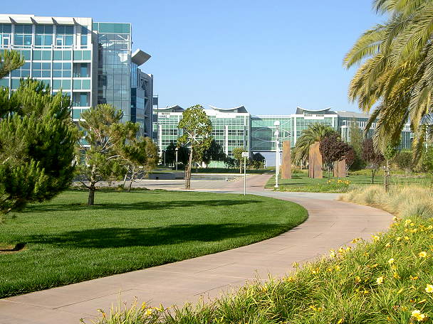 There are walkways, lawns, pools, and sculptures in the center. 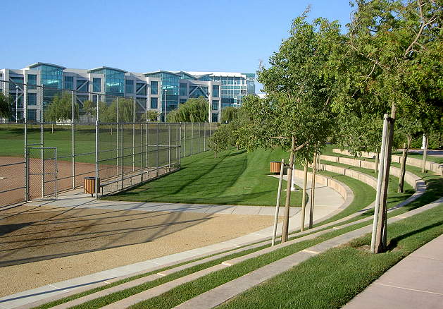 The center has playing fields and a recreation center. |
|
|
Redwood City's port and marina lie
west of Seaport Blvd. along Redwood Creek. Parts of the waterfront are
private and off-limits to the public. Other parts are
publicly-accessible. There is a small park here. To reach it, you must
be on the frontage road west of Seaport Blvd. Turn west on Herkner Road
at the Port Office. There
is a gate and guardhouse, but the shore is open to the public from 8 am
to 5 pm daily.
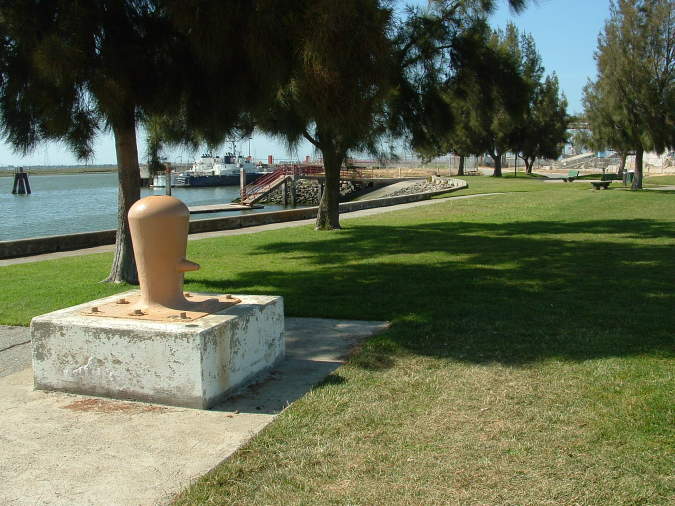 This is a view of the small park, which has benches, lawns, and picnic tables. 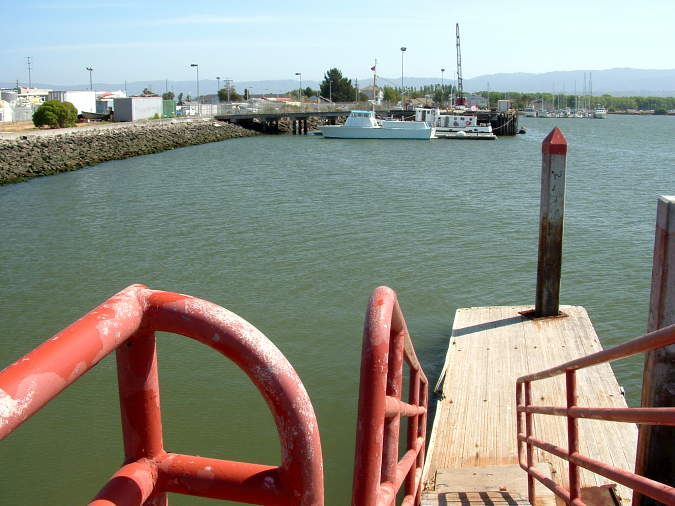 There are boat docks here. The
area to the south is off-limits to the public, so there is no direct
route along the waterfront to the marina. To reach the Marina, go back
on the frontage road, head south, and turn right on Seaport Court.
The marina has
some
newly-constructed
buildings in the Cape Cod style, which are mostly professional offices.
The buildings are surrounded by nicely-landscaped lawns.
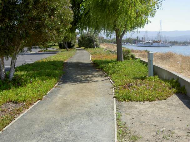
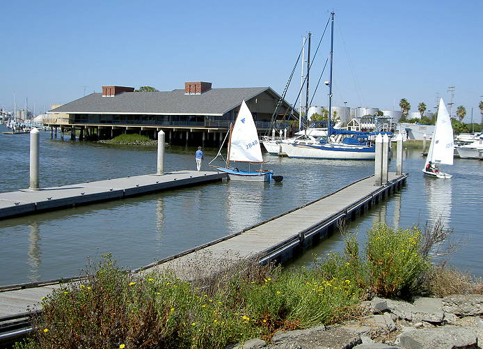
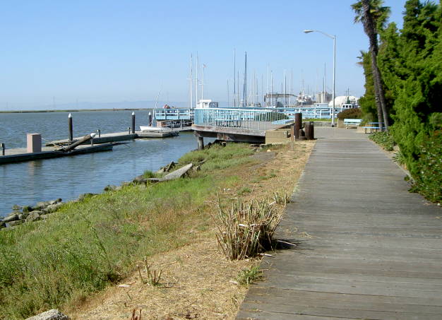 Here is a boardwalk leading to a
viewing platform along the waterfront, with picnic tables. The other
end of the boardwalk leads to a conference center.
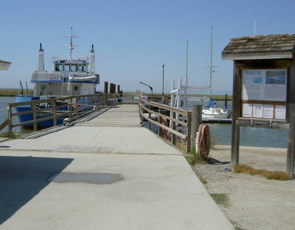
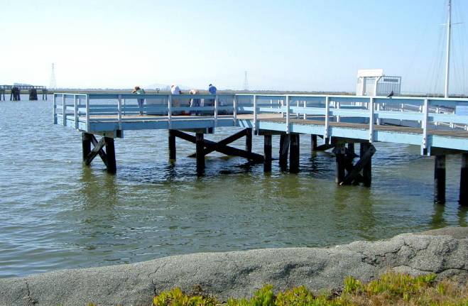 This is a public fishing pier on Redwood Creek. On the other side of Redwood Creek is Middle Bair Island. 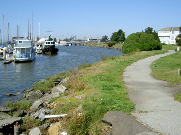 A paved
path
winds between the lawns and the waterfront. Benches and shade trees
are
along the path. The benches provide nice views of the boats sailing in
and out of the harbor. Boats of all size, including some large luxury
yachts are
docked in the marina.
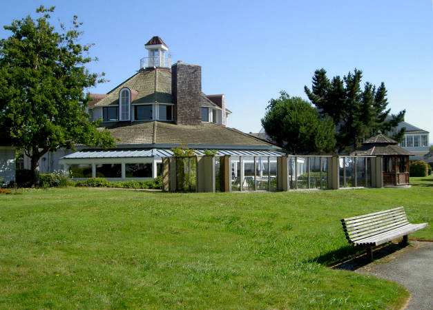 Restaurants occupy a large circular building. They have a gazebo and an outdoor dining area behind a glass wall. 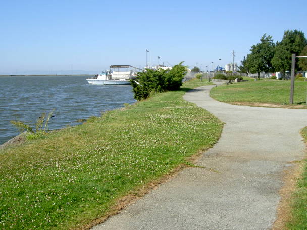 This is near the end of the path and lawns. The area beyond is fenced off. 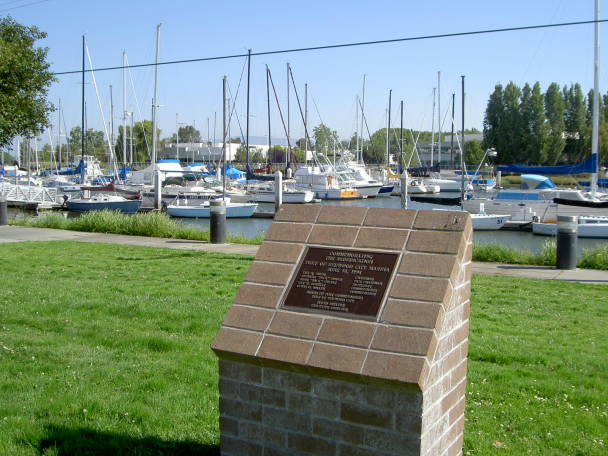 Returning back near the conference
center, this plaque commemorates the rededication of the Port of
Redwood City Marina in 1994. Farther along to the left is a sailing
school and a yacht club. The sidewalk runs along the edge of the marina.
 As it nears Seaport Blvd., the sidewalk turns and runs around the end of the marina. 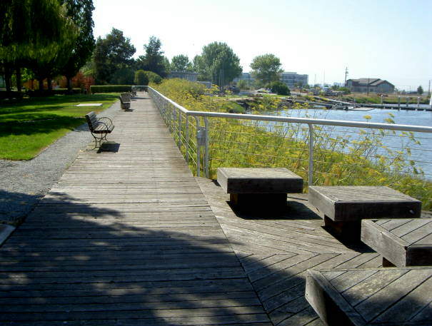 Opposite the marina is a long boardwalk with benches. 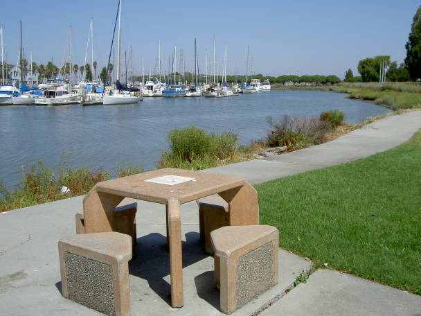 The boardwalk ends at the lawn and sidewalk by the boat launching facility. There are benches and tables here. 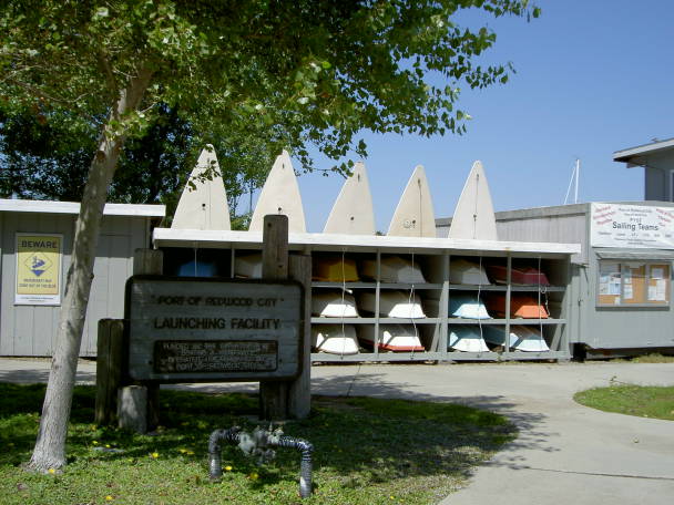 |
|
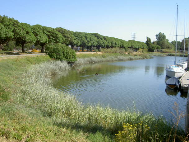
Seaport CentreThere is a 0.7-mile long stretch of public trail (not part of the Bay Trail) along Redwood Creek at the edge of the Seaport Centre industrial park. To reach it, take Chesapeake Drive to Saginaw Drive. Turn right on Cardinal Way.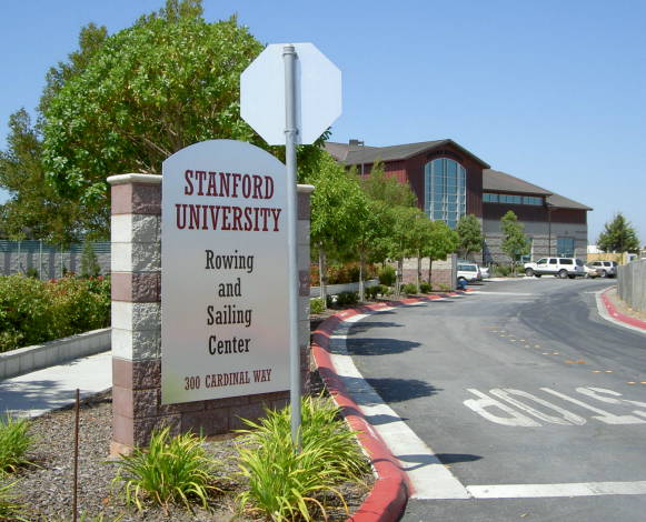 Cardinal Way leads to Stanford
University's Rowing and Sailing Center. This is a large boathouse
facility open to Stanford students and staff. There are a few public
parking spaces to the right of the boathouse.
 Beyond the rowing center is the
Marine Science Institute. This is a non-profit educational institution
offering science and environmental education programs. The
institute
runs the educational Discovery Voyages boat trips on the bay for school
children.
  One of the buildings has an interesting sculpture made of poles and cables.  The path follows a bend in
Redwood
Creek. On the other side of the creek is Middle Bair Island, which is
not open to public access.
 The path runs between the parking lot for the industrial park and Redwood Creek. 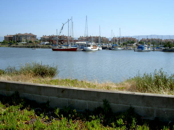 Across Redwood Creek, you can see the boats docked at Pete's Harbor. 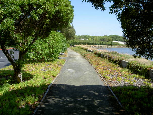 The path is shaded by trees, then runs under a solid line of bushes. 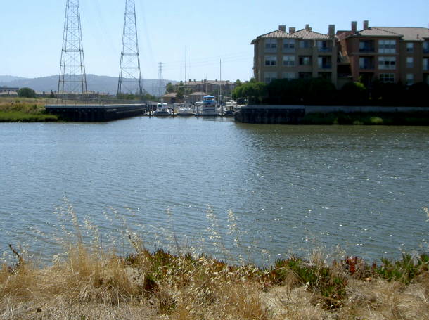 Across the channel is the entrance
to the Bair Island Marina. Near it is
the parking lot and access point for the trail leading to Bair Island.
Redwood Creek
 The path ends at the end of the parking lot of the industrial park. The area beyond is not open to the public. At the time of this writing, there is currently no official Bay Trail route from Seaport Blvd. north to the next section at Bair Island. There is a pedestrian bridge over Redwood Creek next to Hwy 101, but the only way to reach it is through the private (but open to the public) Docktown Marina. The bridge leads to an empty field next to the newly-built Peninsula Marina on Bair Island Road. If you take Bair Island Road to the right, it leads to Pete's Harbor. This is another marina with a wide variety of boats. From here you can look across the channel to get a good view of Bair Island. There is a large new parking lot for Bair Island. Across the street, a trail leads to the entrance of Bair Island itself. Bair Island is actually a series
of
three islands that
were former salt ponds. Parts of the outer two islands are part of the
San Francisco Bay National Wildlife Refuge. The inner island is the
only
one accessible from land and was recently purchased by the Peninsula
Open
Space Trust. It is open to the public and is a popular place for
jogging,
dog-walking, and biking. Rules are posted. Levee trails lead around the
perimeter of the island, with views of San Carlos Airport, Steinberger
Slough, Smith Slough, and the outer islands. Other trails cross through
the center of the island. The inner island is a mixture of dry mud
flats,
wetlands, and waterways. There are plans to restore the marshland on
the island and provide new Bay Trail routes. |
|
LinksPort of Redwood City, Overview, History, Facilities Map, Recreational FacilitiesRecreation & Waterfront Access at the Port of Redwood City & Seaport Boulevard Area Stanford Crew Boathouse Stanford Sailing offers community access Marine Science Institute History of the Port of Redwood City Historic Photos: Port of Redwood City Navigation Chart to Port of Redwood City Port of Redwood City: Seaport of Silicon Valley, California Map to Redwood City boat launching area Bits of History: Pictures of Redwood City Westpoint Marina San Mateo County South Bay Salt Pond Restoration Project Pacific Shores Center |