|
|
|
|
|
|
|
|
|
|
|
|
Squaretop Mountain Elevation: 11,652 feet Mileage: 28 miles Vertical Gain: 3,600 feet Route: Beaver Park / Granite Lake |
Squaretop mountain is the emblem of the Wind Rivers and is the most photographed peak in the range. The road to the Green River Lakes area can be rough at times but it is definitely worth the drive. When visiting the Green River Lakes you have to at least hike to the Upper Green River Lake. The Green River above the upper lake is really green and most of the color comes from silt that falls out into the upper lake. The lower lake and the river from this point below isn't near as green. It's definitely worth the trip up to the upper lake.
July 16, 2001
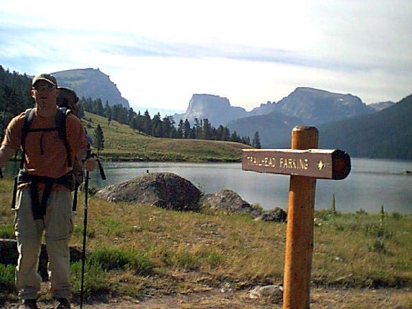
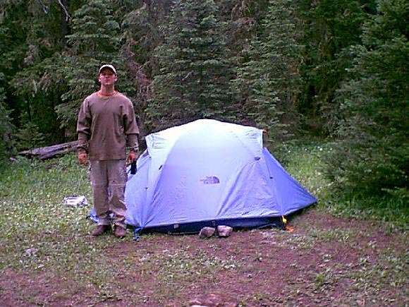
Leaving from the Green River Lakes trailhead at around 9:30 am we followed the highline trail around the left side of the lower Green River Lake. After about 3 miles you come to a large bridge crossing the Green River and from there it's less than a mile to the upper Green River Lake. In the photo below I'm at the trailhead with Squaretop rising in the background about 10 miles away. From this distance Squaretop doesn't look 3 times higher than Devil's Tower but I promise you it is.
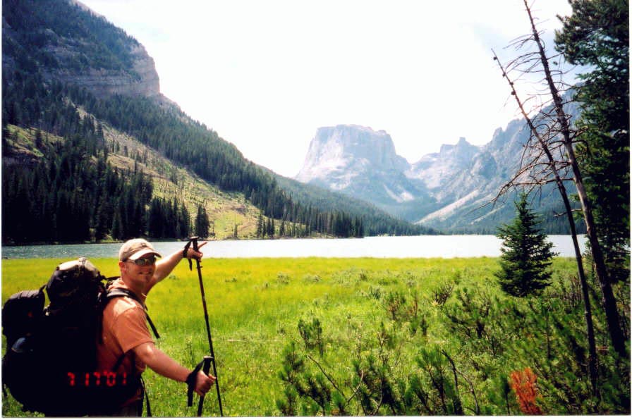
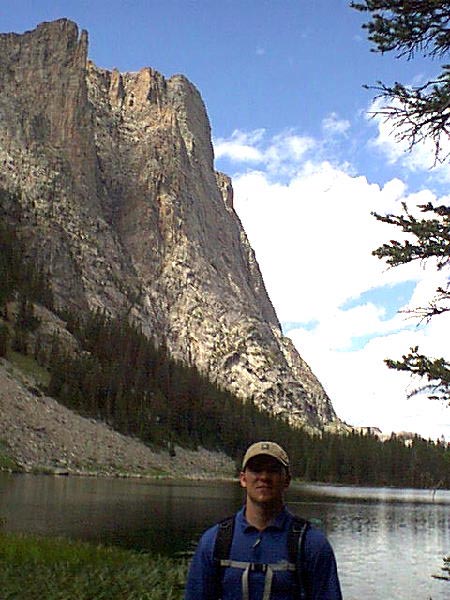
The photo below is taken from the upper Green River Lake about 4 miles into the hike. Squaretop is getting ever closer.
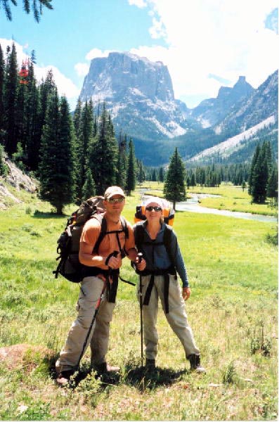
The photo below was taken above the upper lake where we decided to have lunch. Not a bad view huh?
We decided to set up camp at Beaver's Park around 3:30 pm right after you cross another bridge over the Green River. There is a large meadow with lots of campsites all around. After finding the trail and making it to Granite Lake the next day we were glad we didn't carry our packs to Granite Lake. From Beaver Park the old horse trail to Granite Lake climbs almost 1300 feet in less than a mile. For those of you who don't climb much, that means it goes straight up for a long time.
July 17, 2001
We were on the trail at about 7 am and up over the steep trail to Granite Lake by 8 am. The photo below is taken from Granite Lake on our attempted summit day. The lake sits at about 9200 feet elevation leaving you over 2000 feet more to go straight up. After Granite Lake you are on your own to find your way up Squaretop. The trail disappears and the guide book we were using was written about 30 yrs ago and many of the landmarks mentioned did not exist anymore.
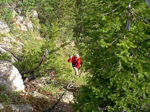
Below Linda is make her way up the steep slopes on the side of Squaretop. Some of the mountain side consists of steep slopes of trees and grass and also steep ledges of rocks and boulders.
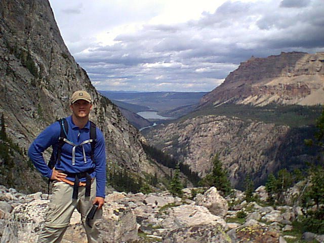
In the photo below I'm standing on a ridge on the side of Squaretop looking back at the lower Green River Lake. From this ridge you are above timberline and must scramble up steep ledges of rocks and grass. We scoured the southern side of the mountain looking for a passage through the cliffs with no luck. After several hours of route searching we descended back to the ridge and thought we seen the route up. By this time we had been on the mountain for 4 hours or so and was too tired to head back up the 2000 feet to the top. We decided to head back to the tent. We didn't feel to bad since we ran into several parties camping who had also been unsuccessful in their summit attempts. We did make friends with one guy Robert from Alanta, GA who made it to the top the day before us. He said he bushwhacked for 3 hours and by luck stumbled upon the chute that leads through the cliffs. Oh well maybe next time.
July 18, 2001
We headed out around 10 am Thursday morning and partway down the trail we found Robert sitting on a rock waiting for us to come by. Where he was sitting we had a view of Squaretop for the Northeast and he showed us the way to the top. If we would have headed north on the mtn. instead of spending our time on the southern end we would have made it. Once we arrived at the lower Green River Lake we decided to take the lakeside trail around the other side of the lake to be in the shade of the trees. This trail was night&day different than the sagebrush studded highline trail on the other side of the lake. However the trail does go up and down quite a bit more so if you are completely wiped out you would be better off taking the highline trail back.
|
|
|
|