The Kota Klias is renowned for its unique proboscis monkeys.
| Klias Peninsula | ||||||||||||||||||||
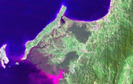
| The Klias Peninsula is an extensive wetland area of approximately 130,000 hectares located 100km southwest of Kota Kinabalu, Sabah Malaysia. The Peninsula encompasses the floodplain for the Padas River and an extensive network of river channels that include the Padas Damit, Nabahan, Bukau and Klias rivers. A second drainage system is formed by the Api-api and Bukau rivers, which join Brunei Bay near the fishing village of Weston. All these rivers drain into the Brunei Bay. | |
|||||||||||||||||||
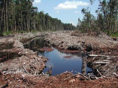
| The intact forests on the LHS of the photo/canal | ||||||||||||||||||||
|
||||||||||||||||||||
|
||||||||||||||||||||
| Presently, the Klias Peninsula contains few remaining examples of wetland ecosystems in the western part of Sabah, partly because many have been protected within six forested areas totalling approximately 31,409 hectares, but mainly because most areas are permanently or frequently waterlogged, saline or generally unsuitable for agriculture or settlements. The Peninsula also showcases significant security of land tenure due to the protection status that has been accorded to certain areas, such as the mangroves in Hindian and Nabahan that pre-dates the land administration in the 1930s. The Kota Klias is renowned for its unique proboscis monkeys. |
||||||||||||||||||||
| Where to go? | ||||||||||||||||||||
| Back to Personal Page | ||||||||||||||||||||
| How to get there? | ||||||||||||||||||||
| How to contact me? | ||||||||||||||||||||