Woodward
Valley Loop at Point Reyes
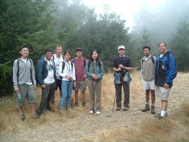
The members @ Stanford outing are
coming up with such irresistible treks that I had to give in to this
one. From the description it looked a nice hike ~ 12 miles. But with
the detours (no not "getting lost" detours but the "wow let's see
what's there" type of detours) it ended up being close to 14.5 miles of
a hike.
This trail includes beautiful forest
and spectacular coastal hiking.
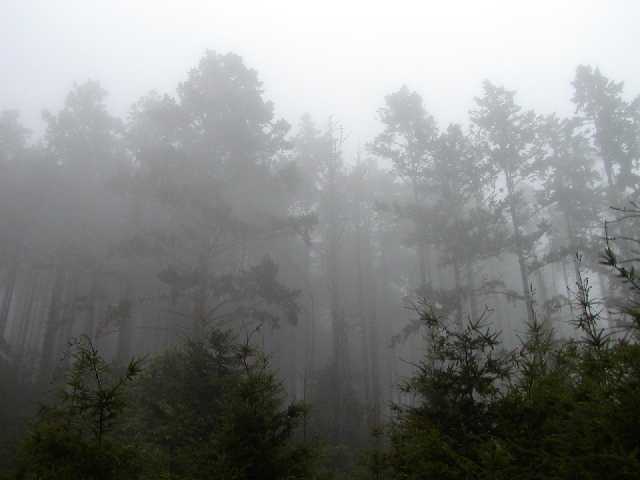
We Began from Bear Valley Trail, climbing Meadow
Trail to Sky Trail. We may
have started around 10am or so and by the time we reached the sky trail it was
almost noon. But there was no way that you could have a clue what the
time was. Right till noon there was dense fog all over the place.
Though soothing and nice to view, it was sort of a put off since the
fog blocked the scenic view from the top as well. From the sky trail we
continued to Woodward Valley,
one of the lushest,
greenest trails in the park. Towards the end of the trail we got out of
the fog, mostly since we lost some altitude. Follow the trail all the
way down to Coast
Trail where we reach the awesome ocean view as we headed south to Bear
Valley . This part of the ocean isn't frequented much and hence it felt
more serene. Beach access is marked along your way at Sculptured
Beach, a
beautiful and remote beach.
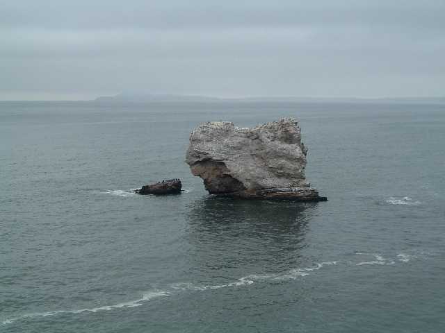
With a lunch break at the beach we
headed to the Arch Rock. I would say that it was sort of a
disappointment as to not find an actual arch. My guess is the sea carves into an arch
shape hence it's called arch rock :). From Arch Rock, follow Bear
Valley Trail
back to Bear Valley Visitor Center, a gentle grade through beautiful
buckeyes, oaks, and Douglas firs. (Begins at the Bear Valley Trailhead
at the end of the Bear Valley Parking Lot.) This part from the
Arch rock to the trail head was a bit crowded as compared to the start.
I guess the reason being the gentel elevation is attractive to many
folks.
At the trail head there is another
very small trail called the earthquake trail. It is supposed to cover
the fault line that caused the earth quakes in San Fransico in ....
some year I don't remember, google it up. Anyways, that was the major
upset. You expect that you would see some sort of folding of land or
some crack in the ground. The only thing that we see is series of blue
poles that signify the fault line !!! Then there are wooden stairs
whose upper part is skewed by almost couple of feet from the lower
part. That was supposedly done by the fault !!! Believe me folks that's
nothing dramatic and you don't want to drag your tired feet to that
small trail after the looong 14.5 miles trail :).
Anyways, a very refershing trek and
long trek after a long time. Goes to show I have not lost touch of the
10+ mile treks!! That's what I call being in shape :).
Links:
photos
Official page of Point
Reyes national seashore