Hidden jewels await the hiker
Sam Bauman
If you've made some of the more demanding hikes we've described thus far, this next one should be a delight as it combines some serious uphill with some not very serious meadow trekking. And its goal is one of the most beautiful, most rarely visited lakes in the Sierra: Meiss Lake.
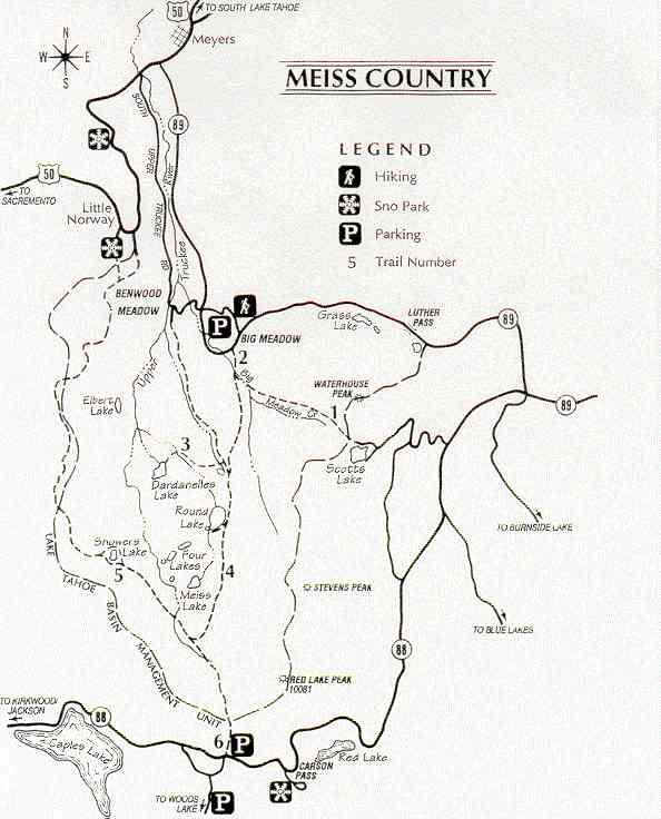
From South Lake Tahoe take U.S. Highway 50 to the turnoff for State Route 89 to Hope Valley. At the State Route 89-88 intersection go right toward Kirkwood. Just beyond the Carson Pass Ranger station and trailhead on your left, on your right is a snow park. Even on weekends this parking area is relatively sparsely used. Looking uphill you'll find the trailhead on your left. Alternately, you can go about a half-mile farther on State Route 88 and use another trailhead on your right. Parking can be tighter there. But you'll save about half a mile of not terribly interesting hiking from this spot. This trail connects with the Pacific Crest Trail which continues to Showers Lake northwest. But our trail goes right and up about 500 feet of vertical over about 1 1/2 miles to a saddle with a small pond on the left. Cattle grazing the grassland here use this pond so it is not exactly the jewel of the Sierra. On your left you'll see a loft peak of 9,445 feet. On the right is Red Lake Peak (10,061 feet). From the saddle it's downhill and a pleasant walk. Happily, very little of this trail is rocky. Instead, it's fine dust, not like the usual granite sand.
By now you're in the midst of a big meadow, with a cabin and barn on the left along with a branch of the Upper Truckee River. Leaving the meadow you'll come across some of the oldest and biggest pines in the Sierra, some with trunks well over six feet in diameter. This area was not logged during the period when the Tahoe Basin was largely denuded of original growth for the silver mines in Virginia City. You'll see a lot of these good old boys still standing, along with some of their sister pines downed by storms and age.
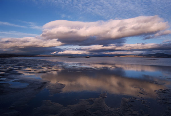
About a half-mile after branching off from the Pacific Crest Trail you need to start looking for a cowpath on your left for Meiss Lake. There are a couple of them and they both wind up roughly in the same place. One thing to be careful about is getting down in the marshy area surrounding much of Meiss Lake. Try to stay on the high ground going between the three small ponds that surround the lake. If you do get into the marshy area backtrack and go again for the high ground. The eastern side of the lake is largely bordered by marsh and what appear to be water lilies (but aren't). There are plenty of rocky outcrops that offer a beautiful view of the placid lake, surely one of the lushest in the entire Sierra. It's also one of the warmest and shallow enough that you can wade across it. Don't drink the water for the usual reasons. This is one of those times when a long, contemplative pause is in order. The area is rich in Sierra plant and bird life so if you've got a guide to both, bring it along. You'll be glad you did. You can laze on the rocks and enjoy the picnic lunch I hope you brought along. And this is one of the few Sierra hikes where we would delight in having a bottle of a good red wine along. Normally, wine and hiking don't mix, but this could be one of those wonderful exceptions. Maybe even a tablecloth for a rock picnic table would make for one of those magic mountain moments. Plus some good Brie and a loaf of French bread.
After absorbing the beauty of this setting, you might want to move on to Round Lake (about three-quarters of a mile along the original trail) or head back to the junction with the Pacific Crest Trail and follow it for about a mile to Showers Lake. Round Lake is probably the easier trek and a much bigger lake. If not, time to head for home. Meiss Lake is about 8,200 feet elevation. Ahead is the walk back through the meadow and along those giant pines (mostly Jeffrey with the familiar butterscotchish scent), past the cabin, which is sometimes used in the winter for cross country/backcountry ski headquarters, and then up the hill to the saddle at about 8,800 feet. Don't be surprised to run into horses on this trail and remember they have the right of way. And as you start your descent back to the parking area keep the lofty walls on your right in view; the snow there often lasts through the summer. And as you cross that stream you're crossing the headwaters of the Upper Truckee. Meiss Lake was worth the hike, particularly one as easy as this (except for that last lap back up to the saddle). It's a gem posing as a lake, and now you've been able to tuck it away in your hiking scrapbook.