 |
|
|
|
|
|
|
|
|
|
|
|
|
|
|
|
|
|
|
|
|
|
|
Trail 295
Plowboy Mountain |
|
|
|
 |
|
|
|
This trail runs from US Forest Service Road 1341 to Trail 291 at Navigation Campground (CG). You can reach the trailhead at Road 1341 as follows: drive to the entrance of the Beaver Creek Campground, then, instead of turning into the Beaver Creek Campground, proceed straight and follow Road 1341 to the trailhead. This portion of Road 1341 is open year round (weather permitting). The gate used to close off Road 1341 during its seasonal closure periods is located at the trailhead.
For driving directions to the Beaver Creek Campground, refer to my writeup for Trail 294, the Lakeshore Trail. |
|
|
|
 |
|
|
This is a very steep trail. The elevation at Road 1341 is 2960 feet. From there the trail ascends to a peak of 4876 feet (as measured by my GPS and my altimeter) before it begins its descent to Trail 291 at 2500 feet.
Note: Elevations based on USGS Quadrangles for Upper Priest Lake and Priest Lake NW, 7.5 Minute Series (Topographic), 1996 except as noted. Also, the trail no longer follows the route shown on these 1996 Quadrangles. |
|
|
|
|
|
|
 |
|
|
|
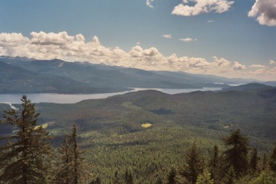
A series of cairns is encountered as one approaches the bench at 4776 feet atop Plowboy Mountain. I counted a total of seven cairns along the trail. There is a cairn at 4300 feet from which one can observe a filtered view of the Thoroughfare.
I hiked from the trailhead on Road 1341 to the top of the mountain and then about 440 feet down the backside of the mountain towards Navigation CG before turning around to head for home. This side of the trail traverses a fantasy land of Old Growth Cedar (as opposed to the pine and fir found on the other side).
|
|
|
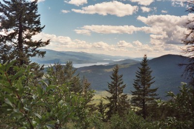
View of Mosquito Bay and the Entrance to the Thoroughfare |
|
|
|
|
|
|
 |
|
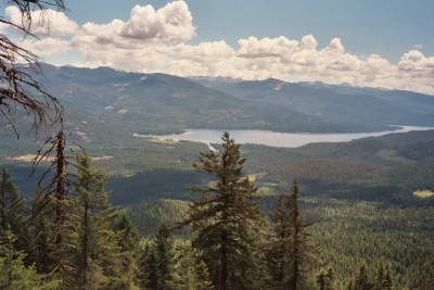
<<== View of Priest Lake from Plowboy Mountain ----- observe the Thoroughfare Entrance and The Narrows |
|
|
|
|
|
 |
|
|
|
|
|
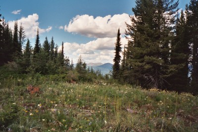
View from Plowboy Mountain Trail between its peak and Navigation CG |
|