 |
|
|
|
|
|
|
|
|
|
|
|
|
|
Trail 176
The John Wayne Loop |
|
|
|
 |
|
|
|
This loop trail is part of the Peewee/Steep Creek Trail System. There are four trails in the system: John Wayne Loop, Steep Creek Trail, Peewee Trail, and Quartz View Trail.
The John Wayne Loop is very steep - it's primarily intended as a horseback riding trail. |
|
|
|
To reach the trail system, take Highway 57 north out of Priest River to Peninsula Road (about 8 miles). Turn right on Peninsula and follow it about 4 miles to US Forest Service Road 334 (located just south of the bridge over the Priest River at McAbee Falls). Turn left on Road 334 and follow it for a mile to the trailhead located on the left side of the road just past the old gravel pit. There is plenty of parking at the trailhead; however, there are no restroom facilities.
By the way, the sign that marks the trailhead and the trail routes is not located on Road 334. You will find it only after you park your vehicle and hike about a 1/4 mile along the system's entry trail.
From the ridgeline that makes up the highest portion of the John Wayne Loop it's possible to see Blue Lake off in the distance on a clear day. |
|
 |
|
|
|
|
|
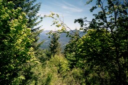
View from about half way up the
John Wayne Loop Trail |
|
|
|
|
|
 |
|
|
|
|
|
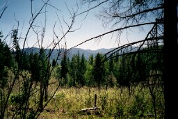
View from just below the ridgeline on the steepest portion of the John Wayne Loop Trail |
|