 |
|
|
|
|
|
|
|
|
|
|
|
|
Trail 127
Bead Lake |
|
|
|
 |
|
|
|
The hiking trail follows along the east side of Bead Lake for about four miles before it leaves the lake and climbs sharply (800 foot elevation change in about 2.5 miles) to the Upper Trailhead on Forest Service Road 3215.
The trail does not circle the lake since the west side of the lake borders on private property. |
|
|
|
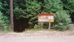
The Lower Trailhead, shown in the picture on the right, is easily accessed from Priest River, Idaho. Drive west from Priest River on U.S. Highway 2. Just before the bridge across the Pend Oreille River, turn right onto LeClerc Road and follow it for 2.8 miles to Bead Lake Road. Turn east onto Bead Lake Road and follow it for about 6 miles to Forest Service Road 3215. Turn right onto 3215 and follow it for a half mile until you arrive at the Lower Trailhead.
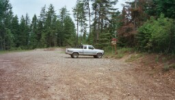
As can be seen in the picture on the right, ample parking is available at the Lower Trailhead.
That's my Ford Ranger in the parking lot. |
|
 |
|
|
|
|
|
 |
|
|
|
|
|
 |
|
|
|
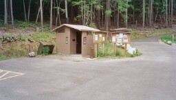
The lake is not visible from the Lower Trailhead; however, it's only about a 10 minute walk to the lake. The trail decends from the Lower Trailhead to the boat launch parking area where a vault toilet is available (see photo at left). Parking in the boat launch area is by permit only - so it's best to park at the Lower Trailhead.
From the boat launch parking area, the trail follows an old logging road for a short distance before it proceeds through a mixed conifer forest. A large campsite in the forest called the Enchantment Campsite is soon encountered.
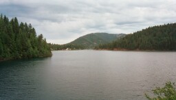
The trail offers spectacular views of the lake (see photo at center, left) and the private residences that line the west side of the lake.
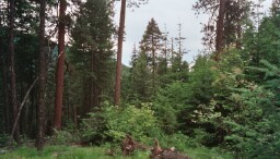
The bottom, left photograph shows the mixed confir forest.
Unfortunately, a thunderstorm developed over the area before I was able to reach the Upper Trailhead. I was forced to return to the Lower Trailhead to take shelter in my truck. One of these days I'll return so that I can view the whole lake from the vantage point afforded by the Upper Trailhead. |
|
|
|
|
 |
|
|
|
|
|
 |
|
|
|
|