Radcliffe Tower - where is it?
Radcliffe Tower was once one of the most considerable manorial residences in the County of Lancaster, but in 1935 its ruins stood in a farmyard - which is no longer there - south-west of the church (Radcliffe Parish Church, the Church of St.Mary & St.Bartholemew). The Tower stands close to Radcliffe Parish Church and is surrounded on three sides by the River Irwell, on the opposite bank of which is the 'red cliff', which is said to have given Radcliffe its name.
OR
refer to the following sketch plan showing relationship of tower to both the River Irwell and the River Roch:
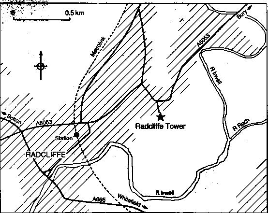
The Tower lies approximately 1km east of Radcliffe town centre off the A6053 (Bury Street). At present there is no public access to the Tower but the building can be viewed from the south end of Sandiford Street.
To obtain a full display of this page, including the email address of the web master, you need to enable JavaScrip. If you are using Internet Explorer 7 or similar, you need to temporaily enable 'scripts' as mentioned in the 'information bar'. The webmaster would like to assure you no harm will come to your computer by doing so. Thank You.