To next page
Istakhri (957) :Kitab al Masalik wa-al-Mamalik,
(book of roads and provinces.)
----------------------------------------------------

(Taken from : Mappae Arabicae by Miller Konrad)
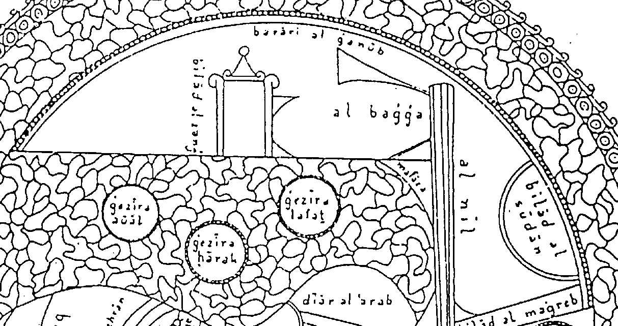
denominate East Africa
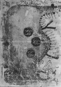
-Al Bagga : The Bedja tribe who lives in Erytrea and surroundings.
-Bilad al Sudan : Land of Black People.
-----------------------------------------------------------------------------------------------------------------------
-N. Levtzion and J.F.P.Hopkins; Corpus of early Arabic Sources for West African History.
- Deherand Alain, L'Afrique et le Sham dans le Kitab al Masalik...
-Stevens, Stephanie: La province du Fars dans le Kitab al Masalik...
-Youssouf KamaltomIIIfasc2
- Das Buch der Lander
Full name: Ibrahim Ibn Muhammad al Istakhri
He was a contemporary of Ibn Hawqal, they actually met in India and not only have their books the same name, they also use many times the same phrases.
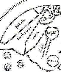
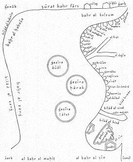
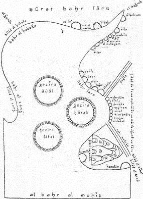
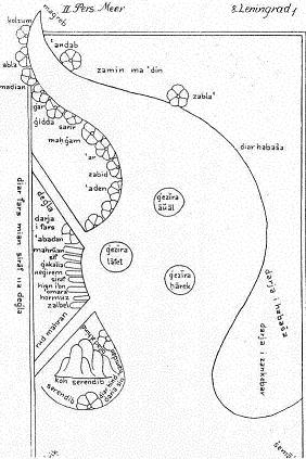
The land of the Zendjs is longer then the land of the negroes (soudan) and has no contacts with any other territory then Habacha. It faces Yemen, Fars, Kerman and also India.
Habesh is situated at the sea of Kolfum, and stretches all the way up to Zanj.
The earth stretches from the extreme North to the extreme South. It starts at the coasts of the Sea al-Muhit, passes by Gog and Magog, the territory of Saqaliba the land of the Bulghar and the Saqaliba, reaches the land of Rum towards Sham, Egypt, an-Nuba and stops in the desert situated between Bilad as Sudan and the one of the Zandj.
And of something similar in the countries of Zanj as the channels and lakes beyond the Rum countries here nothing is mentioned, because they come not directly to those seas.
Then the habashi come to an end and the sea reaches the coast of the countries of Nuba and after that the region of the Zandj who are the biggest region and it stretches in front of all the countries of islam�..
The sea in front of Yemen is called The sea of Aden, because it passes Aden, after that it is called sea of Zeng till Oman, from where it goes to Fars, and here the sea becomes so wide, that the distance to the land of Zeng 700 parasengs is. The sea is dark and black and you don't see anything in it. When you have passed Oman and reached the borders of Islam, and you continue to Serendib, there it is called sea of Fars, and it is very wide in the south to the Zeng countries.
The Nile of Egypt runs through the cities and villages of the Nubians till it arrives in Zanj, from there it goes to further countries. From here you arrive through the sea to the lands of Zanj who are opposite Aden; but it still stretches far along the sea so that it passes all other countries of Islam and is even opposite part of India.
The news has reached me that in the areas of the Zeng there are cold places, where the Zeng are white, the land is bush, thinly populated, and little cultivated except for the neighborhood of the capital
When talking about Zawila in West Africa he gives a list of the best known African people.
...The black slaves....come from there (Zawila) They are not Nubians, or Zanj, Ethiopians or Buja, but a race apart...It is said that the slaves from Zawila are blacker and better then the other races mentioned.
It is said that in that part of the earth inhabited by the black peoples, such as the Habasha, the Nuba, the Buja, and others, there is no region more extensive then that (land of Zawila), for they extend to the neighborhood of the Ocean in the south, and in the north to the desert which adjoins the desert of Egypt beyond the Oases, and then to the deserts between them and the land of the Nuba, and then to the deserts which lie between them and the land of the Zanj. There is no contact between this country and any other kingdom or inhabited land except from the direction of the Maghrib, because of the difficulty of the routes between them and the other nations.
One does not exactly know where the Nile comes from. He comes out from behind the land of the Zandj which is a desert without water where nobody ventures, then traverse the land of the Zandj, the desert as well as the inhabited parts of Nubie, then reaching uninterruptedly cultivated zones, and lastly Egypt.
The biggest town of that province after Shiraz is that of Siraf. It is nearly as big as Shiraz. The houses of Siraf are build in teak wood (Saj) and other kinds of wood that come from Zang; the houses have several floors....
One exports from Siraf the following products that have been brought there by sea; aloes, amber, camphor, precious stones, bamboo, ivory, ebony wood, pepper, sandal and other perfumes, medicines, aromatics of which it is to long to make a list....