To next page
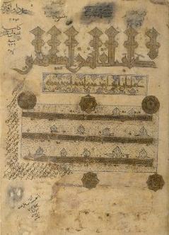
Al Biruni; Al-Qanum al Mas'udi (1030) (Picture of the world):
Taken from; Marcel Devic, Le pays des Zendjs
Gabriel Ferrand; Journal Asiatique
Neville Chittick; East Africa and the Orient.
Tadeusz Lewicki; Arabic external sources......Al-Biruni
Youssouf KamaltomIIIfasc3
Navigators have not passed this limit, the reason being that the sea on the north-east penetrates into the land... while on the south-west, as if by way of compensation, the continent projects into the sea
Then the big sea is in the southern part of the inhabited quarter and is in communication with al-Mouhit-east. She is called according to the countries on its shores or the islands inside it, she starts from the land of Sin to al-Hind and then to the Zandj��. In the west the land of Habacha and the cap of Barbara; the gulf Barbari stretches towards those people�.. The furthest point that the seamen on the big sea go to is Soufala of the Zandj situated on one line with the land of Misr; but they do not go further. This sea is in effect very irregular on the northern side, the eastern one and she goes into the continent on many places. In those places are many islands, like al-Zabadj, al-Dibadjad, Qoumair, al Waqwaq and the Zandj. In the same way the continent is very irregular on the southern sea, on the western side, this continent is inhabited by the Soudan of the West and they go to beyond the equator to the mountains of the moon where is the source of the Nile. ... Beyond this point, the sea penetrates between the mountains and valleys which alternate with one another. The water is continually set in motion by the ebb and flow of the tide, the waves for ever surging to and fro, so that ships are broken in pieces. This is why the sea is not navigated. But this does not prevent the southern Sea from communicating with the Ocean through a gap in the mountains along the south coast (of Africa). One has certain proofs of this communication although no one has been able to confirm it by sight. It is because of this inter-communication that the habitable part of the world has been placed in the center of a vast area environed on all sides by the sea
Table of longitudes starting from the coast of the sea of al Mouhit west and their latitudes starting from the equator.
Names of places situated Longitude Latitude Region and Land
in different climes deg min deg min
Behind the Equator with
Southern Latitude
Soufala of the Zandj; 55 0 10 0 Zandj
Muslims, on one line
with al-Iskandariya
and Egypt
Qanbalouh, residence of 52 0 8 0 Zandj
the Zandj king, on an
island
Zaghawa, one of their 56 0 1 0 Zandj
towns