-Home- ---------------------------------- -Gallery- ---------------------------------- -Photo Blog- ---------------------------------- -Message Boards-
Hawaii Trip 2008, Sep 10 - 23
|
You'll probably notice a common theme running through my pictures from this trip. They aren't the postcard perfect places you normally think of. However, this is the Hawaii I wanted Lou to experience. It's the variety that I love about the Big Island. I wanted Lou to experience the variety of terrain and the non-tourist areas -- the lonely Hawaii. Believe it or not, the Big Island actually has lonely places!
|
|
NOTE: Below, I have first posted 9 panoramas, then an extensive trip report with 46 regular photos. The panoramas are actually links. When you click on them it will open the full panorama in your browser window. If you then click again on that panorama it will enlarge to full size. This is the best way to experience them!
|
|
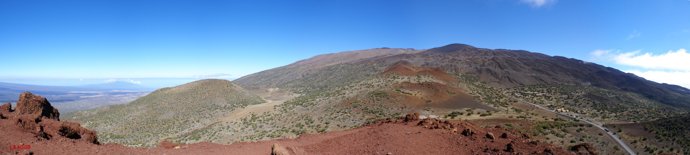
This view looks East towards Mauna Kea from above Hale Pohaku. I really like the perspective in this panorama. I took this from a cinder cone on the side of the volcano.
|
|
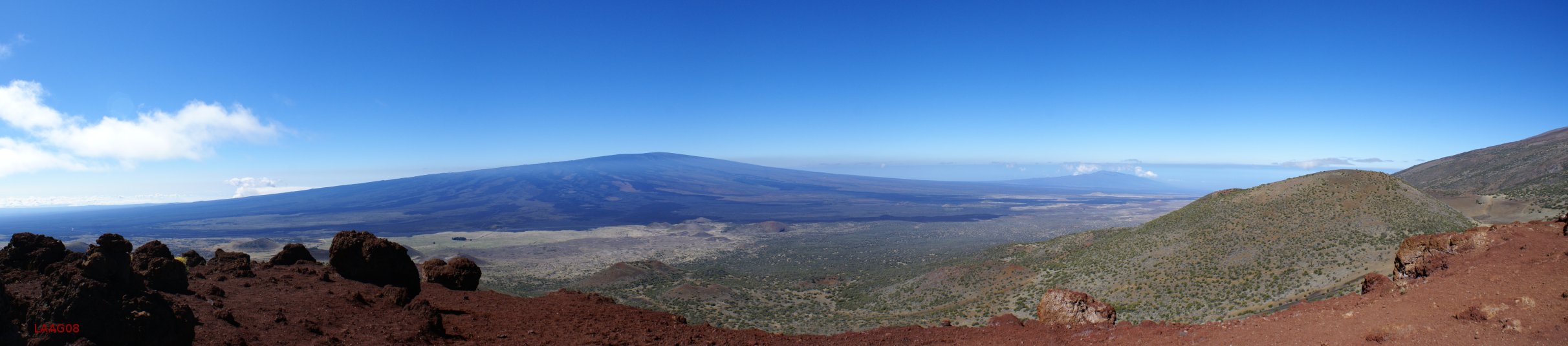
Looking West from the same Cinder cone as above. This gives a great perspective of Mauna Loa.
|
|
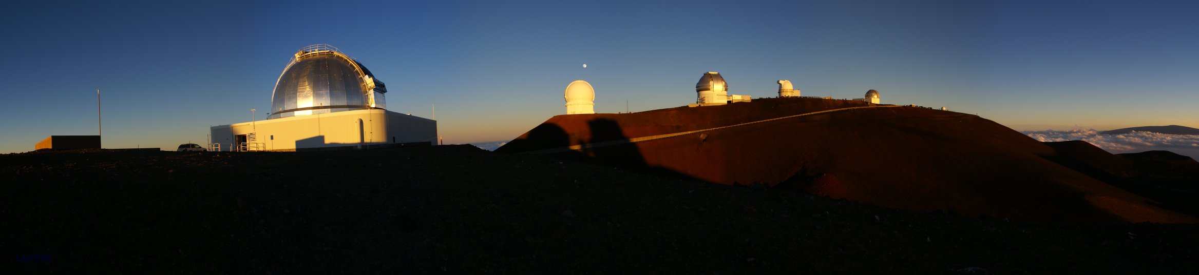
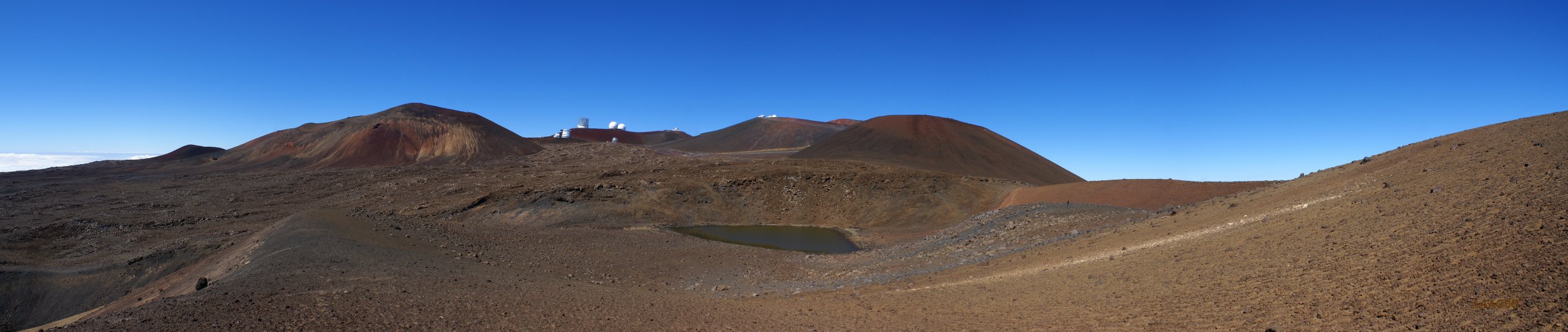
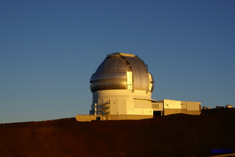
The telescope I was using (IRTF) is the closest one on the left. The other telescopes on the ridge are (left to right) CFHT, Gemini, UKIRT and the UH 88 inch.
|
|
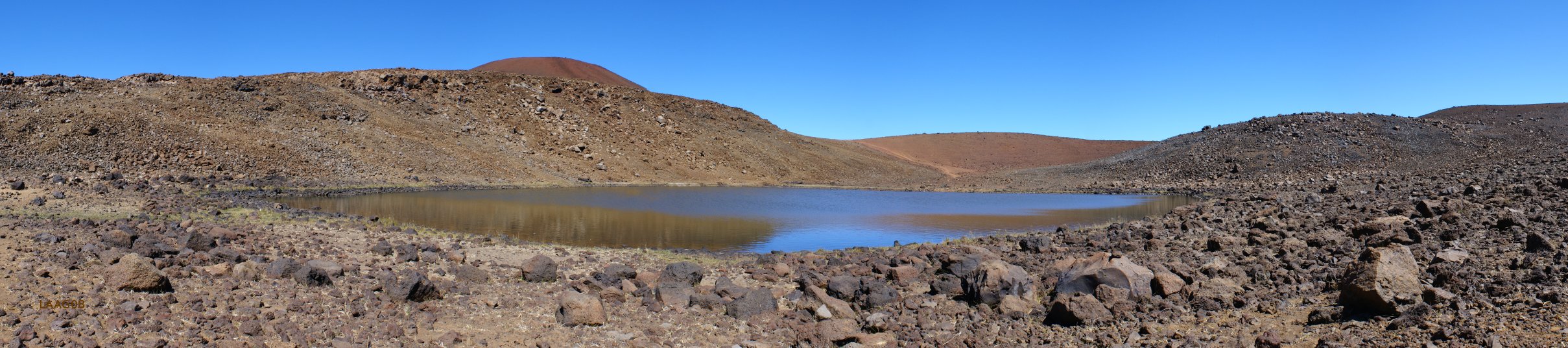
Lake Wailu is the only lake on Mauna Kea. It's a strange place. It's fed by slowly melting permafrost leftover from the last ice age strangely enough. It's also the only alpine lake in the Pacific Ocean.
|
|
This pano has a better view of the summit behind the lake. You can see how the telescopes actually take up a very small portion of the Mauna Kea summit.
|
|
Road to the Sea Beach. This wasn't the greatest beach day. It was too voggy. It's a good beach if you want some solitude and don't mind driving down a long dirt road. I'de like to go back there. It's a great beach for a swim.
|
|
I wish this pano from South Point had come out better, but it still looks awesome. It needs some work, because there is a discontinuity in the middle.
|
|
I took this pano from near the Akaka Falls parking lot. Normally it's the East (windward) side that has the terrible weather. During our trip, it was the West (leeward) side that had the horrible weather. The East side was perfect, as this pano shows. Ahhhh, to be back there.
|
|
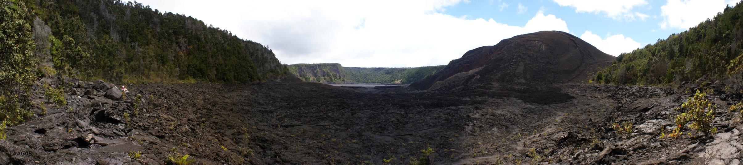
With all the vog and park closures I was skeptical about going to Hawaii Volcanoes NP. I'm really glad we did. I had never hiked down into the Kiluea iki crater and it was totally worth it. I even had a broken toe (yep, whole trip) but I made the hike. It was especially interesting because the main Kiluea crater was actually actively outgassing probably a mile from where we were, and you could see the huge cloud.
|
|
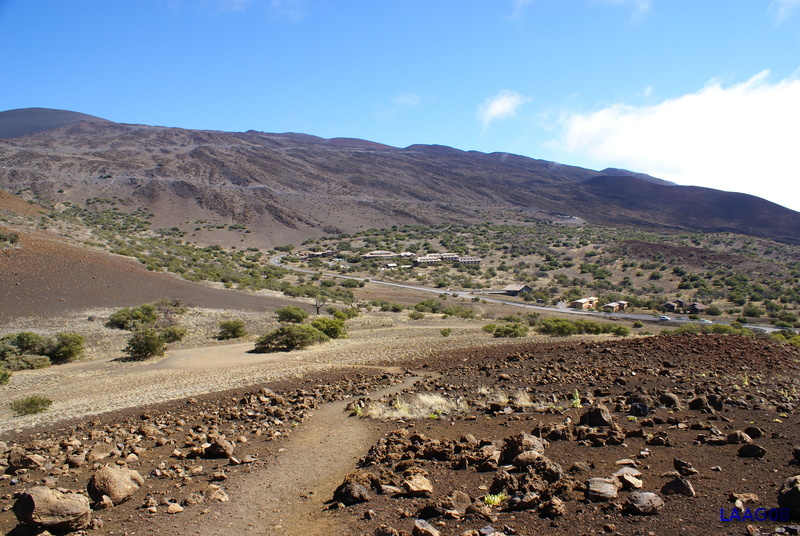
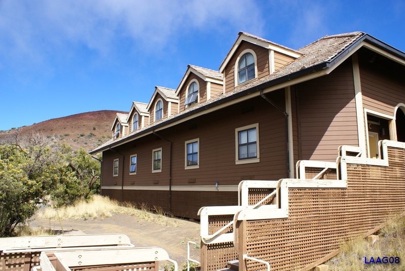
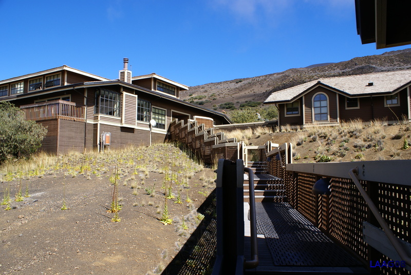
Hale Pohaku (name means house of stone) is the cluster of buildings roughly in the center of this pic. Above, the switchbacking road leads to the summit of Mauna Kea. "HP" as the astronomers call it, is where nearly every astronomer rented a room, while they were observing from the summit. It used to be a buzzin' place, but with many observatories making the switch to remote observing, the place is more sedate.
|
|
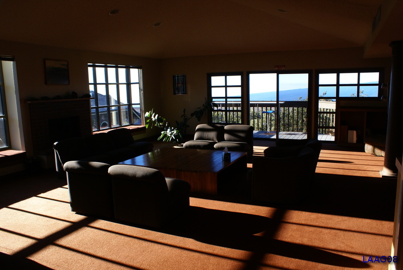
The lounge in the main lodge. I arrived late in the afternoon exhausted from my flight and this room looked awesome. It was exceptionally clear that day.
|
|
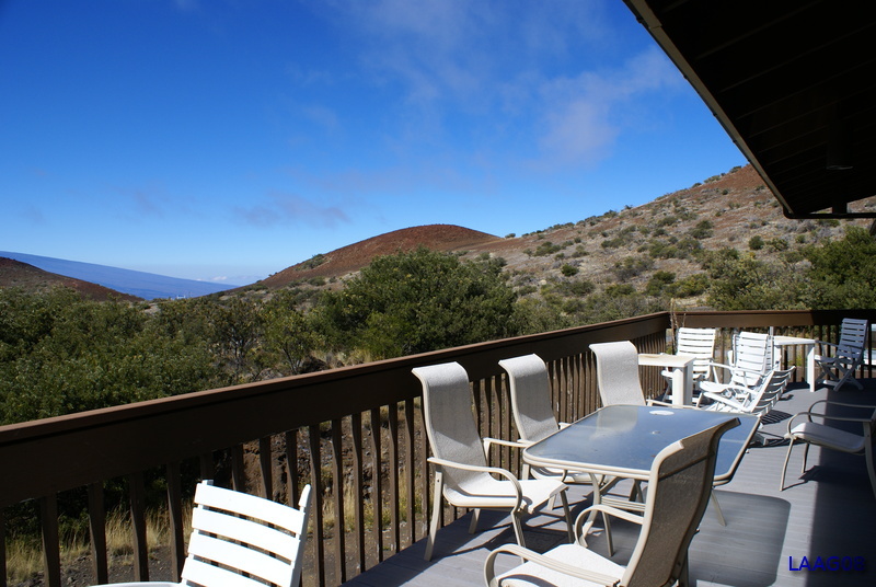
The deck, with views towards Mauna Loa on a clear day. The weather was so unpredictable here, that within 10 minutes it might go from a warm sunny day to foggy and drizzly. Consequently, I didn't spend much time out there.
|
|
Dorm building C, where my comfortable room was located.
|
|
The stairs leading from the dorms to the main lodge.
|
|
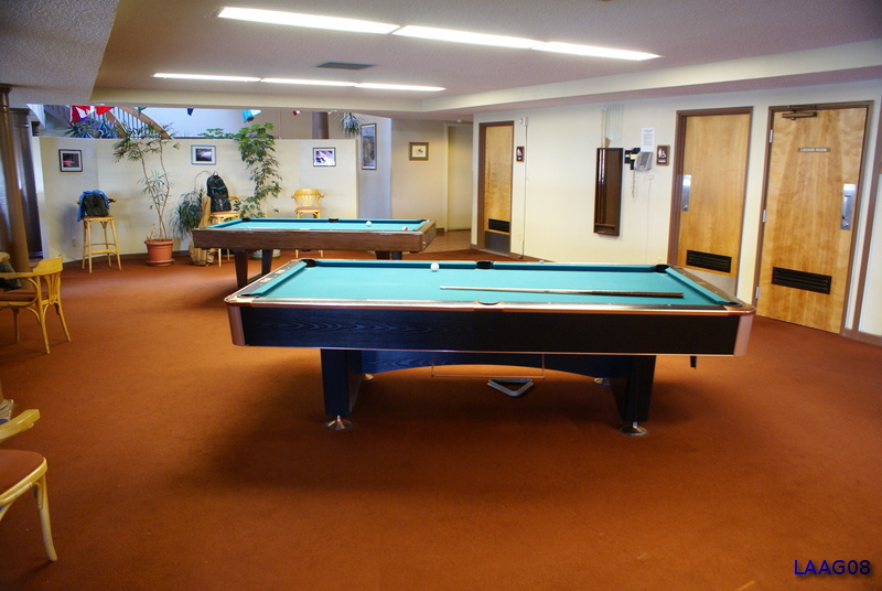
The all important pool tables. The need for 2 of them attests to the popularity of HP before remote observing. I'm told this area was packed solid most evenings.
|
|
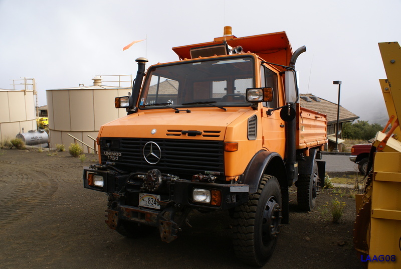
They have their own mog for the muddy (and occasionally snowy) winter months when the road can become impassable.
|
|
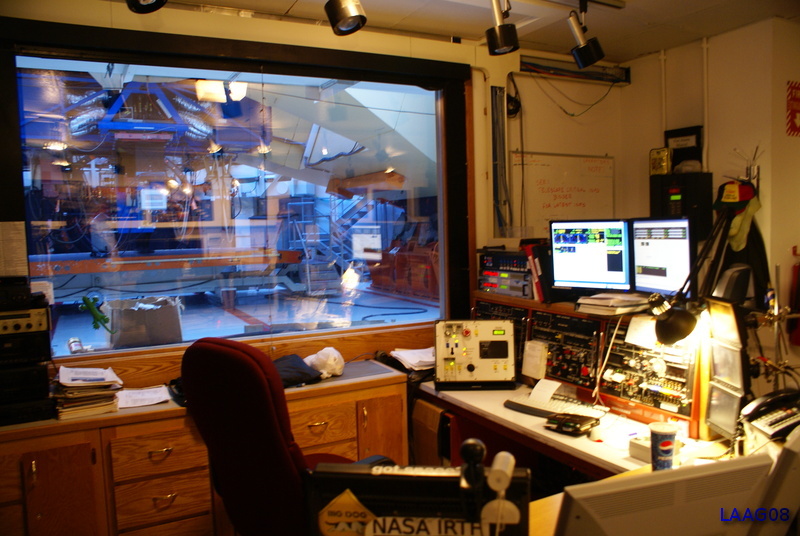
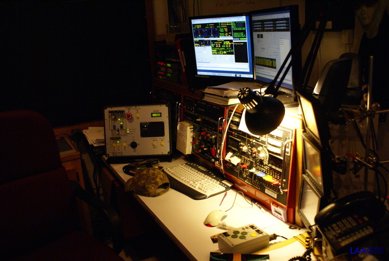
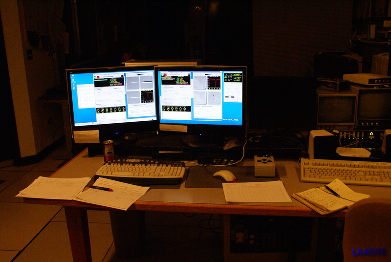
I was observing from the NASA Infrared Telescope Facility (IRTF). This is a shot of the telescope operator's booth.
|
|
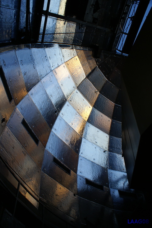
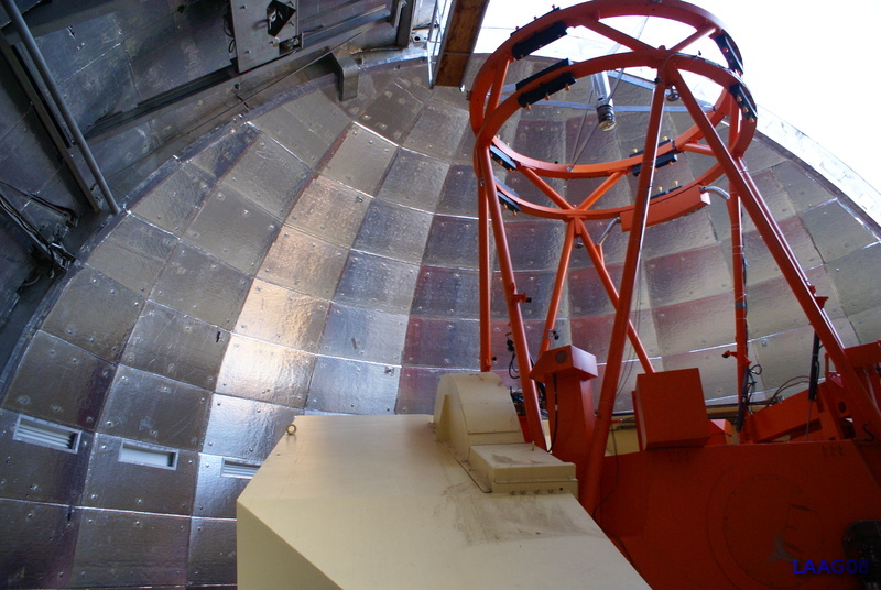
The inside of the IRTF dome.
|
|
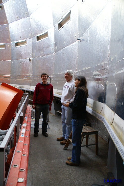
Gaby Canalizo, Steve Croft, and Bobby Bus shooting the breeze in the dome.
|
|
SpeX spectrograph.
|
|
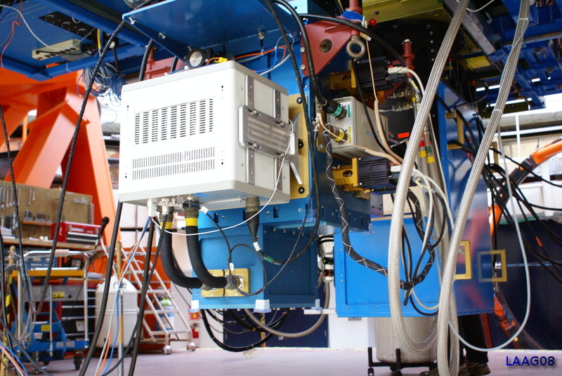
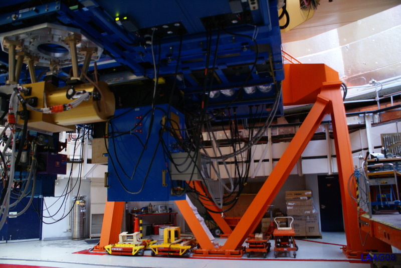
Another view of the telescope underbelly.
|
|
A full view of IRTF. Supposedly either the dome of the telescope (or both) were made from an Italian battleship.
|
|
The observer's station.
|
|
The observer's terminal. Imagine how confusing this can get when it's 2am and you're at 13,000 feet!
|
|
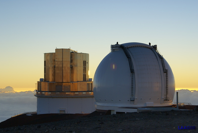
A better view of Gemini North with its beautifully engineered dome.
|
|
A view of Keck II and Subaru observatory. One morning at 6:00am the moon rose directly over the top of Keck II. It was a full moon, and due to some atmospheric effects I have never seen more detail in the moon than I did that morning. If I had had a little more time I would have set up my tripod, but we were in a hurry to get down the mountain. Perhaps it was the fact that the seeing was so good (Mauna Kea after all), and the moon was so low combined with the way the sun rose. I have no idea, but the moon wasn't overly bright. I was able to see structure within the mares, that I had never noticed before.
|
|
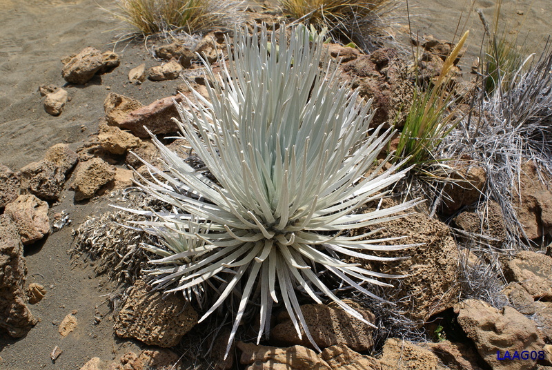
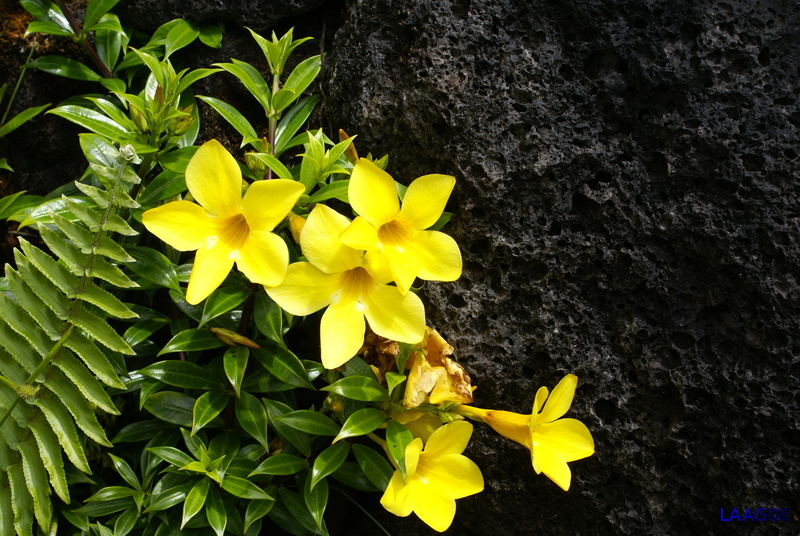
Near Hale Pohaku is a small reserve for the rare silver swords. They are a little smaller than the ones found on Haleakala. They're still pretty. The ranger told me that goat predation is the main cause of their decline in the wild.
|
|
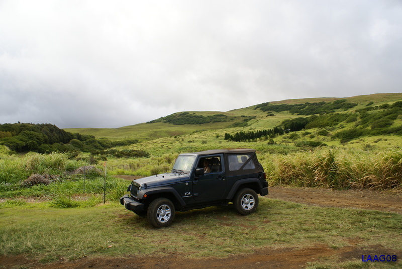
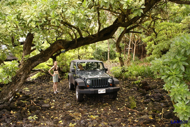
After a week of observing, I was totally exhausted. I rented an jeep and crashed at the B&B near Pahoa. Lou finally arrived and we settled into our room. The next day we drove out to Road to the Sea beach. It turned out to be a bit voggier than I expected. (There's a pano of the beach above.) I guess all the smog mixed with fog was being blown out to the Kona side. It wasn't the best beach day. It was also kinda scary getting there as the dirt road was thrilling. Had it been my jeep, I think I would have been a little more relaxed, but after spotting two jeep tailpipes on the way to the beach, I got worried. If I'm going to spend a grand on a truck repair I want it to be my truck.
|
|
On the way to Road to the Sea we stopped at this rugged shoreline. Many of the towns around this part of the island are built right on top of recent lava flows.
|
|
The jeep surrounded by green hills. I think this pretty spot was near Ka'u. This place reminded me a lot of Northern Cali on a foggy day.
|
|
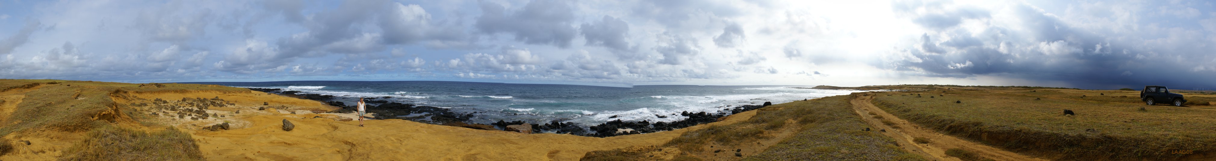
On our way back to Pahoa, we stopped to take in the sights at South Point. This scene caught my eye and I had to park the jeep by the road side and get out. I think people thought I was crazy. What an incredible view! I just love the clouds in Hawaii.
|
|
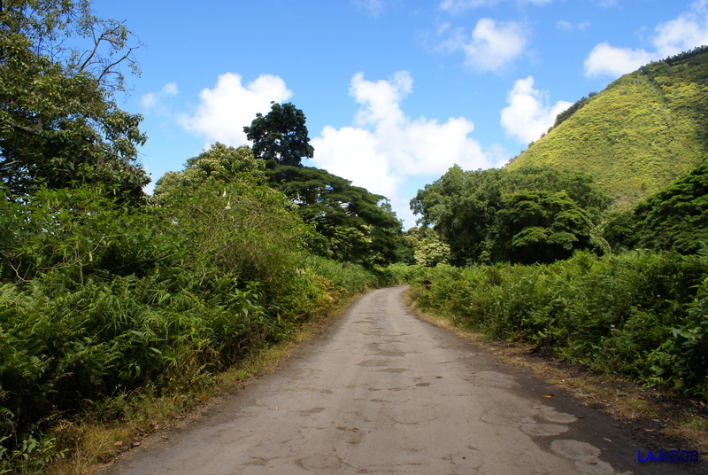
The next day it was my great pleasure to take Lou down my favorite Hawaii road, Pahoa-Pohoiki road. This was the same road I drove the first time I came to Hawaii -- the one that made me love the Big Island. How can you be in a hurry in Hawaii when you're driving down this road?
|
|
I snapped this shot next to the Pahoa organic foods market of all places. I visited this market for the Tahitian limeade the first time I was in Hawaii.
|
|
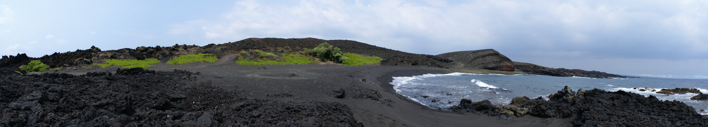
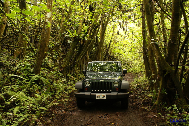
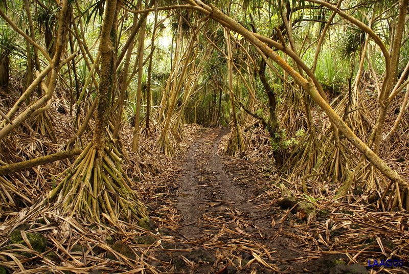
This little jeep road leads to a tidepool in the Puna area. This was the coolest road in Hawaii. I loved it!
|
|
I wouldn't want to take anything much bigger than a jeep on this road.
|
|
Farther down the jeep road. Believe it or not, there was a minivan (or at least the dead hulk of one) parked near the end of the road. I imagine you might be able to get to the beach in 2WD, but in order to get up the muddy slope you would need 4WD. It's not like a tow truck could get down there, so I guess they just had to leave it behind.
|
|
The jeep parked at the rocky beach. The tidepool was a short walk down the beach.
|
|
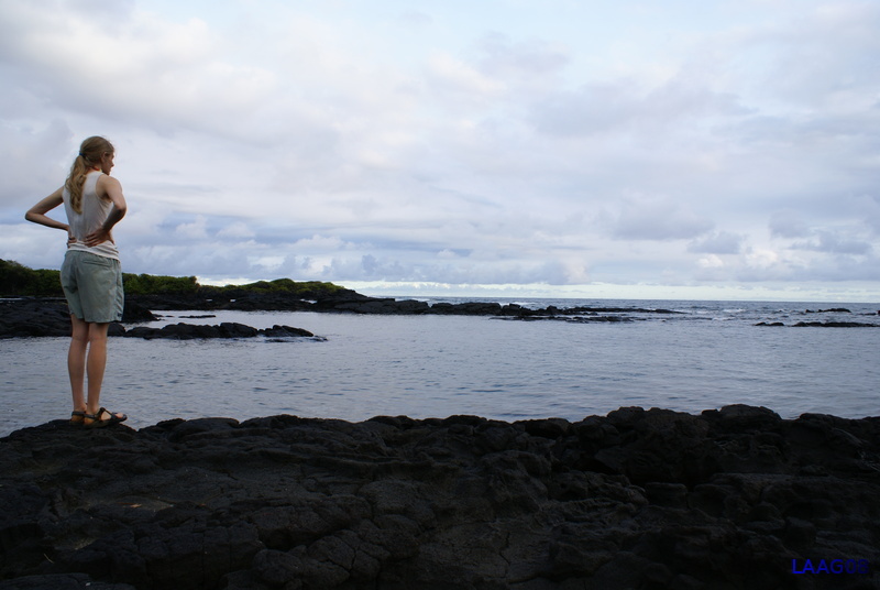
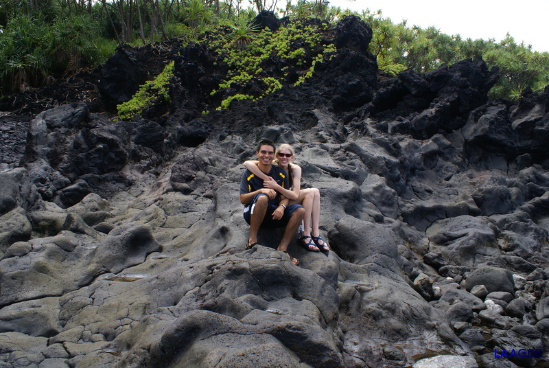
The two of us at the rocky beach.
|
|
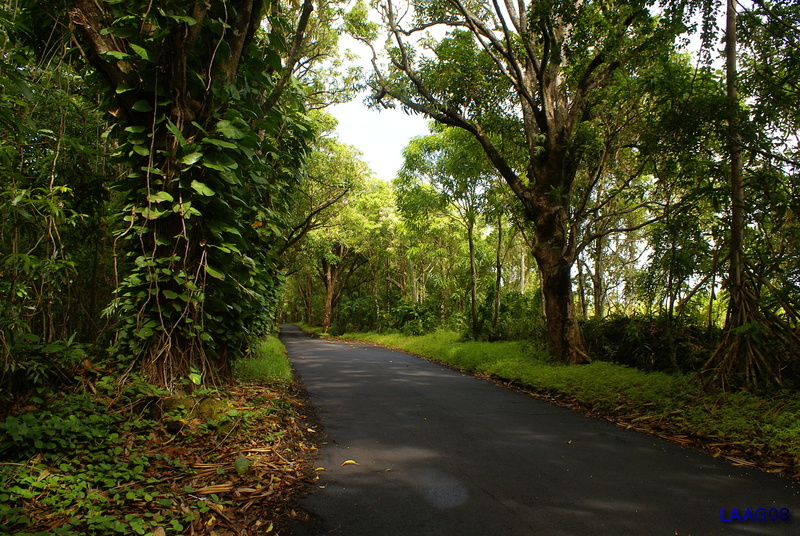
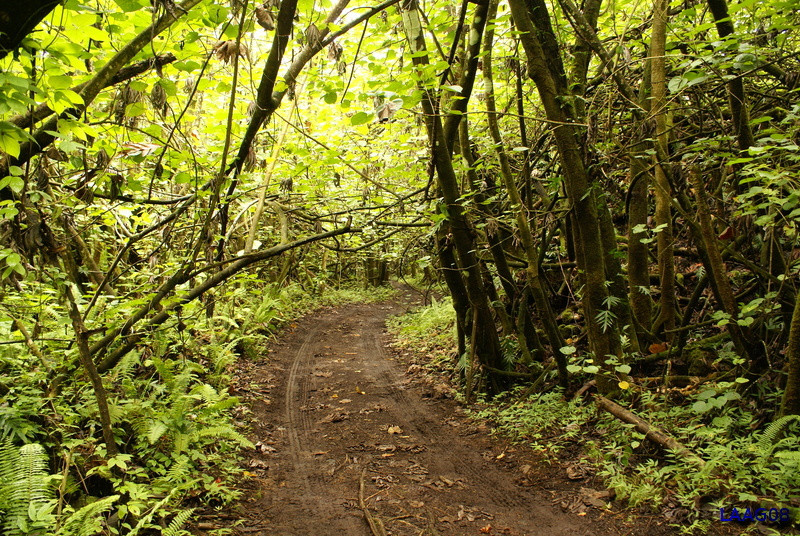
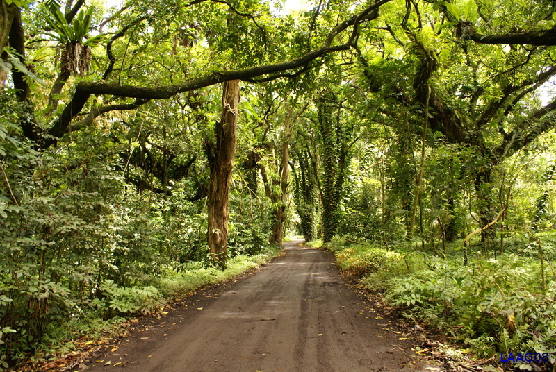
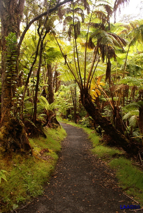
The main road through the rainforest. These roads are great.
|
|
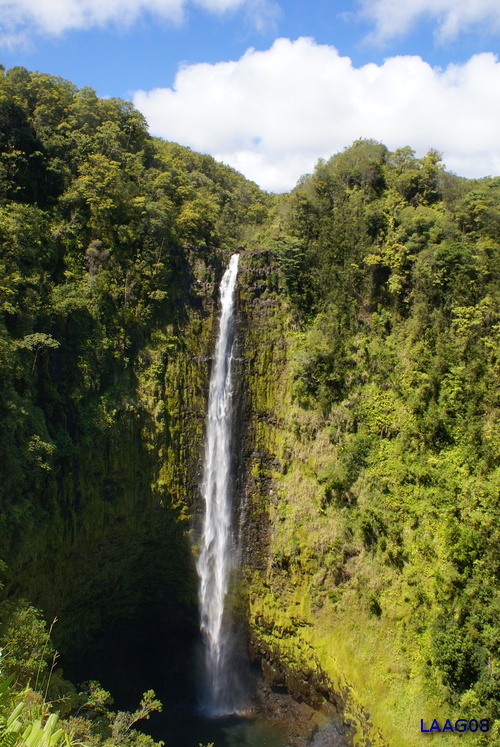
The next day we headed north from Puna to the Honokaa area. This gave me a chance to show Lou the windward side. It turned out the weather was perfect (not the norm) on the windward side. We stopped first at the customary tourist spot of Akaka Falls.
|
|
I always wanted to be able to drive down into Waipio Valley. This has to be the steepest main county road I've ever driven (25% grade). The only vehicles allowed on the road are 4WDs with low ranges. Even so, it feels like the back of your vehicle is going to tip end over front as you drive down. This view is taken from the bottom of the valley. The road down goes along the cliffs on the right.
|

|
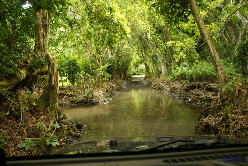
Several times we had to cross channels of the river with the Jeep. I don't think Lou enjoyed this.
|
|
The view from inside the Jeep. Luckily none of these channels were much more than a foot deep. Still, it was unnerving approaching them. I didn't want to lose the Jeep down here.
|
|
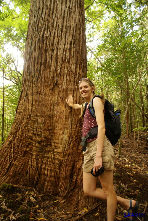
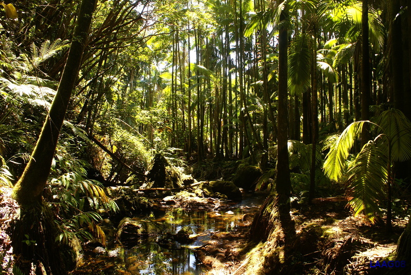
On a whim we stopped at the Kalopa Native Forest. I'm really glad we did. This was one of the best hikes I've done in Hawaii. It reminded me more of the redwood forests in Northern Cali.
|
|
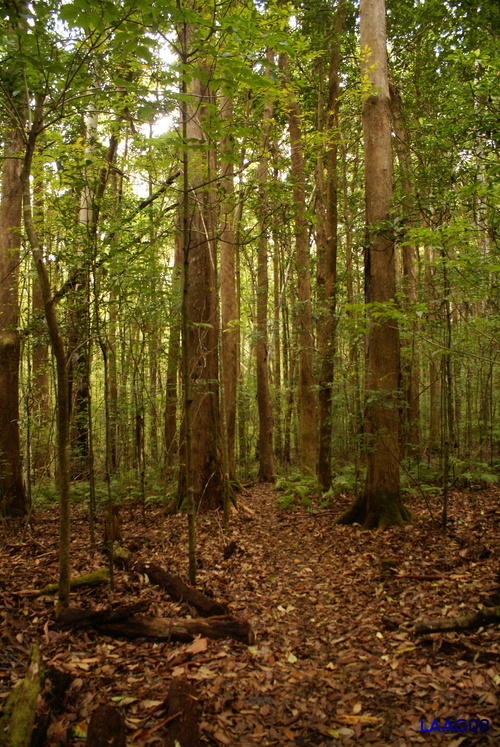
Another shot of the forest. Much of the Big Island's forests were cut down for sugar cane fields, so it makes this area all the more special.
|
|
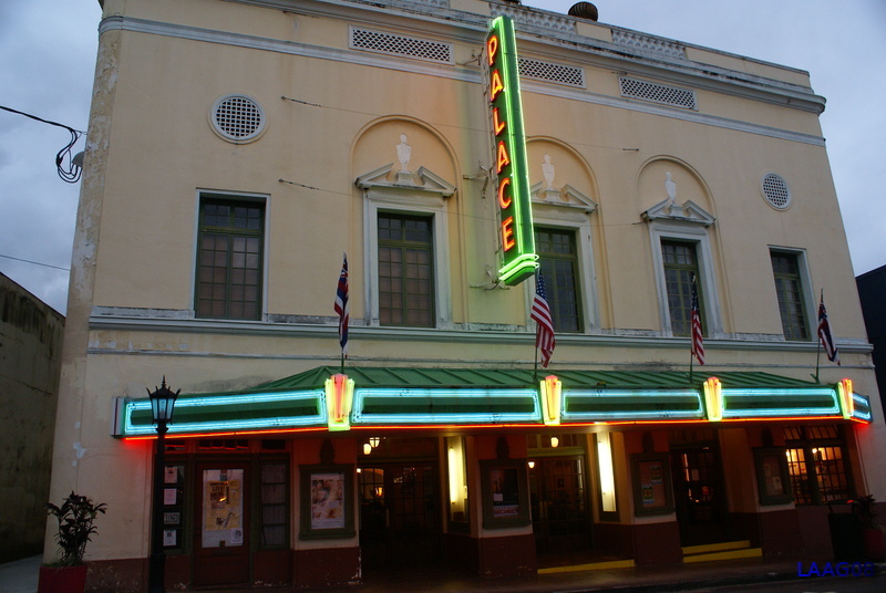
We finished the day with dinner in Hilo. Walking around Hilo I snapped a pic of this theatre.
|
|
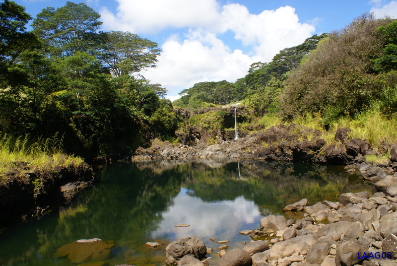
The next day we decided to see some of the sights around Hilo. This was one of those tropical days (90 deg and 90% humidity) and I was thankful the Jeep had a good air conditioner. We stopped at Rainbow and Pe'epe'e Falls (shown here) but for some reason the Hilo River was running incredibly low. I think they were having a drought. Go figure.
|
|
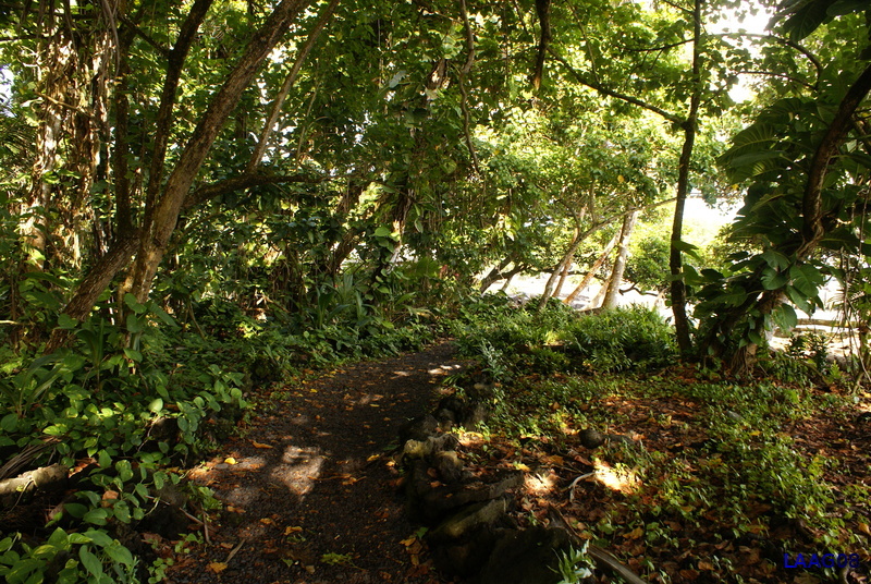
We headed next to the botanical gardens. They are somewhat worth the admission price, both for the jungle like feel and the scenic shoreline.
|
|
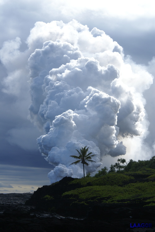
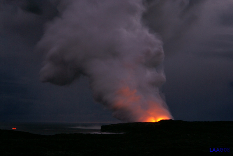
That night we walked out to view the Lava. Since 2004, the lava had shifted east from the end of Chain of Craters road, to the end of Hawaii 130 in Puna. Before we started our trek to the lava, we hiked a couple of miles down an old dirt road to this lonely spot. The view of the steam cloud was perfect from here so I'm glad we did.
|
|
Near sunset, you could see huge steam explosions tossing rocks near the base of the steam cloud. However, as soon as the sun set the winds shifted, and you couldn't get a good shot of the lava. The only folks who were getting lava pics were the ones on that boat.
|
|
We decided to head to Hawaii Volcanoes NP. Large portions of the park were shut down due to the heightened activity. Me and Lou decided to hike the Kiluea iki trail and I'm glad we did. (see the pano from the crater above).
|
|
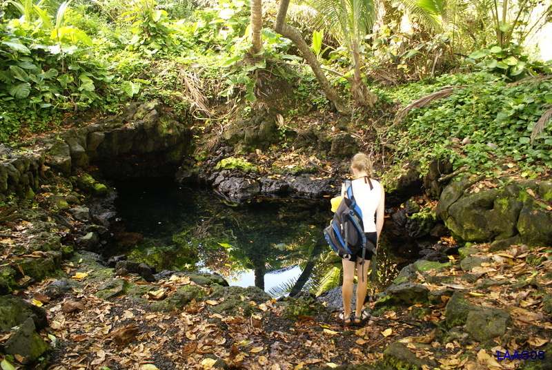
On our last day, we headed down Pohoiki road to Pohoiki pool, a natural volcanic hot tub. This little path leads to the pool.
|
|
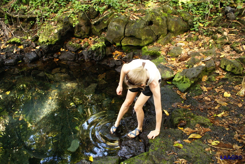
We arrived at the pool and luckily had it all to ourselves. I wasn't sure if I could trust the water, but it looked crystal clear.
|
|
Lou tests the water.
|
|
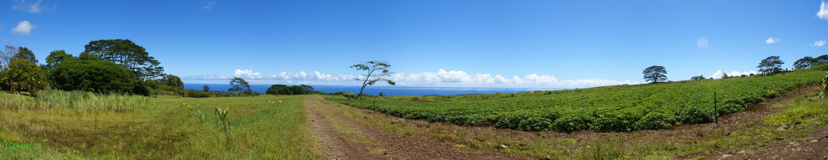
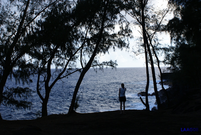
Mackenzie state park. Me and lou stopped here to take in the view. I love staring out at the Pacific Ocean. I spent some time just thinking about all the things we did, and what I like about Hawaii. Could I live here? I don't know yet.
|
Back to World Travel Menu
Back to the Gallery
Back to the Homepage
All photos copyright Edward Laag 2007