 |
|
|
|
|
|
|
|
|
|
|
|
|
|
|
|
|
|
|
|
|
|
|
|
|
|
|
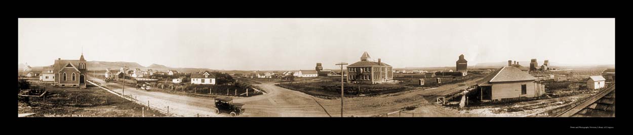
Sentinel Butte, ND |
|
|
|
 |
|
|
|
 |
|
|
 |
|
|
|
|
INTRODUCTION: |
|
|
|
|
|
FEATURED TOPIC:
Geography of
Sentinel Butte North Dakota is eight miles east from the Montana border, and 150 miles west of Bismarck, the capitol. Sentinel Butte is located in Golden Valley County, only 12 miles from Theodore Roosevelt National Park. The 79 residents (as of 1990 census) experience average daily temperatures of 67 degrees farenheit from June through August and an average 21 degrees from November through February.
|
|
|
|
|
|
Sentinel Butte is believed to be named for two Arikaree Indian sentinels or scouts (American Black Eagle and Standing Together) who were slain in this area by Gen. Custer's men. The butte located 3 miles south of town is divided into two plateaus of 240 acres total and is the second highest point in North Dakota. Once the largest town in the county Sentinel Butte was offered the county seat. |
|
|
|
|
|
|
|
|
|
|
|
|
|
RECENT NEWS/NOTES: |
|
|
LINKS: |
|
|
|
|
|
|
School
Message Boards
Genealogy
Links Page |
|
|
Source: (Type your source here) |
|
|
|
|
|
|
|
Type any additional information for your page here; news, notes, online alerts, etc. |
|
|
|
|
|
|