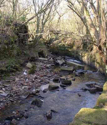
 Looking across the brook it is possible to see where it doubled back on itself as it flowed under the factory building. Looking across the brook it is possible to see where it doubled back on itself as it flowed under the factory building.
(Shown as a dotted blue line on the sketch map.)
|
|
|
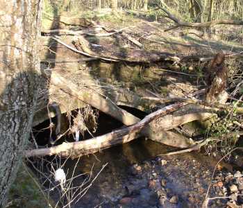
 The brook almost divided the factory in two. Looking along it towards the higher opposite bank the remains of openings can be made out in the stone wall. The brook almost divided the factory in two. Looking along it towards the higher opposite bank the remains of openings can be made out in the stone wall.
As shown on the sketch map, the works was quite extensive. The main building was around 130 metres long, with numerous outbuildings.
|
|
|
Kirklees Brook must have been an important water supply in the nineteenth century. In addition to the bleach works and printing works described above, further downstream towards Bury there were:
- Kirklees Print Works
- Kirklees Bleach Works
- Dunsters Bleach Works
- Woolfold Bleach Works which became Woolfold Paper Mills and then Olives Paper Mill
Reservoirs and occasionally stonework from these factories still exist along the line of the brook:
|
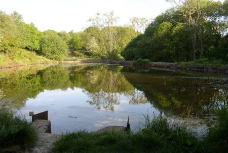 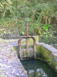
A reservoir near the former Kirklees Bleach Works and the sluice control which fed it from Kirklees Brook upstream. |
|
Retrace your steps along the side of Kirklees Brook, keeping it on your left, to return to the footbridge. Cross the bridge and look to your right.
Behind the trees, to the west, is a stone wall marking the embankment of one of the reservoirs and also forming the outside wall of the factory building.
The area between the footbridge and this wall was the floor inside the works, with the brook flowing underneath.
|
|
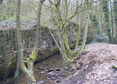
 The arch of the tunnel where the brook begins to pass under the floor of the factory can be found at the south west end of the outside wall described above. The arch of the tunnel where the brook begins to pass under the floor of the factory can be found at the south west end of the outside wall described above.
With care the brook can be followed upstream in its stone lined channel around the side of Island Lodge and underneath the railway viaduct.
|
|
|
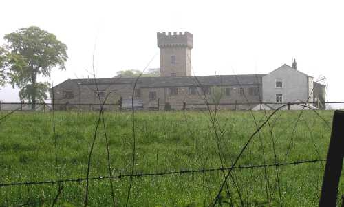
  Just north of Tottington Mill Print Works is Tower Farm with its distinctive square tower, modelled on Nuttall Hall Farm in Ramsbottom, and dated JK 1840 (Joshua Knowles) on the east side. Just north of Tottington Mill Print Works is Tower Farm with its distinctive square tower, modelled on Nuttall Hall Farm in Ramsbottom, and dated JK 1840 (Joshua Knowles) on the east side.
The buildings were originally staff housing, with stables on the north and west sides for the horses which hauled the printed merchandise from Tottington Mill Print Works to Manchester and Leeds. |
It was claimed that two teams of horses were kept, one for the Manchester run and one for the Leeds. They knew the route so well it did not matter if the cart driver fell asleep.
|
|
|
The easiest way to leave the site is to return to the footbridge over Kirklees Brook then follow the cobbled road at the side of Island lodge, either returning to the cycle path or passing under the viaduct back to Mill Street.
|
|
A footpath to the right of the cycle track, a short distance north of the viaduct, curves around the edge of the field overlooking Tower Farm to the northern end of the Tottington Mill site.
This footpath was originally Knowles Siding, a railway track to link the print works to the main Bury to Tottington line.
|
|