Tottington Mill Print Works was started by Joshua Knowles in 1820 on the site of an old corn mill.
Its business was calico printing of fabric, rather than paper, and it had five printing machines plus 95 hand-block printing tables in 1841, and seven machines by 1846. The site employed over 400 people at its peak, of whom about a quarter were under the age of 13.
A large reservoir and two smaller reservoirs nearby survive but the remains of the works itself are very overgrown.
The site is on Mill Street which is an unsurfaced track at the junction of Chapel Street and Royds Street just north of the centre of Tottington. Follow this track past the site of a former bleach works (marked on a map of 1851 and now several industrial units) then along a footpath and under a railway viaduct.
Alternatively the site can be reached from the footpath/cycle path which was previously the Tottington branch of the Lancashire and Yorkshire Railway. This footpath can be joined at various points off Bury Road on the approach to Tottington, for example via Laurel Street or Sunnywood Lane. Travelling along the footpath from Bury to Tottington, cross the viaduct over a reservoir then immediately take a path leading down and to the right to join a cobbled road.
In either case follow the cobbled road away from the viaduct towards Kirklees Brook at the bottom.
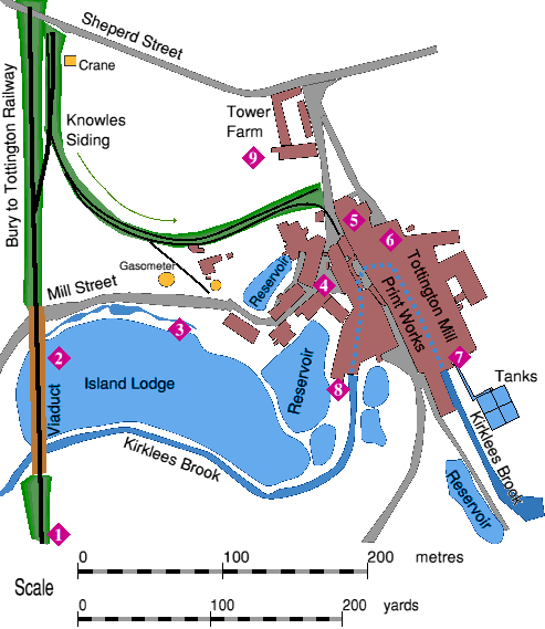
 This map (left) shows the layout of Tottington Mill Print Works as it was in the early 1900s. Click on the image to open the full size version in a new window. Numbers inside purple diamonds identify locations described below. This map (left) shows the layout of Tottington Mill Print Works as it was in the early 1900s. Click on the image to open the full size version in a new window. Numbers inside purple diamonds identify locations described below.
|
|
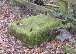
 While walking along the converted railway line, look out for rectangular concrete blocks with steel rods protruding from the top, at the side of the path. These were the plinths which supported overhead power lines when this stretch of track was electrified in 1912. While walking along the converted railway line, look out for rectangular concrete blocks with steel rods protruding from the top, at the side of the path. These were the plinths which supported overhead power lines when this stretch of track was electrified in 1912.
|
|
|
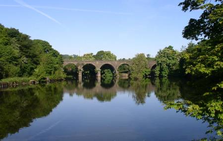
 This is the very impressive nine arch viaduct and the millpond (known as Island Lodge) it crosses, viewed from close to Tottington Mill Print Works. (Some arches are hidden by the trees.) This is the very impressive nine arch viaduct and the millpond (known as Island Lodge) it crosses, viewed from close to Tottington Mill Print Works. (Some arches are hidden by the trees.)
The railway was not opened until 1882 and thus had to cross the existing millpond. The line reverted to steam haulage in 1951 but closed to passengers in 1952 and to goods in 1963.
|
|
|
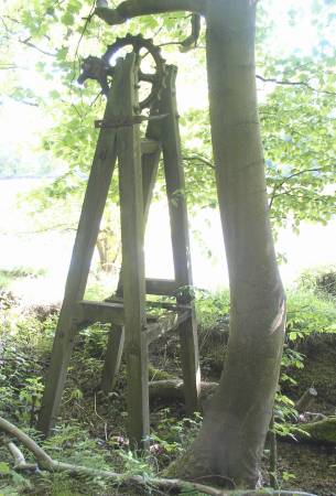
 Between the cobbled road and the large reservoir there is a channel and at the end of it is this wooden framework with a sprocket wheel on top. This would have raised a chain with a sluice gate attached. Between the cobbled road and the large reservoir there is a channel and at the end of it is this wooden framework with a sprocket wheel on top. This would have raised a chain with a sluice gate attached.
There are two smaller reservoirs on the right hand side of the road just past here.
|
|
|
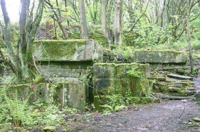
 The first part of Tottington Mill Print Works you reach is this, which appears to be mostly mounting blocks for machinery. The first part of Tottington Mill Print Works you reach is this, which appears to be mostly mounting blocks for machinery.
|
|
|
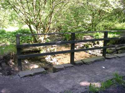
Now pass the left hand end of this bridge but do not cross it, and carefully make your way into the rest of the site, keeping the stream on your right.
|
|
|