|

Preface:
�Land closings have forced the AT off the main ridge in this section, but the Trail now follows a stable route on a protected corridor to the west. Consequently, the Trail seesaws in and out of a succession of hollows and over numerous side ridges, making this probably the most difficult section in this book. (Poison ivy may be a problem in some areas.) Nevertheless, the route may be seen as an interesting contrast to the ridge-walking that dominates most of the AT route in Maryland and northern Virginia.�
Source: Appalachian Trail Guide to Maryland and Northern Virginia with Side Trails, 15th Edition - 1995 by Potomac Appalachian Trail Club This is euphemistically called The Roller Coaster. Ten hills in ten miles, averaging 500� of climb. To be an Appalachian Trail designer, one must have a proven history of sadism.
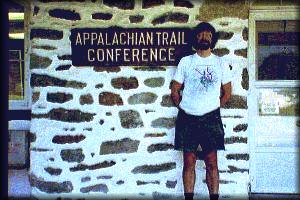
Day 0. I lightened up my pack this year. Last backpacking trip, I carried 45#. This was very hard on my feet. I had seven blisters, and a problem with my right Achilles Tendon. I promised myself never to carry dungarees again! Instead, I carried two pairs of hiking pants with zip-off legs, a new breathable rain jacket, and a set of Ridge Runner �water-resistant� pants and jacket. Pack weight 35#! I woke early, and drove 315 miles to Va Rte 601 (one of many roads with that number). Four miles in from the US highway, I parked my new car in a parking area on a dirt road and waited for the �shuttle�. (Shuttles are people who, for a fee, will pick hikers up and drive them to a trailhead.) Ray was 45 minutes later, and I began to panic. He drove me to the Comfort Inn in Harpers Ferry, West Virginia for $60. Not a bad price, all things considered. I spent the night in the Comfort Inn (which is about 200� off the Trail.) Dinner at a pizzeria. Day 1. 8.1 miles. 1410� of climb. Temp 65-85 degrees. 5 hr 10 min. 1.6 mph. Harpers Ferry, West Virginia to David Lesser Shelter. (Okay, the Dolphin is a slow hiker. He knows that and plans accordingly. Everyone hiking the Trail has a trail name. My trail name is Harry Dolphin. It�s a long story; don�t ask.) Across the new Rte 340 bridge. Walkway on the side exclusively for hikers, with a stairway under the bridge. A nice, but high climb, up Loudon Heights. I passed 21 northbound thruhikers, and a group of eight boys from some boys group. Fairly level, slightly rocky hike to the David Lesser Shelter. A nice, fairly new shelter. It even has a swing in the eating area (picnic table under a roof). Spring is 250� down the mountain. I filled up my four liters of �hydration system� after dinner (I had drunk 2 liters of water during the day�s hike.). (I carry two x two liter plastic bladders {Platypus Brand}, with a drinking tube, and a bite valve. This way I don�t have to take off my pack when I want water. This is called a �hydration system� {Cutesy names for everything these days.} I carry a Pur water filter. I filter all water that doesn�t come from a tap.) I shared the shelter with Dingo. A boy�s group camped in the camping area, and played War Games until dark. I had a Mountain High freeze-dried dinner (Beef Stroganoff). Day 2. 11.1 miles. 2010� of climb. Temp 65-95 degrees. 9 hr 30 min. 1.2 mph. Quaker Instant Oatmeal for breakfast. I put moleskin on the inside edges of the balls of both feet. I had 3 liters of water. Figured that should get me through the day. I didn�t want to climb down and back up that 250� to the spring. There are no views from any of the viewpoints. It�s far too hazy with this hot and muggy weather. A few ups and a few downs. A few rocks. Down a hill to the Devil�s Racecourse. This is a stream that flows under a field of boulders. You hear the water, but don�t see it. It gurgles. This is also the beginning of the Roller Coaster. 300� climb up to Raven Rocks and Crescent Rock Cliffs. There is supposed to be a beautiful view of the Shenandoah Valley from here. But it�s too hazy. Very pretty cliff, though. Down to Raven Rocks Run. 330� climb up unnamed ridge. Descend. Ascend to VA Rte 7. I�m getting thirsty and running low on water. Much hotter and muggier than I expected! 300� climb up to Bears Den Rocks. And I�m out of water! Bears Den is another beautiful cliff, with the view lost to the haze. One-half mile to the Bears Den Hostel. I arrive dehydrated. I drink two liters of water; then check in. Ray (the shuttler) and his wife run the Bears Den Hostel. $15 for non-members. Bunkroom downstairs with ten bunks for hikers, one bathroom with shower. (The shower felt magnificent!!) Use of kitchen; washer and drier available; tap water. The other ten bunks upstairs are occupied by a group of girl scouts. (Annoying little brats!!) J I buy a package of Noodles Alfredo with Broccoli, and cook it for dinner. The Girl Scout leader gives me some cantaloupe. Loretta (Ray�s wife) serves chocolate-peanut butter cake. (Oh, I bring along crackers with cheese and GORP {in my case sunflower seeds and cashews} for snacking while hiking. Shared the bunkroom with eight northbounders. Only one whose name I can recall is Stray Cat. They don�t turn the lights out until 10 PM! To Sleep Early, Start Out Early is my motto for hot, humid days. Day 3. 9.9 miles. 2800� of climb. Temp 70-101. 10 hr. .99 mph (Slowest I�ve ever done!!!) Bears Den Hostel to Rod Hollow Shelter. Up and out before breakfast. Put moleskin on big toes. Time out: 6:45. Made sure I had 4 liters of water! (Okay, okay, I don�t and can�t think in metric, but water bottles/bladders are listed in liters. Try figuring out {when you�re tired from a hike} how much the two cups of water you need to cook your dehydrated dinner is in liters! The map of the northern section shows ten meter intervals; the map of the southern section has one hundred foot intervals.) And it�s off into the last seven hills of The Roller Coaster! This section is hard in nice weather. In 101 degrees, hazy and humid, it�s brutal!! 100� climb over first hill. 600� climb to view lost in haze. Past the Sam Moore Shelter (stopped in to sign the register.) Easy 300� climb up Tomblin Hill (I like switchbacks!) Nasty 600� climb up Buzzard Hill. Long rest at the top of this one, to admire the haze. Welcomed, delightful spring just past the cellar ruins of an old cabin. A short 200� climb. Down to Morgan Mill Stream and a water refill. Fairly easy 600� climb up Piney Ridge, but the heat and humidity is taking its toll. More water from Bolden Run. And another 400� climb up the LAST hill. And into Rod Hollow Shelter. The spring is barely dripping, but there�s water in Rod Hollow Run. Four thruhikers here for the night already. He-Man and Detour (married, I assume), Spiz and Hamster Head. They hadn�t seen each other since somewhere in Tennessee. They�ll all hike together into Harpers Ferry. Several other thruhikers stop by for water, or to cook dinner; they continue on to Sam Moore, or stealth camping. They have to get in their 20 miles! Better them than me. Mountain Air Chicken and Rice for dinner. This was a really brutal day! I drank five liters of water while hiking and was still very thirsty. Spiz and Hamster Head set up hammocks in the picnic table shelter. They�ll never get me into one of those hammocks!! Three short-section hikers come in. One wants to start a roaring fire. We tell them �No�, it�s too hot, and the hearth is too close to the hammocks. They go off to the tent platform. One of them comes into the helter to sleep, well after dark. Day 4. 9.0 miles. 1700� of climb. Temp 65-80. 6 hr 30 min. 1.4 mph. Rod Hollow Shelter to Dick�s Dome Shelter. Band-Aid on right (ring?) toe. Nasty blister there. Oatmeal for breakfast. Much easier and much cooler day!! Up a few hills, down a few hills to US 50 in Ashby Gap. Up a long, gentle climb through Sky Meadows State Park, and Thompson Wildlife Management Area. Another stupid euphemism! In Pennsylvania, they call them �State Hunting Grounds�. Nice little spring before the descent into Whiskey Hollow and Dick�s Dome Shelter. This is a privately built shelter, maintained by PATC. It�s a small geodesic dome of sorts, with shingles(!). It only sleeps four (barely). Water from Whiskey Run (and, no, it does not taste like whiskey). Several hikers come through, and bemoan the hike down the hollow to see this silly shelter. White Wind comes in to spend the night. He was strongly considering continuing on to Rod Hollow; but thought a thunderstorm might hit before he got there. He�s planning to mail-drop most of his gear in Harpers Ferry so he can take the Maryland Challenge. The Maryland Challenge is to hike across the 41 miles of Maryland in one day. He figures to leave about 2 AM. (The other Challenge is the Four State Challenge: Leave from Virginia, cross West Virginia and Maryland, and make it to Pennsylvania the same day. That�s only two miles longer, but would not permit a stop in Harpers Ferry for mail, or a visit to the ATC headquarters to have one�s picture taken.) The Postman continued on, to stealth camp. Two hikers doing the same section as I tented by the run, as did a thruhiker. Sunrise and Sunset tented by the run too. The three kids (probably in their early 20�s) hiked in, and did start a humongous camp fire; and passed around a flask of Jagrmeister. J Forget what I had for dinner. Garrett, the pyro, slept on the picnic table, another in the shelter, and the third on the ground. Day 5. 10.1 miles. 2300� of climb. Temp 55-80. 6 hr 30 min. 1.6 mph. Dick�s Dome Shelter to Jim & Molly Denton Shelter. More oatmeal. A steep climb up out of the hollow, over a few hills, and into the Manassas Gap Shelter. This shelter is reputed to have three or four copperheads living in or under it. Someone is supposed to have killed most of them. I didn�t see any. (White Wind said that someone had killed a rattler that was coiled to strike, in Shenandoah National Park, then cooked it for dinner with Lipton Noodles. If Mountain Air comes out with Noodles with Rattler, I ain�t buying!) It starts to shower a bit after I leave the shelter. Three northbounders pass by. Partway down into Manassas Gap, a massive thunderstorm comes rolling through. Dang, I should have waited in the shelter. When it shows no sign of letting up, I stop to put on my rain jacket (breathable), and a plastic bag over my pack. And it pours, and pours! Deep puddles form along the trail. It showers for a while, and I take a much needed rest under I-66. Boots are soaking wet (despite the Gore-Tex {or perhaps the Gore-Tex is giving out?}) My boot liners are bunching up, and the moleskin has come off in my socks. (Question {asked by White Wind}: What�s the difference between a hiker and a tramp? Answer: Gore-Tex.) Up the next hill (with view of Trumbo Hollow lost in the rain). The rain has stopped. Passed a few more northbounders. Small stream that probably was a bare trickle a few hours ago now goes over my boots. Oh, well, boots were soaked anyway. Met Cathy, a PATC member, who had helped to build the Denton Shelter 10 years ago. She doesn�t have a trail name, so we decide she should be Belle (her religious name {don�t ask me, I have no idea what this means.}] She decides to ford the stream so she can visit the shelter. The sun is out and it has warmed up when I arrive at the Jim and Molly Denton Shelter. The plastic bag would probably have kept my gear dry through a shower or light rain, but not in this thunderstorm. So, I lay a lot of gear out to dry. Denton Shelter has a porch with a bench along one side, and a long Adirondack chair. This shelter has two bunks, and probably sleeps 6 comfortably. I changed into dry shorts, the sleeping pad on the railing, and a lot of wet clothes on the railing too. I hang the boots from a peg. There�s even a gravity-feed cold shower and water supply. I don�t know where the water comes from, so I filter, and take a cold shower. A number of hikers come in (so I have to move some of my gear to make room). A family of four northbound thruhikers. Mother, father, girl of 12 and boy of 10. ?!? There should be a law against taking a 12 year-old and a 10 year-old on a 2140 miles hike! They make dinner, then head out for some more miles, along with Big Red and another. Minnesota Mike and Zen Master are in for the night. Minnesota Mike has to catch a plane at Washington on the 24th to attend a wedding in Minnesota; so, he�s trying to figure out how far he can hike, and find public transportation into Washington. He�d originally planned on the train from Harpers Ferry, but now thinks he can make it to Caledonia State Park, Pa., and take a bus from Gettysburg. A very heavy mist settles in. It starts to rain, and another thunderstorm rolls through. Dinner is Spicy Thai Chicken. A bit too spicy for a hiking dinner. Day 6. 7.8 miles. 1700� of climb. Temp 55-75. 5 hr 45 min. 1.4 mph. Jim & Molly Denton Shelter to Va Rte 601. Oatmeal again (I should have taken some of the Instant Grits that Garrett left at Dick�s Dome Shelter, for variety.) Drizzly, so I start out in my black Marlboro �rain-resistant outerwear�. A bit of a climb up past the Mosby Primitive Campsite (another euphemism. �Primitive� means �without privy�. J) Over the hill and down past the Research and Conservation Center (a 4,000-acre wildlife preserve belonging to the National Zoological Park, part of the Smithsonian Institution.) Nobody knows what this means. We�re all expecting to see two-headed bison, or twenty-foot ostriches, or maybe aliens from outer space. The much photographed sign is missing (No trespassing. Violators will be eaten.) I�m crestfallen! I saw an indigo bunting that escaped from the compound. J Across US 522 and up the other side of Chester Gap. A northbounder has his camera out. From a distance, he thought I was a black bear (my black rain gear). Pass a number of northbounders. Most section hikers would probably have ended at the gap; but (planning ahead) if I end at the side-trail to Va 601, next year�s section will start at Va 601, and the first day will be a 13-miler to Gravel Spring Shelter in Shenandoah National Park. The map section, however, ended at Chester Gap. I scanned the next part, and printed it with my bubble-jet. It got wet, and was completely illegible. L Up another steep hill toward Tom Floyd Wayside. I take the blue side trail; but it�s the wrong one. This one goes to the 4H Center. So it�s back up the hill to the AT, and more switchbacks to the blue-blazed side trail down to Va 601, and my beautiful car. Fortunately, this parking area was far enough off into the middle of nowhere, on a dead-end dirt road, that there was no vandalism. Vandalism at trailheads is not too common, but, unfortunately, it�s increasing. There are several trailheads where vandalism is common, and parking is not advised: Keys Gap, WVa, US 19E in Tennessee, and Grafton Notch State Park, Maine are the most notable. But my car was waiting safe and sound!! And it�s early enough that I still have time to drive the six or seven hours to get home before dark. I looked for post cards in Front Royal (but not too much, cause I wanted to get home.) Stopped for gas and cigarettes in White Haven, Pa. Virginia cigarette taxes are a bit lower than Pennsylvania, and a heck of a lot lower than New Jersey. I color in (with magic marker) my new section on my official US Park Service brochure/map. J Afterword: This was a brutal section!! 101 degrees through The Roller Coaster. Wild thunderstorms. Totals (may not add up, due to rounding. J): 56.2 miles. 11980� of climb. 43 hr 25 min. 1.3 mph. (Not too bad, all things considered.) Four hot spots on my feet, but they did not blister. One nasty blister on a toe. Right Achilles Tendon did not bother me at all. Lighter pack (34#) did make a big difference!! I lost 17 pounds! Weighed in at home at 190#, down from 207#. Most of that is probably water loss, and will return. Oatmeal becomes boring very quickly. Since I cook my dinners in my pot, not in the bags, I should probably take the freeze-dried dinners out of the foil packets and put them in zip-locks. Despite what the packets say, these dinners do NOT serve two. They serve one hungry hiker (and provide 98% of your salt allotment for the day). Despite what the doc says about my BP, I sweat out a lot of salt hiking. Especially on this section. I even had a butterfly land on my hand and eat salt off my skin. (Either that or they have vampire butterflies in Virginia.) I saw two deer, three box turtles, one toad, and one partridge(?). There are a lot of towhees in Virginia (distinctive call). I don�t know what that other bird with the distinctive call is. (I�m told this is probably a phoebe.) Silly thing kept telling me that it was a bird. �Birr-DEE�. J There is a lot of Poison Ivy in Virginia. North of Maryland, one seldom sees it on the Trail; here it is common. Not too many flowers in bloom. Honeysuckle, bluets, mountain laurel. There are about eleven �views� listed for this section. They were all lost in the haze, mist, or rain. There was absolutely no need to make The Roller Coaster THAT challenging. Trail designers ARE sadists!!!!! They could have run more contours around the hills; but then that section would have had very little to remember it by. Never hike when the temp is over 90! With rain threatening, I should have put plastic bags inside my pack, and the gear inside the bags. I ruined my wallet (I needed a new one anyway.) I paid for gas in Penna with wet bills. I�ve spent two days with wet gear drying out all over the apartment. Ah, well. I did survive. Though, I can�t say that I enjoyed this section.

 This page hosted by Get your own Free Home Page Free search engine submission and placement services! |