|
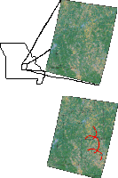
Circular features of various geologic origin have been identified in many places around the world. In 1972, the return of images from the first Landsat satellite, known then as the Earth Resources Observation Satellite no. 1 (EROS-1), revealed many which had previously gone unnoticed. Previous investigations of such space-identified features generally placed them in one of the following categories (not in any particular order): 1) structural dome, 2) intrusive pluton, 3) fracture pattern, 4) erosional or collapse basin (including karst), 5) impact structure, 6) artifact of illumination, 7) chance morphological pattern, or 8) unexplained. (Everett et al., 1986). Circular features visible on remote sensing imagery in the St. Francois Mountains and surrounding areas in east central and southeastern Missouri were first noted by Gillerman in 1968, using side-scan radar. He favorably compared the radar�s response to aerial photography, but tried unsuccessfully to correlate the features with magnetic anomalies or known topographic highs in the basement. Allen et al., (1973) were the first to notice circular features on multi-spectral scanner (MSS) images, however they limited their analysis to possible association of the circular lineations with known geologic structures. Using both 1:24,000 scale topographic maps and stereo pairs of air photos, Kisvarsanyi and Kisvarsanyi (1976) noticed that in areas with no sedimentary cover, the circular features appeared to cluster in areas of volcanic rocks. Where a thin cover was present, the circles corresponded to curving segments of stream channels. Knepper (1980, 1981) reported correlation of circular features visible on Landsat images to both gravity and magnetic highs. Later, Cwick et al. (1987) identified circular areas from Thematic Mapper (TM) data, which they were able to relate only to vegetation leaf moisture content. Their circular features, however, were only visible using the 2.08-2.35�m TM band, which they referred to as band 6, and a TM band ratio of their band 6 / band 4 (0.76-0.90�m). Their band 6 electromagnetic (EM) wavelength range is not measured by the multi-spectral scanner. The previous work was, however, limited to the most eastern quadrant of the state, where data are plentiful and the Precambrian rocks of the St. Francois Mountains lay close to or at the surface (Gillerman, 1968; Allen et. al., 1973; Kisvarsanyi & Kisvarsani, 1976; Knepper, 1980, 1981; Cwick et al., 1987). Circular or arcuate lineations in the east-central portion of the state have been largely ignored.
|