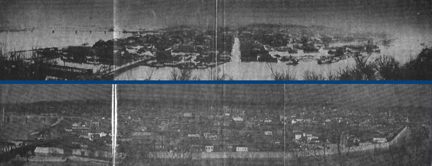
The top photo here shows Parkersburg, W.V. during the flood of 1913 before the floodwall, seen in the bottom photo, was erected. The top photo shows the flood water above the fifth St. intersection and the accompanying damage to the low lying sections of the city. The channel of water seen in the middle of the top photo is actually Market Street. The bottom photo shows approx. the same view of Parkersburg during the flood of 1959, it was estimated that had it not been for the floodwall the water would have reached nearly to the Fourth St. intersection and could have caused thousands of dollars worth of damage. Both photos were taken from Fort Boreman Hill on the Southside of the Little Kanawha River. Although the photos are somewhat difficult to make out due to age, it is possible to see, on close scrutiny, the changes in the appearance of the city from 1913 to 1959. Notice that there is only one bridge across the Ohio River, ( Top left corner of both photos ).
To see a reverse view of the top photo taken from Market St. looking toward Fort Boreman Hill, where these photos were taken, Click Here! |