Basic mechanism
Weather happens because different areas of a planet receive differing amounts of energy from the Sun. Because of a planet's curvature, sunlight is incident at different angles at different latitudes (higher latitude -> lower angle of incidence -> less heating). See how directness of sunlight causes warmer weather. Different types of surface (e.g. ocean, forest, ice) have different properties of reflectivity (albedo) and absorb and radiate different amounts of energy. It is due mainly to these two factors that the surface is heated to different extents.
These surface temperature differences cause vertical wind currents as the hot surface heats the air directly above it. This hot air expands and rises lowering the air pressure and drawing colder air into its place, which is in turn heated and rises and so on. When the hot air later cools it shrinks and sinks lower, increasing air pressure and displacing the air already below it. Horizontal wind currents are formed at the boundaries between differentially heated areas and can be exacerbated by the presence of sloped surfaces. The simple systems thus formed can then display emergent behaviour to produce more complex systems and thus all other weather phenomena. A large scale example of this process can be seen in the Hadley cell and other forms of atmospheric circulation, a smaller scale example would be coastal breezes.
The only two fundamental causes of weather are thus surface temperature, and to a lesser extent, elevation.
Any precession in a planet's orbit will affect the amount of energy received at a particular spot throughout the year. This effect causes seasons and may influence long-term weather patterns.
Terrestrial weatherFair weather Cumulus clouds
On Earth, regularly occurring weather phenomena include such things as wind, cloud, rain, snow, fog and dust storms. Less common events include natural disasters such as tornadoes, hurricanes and ice storms. Almost all recognised weather phenomena on Earth occur in the troposphere (the lower part of the atmosphere). Weather does occur in the stratosphere and does affect weather lower down in the troposphere, but the exact mechanisms are poorly understood
The Earth's atmosphere is one large chaotic system so small changes to one part can have large effects elsewhere. This makes it very difficult to accurately predict short term weather changes more than a few days in advance, though weather forecasters are continually working to extend this limit through the science of the study of weather, Meteorology.
Shaping the planet
Along with plate tectonics and ocean circulation, weather is one of the fundamental processess that have shaped the Earth since its creation and will continue to do so as long as it exists. The process of weathering breaks down rocks and soils into smaller fragments and then into their constituent substances. These are then free to take part in chemical reactions that can affect the surface further (e.g. acid rain) or are reformed into other rocks and soils. Weather also plays a major, if indirect, role in erosion of the surface, moving surface constituents around.
Human history New Orleans after Hurricane Katrina.
Weather has played a large, and sometimes direct, part in human history. Aside from climatic changes that have caused the gradual drift of populations (for example the desertification of the Middle East, and Ice ages in Northern Europe), extreme weather events have caused smaller scale population movements and intruded directly on the course of human history. One such event that is celebrated is the saving of Japan from invasion by the Mongol fleet of Kublai Khan by the Kamikaze winds in 1281. The Little Ice Age of the 14th to 18th centuries had wide ranging affects in the northern hemisphere, including decimating the fledgling Viking colonies of Greenland, catalysing the formation of leagues among the Native American groups in North America, and forcing the change of patterns of agriculture across Europe to accommodate the shortened growing season. A series of great storms throughout the 13th century caused the powerful English Cinque Ports to be silted up and hence lose their influence. More recently, Hurricane Katrina forced the temporary abandonment of the entire city of New Orleans in 2005.
Because of the large affect that weather has on day-to-day life and due to the impossibility of any type of forecasting before the advent of modern technology, a large body of folklore aimed at trying to explain the weather has grown up, some of which is fairly accurate, most less so. A well known example is the Groundhog Day celebrated near the end of winter in parts of the United States.
The effect of seasons on the life of primitive peoples also caused them to observe and celebrate certain events during the calendar, some of which, in adulterated form, are still observed today. Christmas, for example, is the Yule of the pagans, celebrated around the winter solstice (the shortest day of the year).
In the future
It is the goal of some scientists to control the weather. Experiments have been carried out for many years, but the results are usually ambiguous. On a grander scale, science fiction authors have long posited the idea of terraforming other planets in order to make them habitable by human beings. While this may be possible in the distant future, this is far beyond current technology.
Climate
Tropics
The tropics are the geographic region of the Earth centered on the equator and limited in latitude by the two tropics: the Tropic of Cancer in the northern hemisphere and the Tropic of Capricorn in the southern hemisphere. The tropics are also called the tropical zone and the torrid zone.
This area lies approximately between 23°30'/23.5° N latitude and 23°30'/23.5° S latitude, and includes all the parts of the Earth where the sun reaches a point directly overhead at least once during the solar year. (In the temperate zones, north of the Tropic of Cancer and south of the Tropic of Capricorn, the sun never reaches an altitude of 90° or directly overhead.) The word "tropics" comes from Greek tropos meaning "turn", because the apparent position of the Sun oscillates between the two tropics with a period that defines the average length of a year.
Tropical plants and animals are those species native to the tropics. Tropical is also sometimes used in a general sense of a place that is warm and moist year-round, often with the sense of lush vegetation. However, there are places in the tropics that are anything but "tropical" in this sense, with even alpine tundra and snow-capped peaks, including Mauna Kea, Mt. Kilimanjaro, and the Andes as far south as the northernmost parts of Chile and Argentina.
In Köppen's scheme of climate classification, a tropical climate is defined as a non-arid climate in which all twelve months have mean temperatures above 18 °C. See how directness of sunlight causes warmer weather.
Subtropical climate
Subtropical (or semitropical) areas are those adjacent to the tropics, usually roughly defined as the ranges 23.5-40° N and 23.5-40° S latitude. These areas typically have very warm to hot summers, but non-tropical winters. In certain areas of the world the subtropics are plagued by tropical cyclones that originate in the tropics in the summer and fall.
Desert
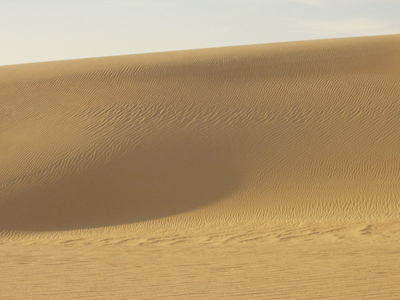
In geography, a desert is a landscape region that receives little precipitation - less than 250 mm (10 in) per year. Deserts have a reputation for supporting very little life. Compared to wetter regions this may be true, although upon closer examination, deserts often harbor a wealth of life that usually remains hidden (especially during the daylight) to preserve moisture. Approximately one-third of Earth's land surface is desert.
Desert landscapes have certain common features. Desert soil is often composed mostly of rocky surfaces called regs. Sand dunes called ergs and stony or hamada surfaces compose the minority of desert surfaces. Exposures of rocky terrain are typical, and reflect minimal soil development and sparseness of vegetation. Bottom lands may be salt-covered flats. Eolian (wind-driven) processes are major factors in shaping desert landscapes.
Deserts sometimes contain valuable mineral deposits that were formed in the arid environment or that were exposed by erosion. Because deserts are dry, they are ideal places for human artifacts and fossils to be preserved.
Semi Arid
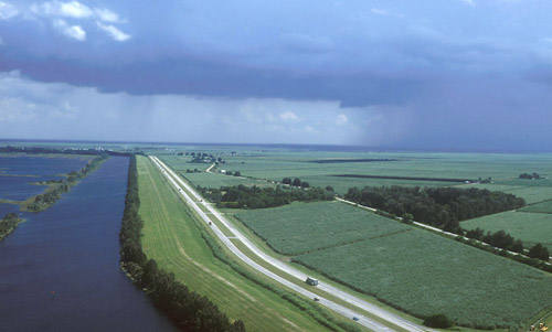
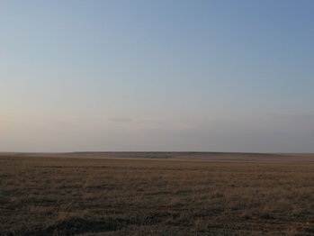
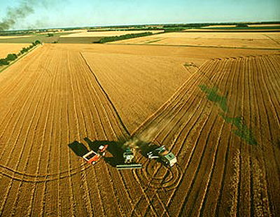
In physical geography, a steppe is a plain without trees (apart from those near rivers and lakes); it is similar to a prairie, although a prairie is generally considered as being dominated by tall grasses, while short grasses are said to be the normal in the steppe. It may be semi-desert, or covered with grass or shrubs, or both depending on the season. The term is also used to denote the climate encountered in such regions, too dry to support a forest but not so dry as to make it a desert. They are usually found in areas of the world less prone to moisture. The soil is considered too moist to be a desert, but also too dry to support normal forest life.
The climate of steppes can be summarized by hot summers and cold winters, averaging 10-20 inches of rain every year.
Plant life is usually greater than one foot tall, including the blue grama and buffalo grass, cacti, sagebrush, speargrass, and other small relatives of the sunflower.
Animal life includes but isn't limited to the Corsac Fox, Mongolian Gerbil, Saiga Antelope, Northern Lynx, and the Saker Falcon.
The world's largest zone of steppes is found in central Russia and neighbouring republics of Central Asia. The steppes begin east of the Volga river and extend through desert or semi-desert south of the Ural Mountains and to the north and east of the Caspian Sea. To the east of the Caspian Sea they extend through Turkmenistan, Uzbekistan and Kazakhstan to the mountain ranges of Mongolia, China, Kyrgyzstan, Tajikistan and Afghanistan. To the north on the eastern side of the Urals is the forested West Siberian Plain which extends nearly to the Arctic Ocean.
Another large steppe area is located in the central United States and western Canada. The High Plains steppe is the westernmost part of the Great Plains region.
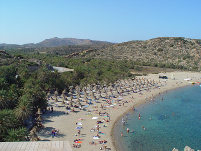
Mediterranean climate
A Mediterranean climate is one that resembles those of the lands bordering the Mediterranean Sea. These climates occur on the western coasts of continental landmasses, roughly between the latitudes of 30° and 45° north and south of the equator.
Location
Regions having a Mediterranean climate include much of California and small parts of the adjacent Pacific Northwest, Western Cape in South Africa, central Chile, Western Australia, and of course the Mediterranean Basin itself.
The northernmost instance of a Mediterranean climate occurs on the southeastern tip of Vancouver Island, Canada, which recieves less precipitation than nearby cities such as Vancouver and Seattle, Washington owing to its proximity to the rain shadow of the Olympic Mountains. Oak savannas and sclerophyllous vegetation attest to the unusual climate.
It is still debated whether some of the valley microclimates of western Washington and Oregon should be considered Mediterranean. These regions have mild winters and dry summers, but receive heavy rainfall during the wet season, enough to support lush forests more typical of a cool temperate marine climate than a Mediterranean climate.
Cause
In most places with Mediterranean climates, rainfall results almost entirely from the procession of the westerly zone of frontal storms during the low-sun season; during the summer, the subtropical high pressure zone dominates the seasonal weather, preventing rainfall by inhibiting rainstorms from forming.
This summer-dry, winter-wet rainfall pattern is extremely rare, and is only found in a small number of regions on Earth. The greatest concentration of Mediterranean climates is encountered immediately poleward of the great dry belt of subtropical deserts but equatorward of the zone of maritime temperate or oceanic climates. They are never on the east coasts of continents.
Precipitation
During summer, regions of Mediterranean climate are dominated by subtropical high pressure cells, and are thus equivalent to deserts from the point of view of air mass positions, while during winter the polar front brings weather conditions similar to those of an oceanic climate, with frequent precipitation. As a result, areas with this climate receive almost all of their yearly rainfall during the winter season, and may go anywhere from 2-5 months during the summer without having any significant precipitation.
As an example, San Francisco in California, USA, recieves an average of 448 mm (17.6 in.) of rain from November through April each year, but averages only 52 mm (2 in.) of rain for the rest of the year, and recieves almost no precipitation at all during the months of July and August.
Temperatures
All regions with Mediterranean climates have relatively mild winters, but summer temperatures are variable depending on the region. For instance, Athens, Greece experiences rather high temperatures in the summer, while San Francisco, California has cool, mild summers due to its proximity to the open Pacific Ocean. Because all regions with a Mediterranean climate are in close proximity to large bodies of water, temperatures are generally moderate with a comparatively small range of temperatures between the winter low and summer high (although the daily range of temperatures during the summer is large, except along the immediate coasts). Temperatures during winter rarely reach freezing (except in areas with a high elevation), and snow is almost unheard of. In the summer, the temperatures range from mild to very warm, depending on distance from the open ocean, elevation, and latitude. Even in the warmest locations with a Mediterranean-type climate, however, temperatures don't reach the high levels of desert regions.
Inland locations sheltered from or distant from sea breezes can experience severe heat during the summer. Locations inside the Sacramento Valley of northern California, for example, are subject to summer temperatures characteristic of hot deserts (often around 40 °C or 100 °F), although winters are rainy enough to allow lusher vegetation than is typical in deserts. Unlike the coastal climates that are designated Csb in the Köppen climate classification - characteristic of places with cooler summers - the hotter, typically inland areas have the Csa classification that indicates a hot summer. Areas that experience the typical Mediterranean pattern of cool, rainy winters and very dry summers, but which experience milder average summer temperatures include, Porto, in Portugal and San Francisco, in California.
Likewise, locations that are slightly higher latitude and cut off from milder ocean winds may have somewhat colder winters and more distinct seasons. This "temperate Mediterranean" climate is most noticeable in northern Italy and Greece, as well as southern Oregon. In these areas, plants that are commonly associated with milder Mediterranean climates, such as citrus, date palm, olive, oleander and eucalyptus, can be frozen to death in the occasional severe winter.
Areas of high altitude adjacent to locations with Mediterranean climates may have the cold winters that are characteristic of a continental climate; under Köppen's scheme such places might earn the designation Dsa, Dsb or even Dsc
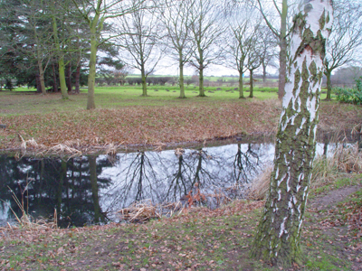
Temperate
In geography, temperate latitudes of the globe lie between the tropics and the polar circles. The changes in these regions between summer and winter are generally subtle, warm or cool, rather than extreme, burning hot or freezing cold. However, a temperate climate can have very unpredictable weather. One day it may be sunny, the next it may be raining, and after that it may be cloudy. These erratic weather patterns occur in summer as well as winter.
The north temperate zone extends from the Tropic of Cancer at about 23.5 degrees north latitude to the Arctic Circle at about 66.5 degrees north latitude. The south temperate zone extends from the Tropic of Capricorn at about 23.5 degrees south latitude to the Antarctic Circle at about 66.5 degrees south latitude.
Within these borders there are many individual climate types, which are generally grouped into two categories: continental and maritime.
The maritime climate is clearly affected by the oceans, which help to sustain somewhat stable temperatures throughout the year. In the temperate zones, the prevailing winds are to the west, the western edge of temperate continents most commonly experience this maritime climate. Such regions include Western Europe, especially the UK, and western North America at latitudes between 40° and 60° north.
The continental climate is usually situated inland, with warmer summers and colder winters. The large land mass increases its effects on heat reception and loss. In North America, the Rocky Mountains act as a climate barrier to the maritime air blowing from the west, creating a continental climate to the east. In Europe, the maritime climate is able to stabilize temperatures further inland, because the major mountain range - the Alps - is oriented east-west.
The idea of a temperate "zone" was first hypothesized by the ancient Greek scholar Aristotle. He said that the earth was divided into three types of climatic zones, based on their distance from the equator.
Thinking that the area near the equator was too hot for habitation, Aristotle dubbed the region around the equator (from 23.5° N to 23.5° S) as the "Torrid Zone." He reasoned that from both the Arctic Circle and the Antarctic Circle to their respective poles was permanently frozen. He called this uninhabitable zone the "Frigid Zone."
The only area that Aristotle believed was livable was the "Temperate Zone." The two Temperate Zones were thought to lie between the Tropics and the Arctic and Antarctic Circles. One of the reasons Aristotle believe that the Temperate Zone was the best for life could come from the fact that he lived in that zone.
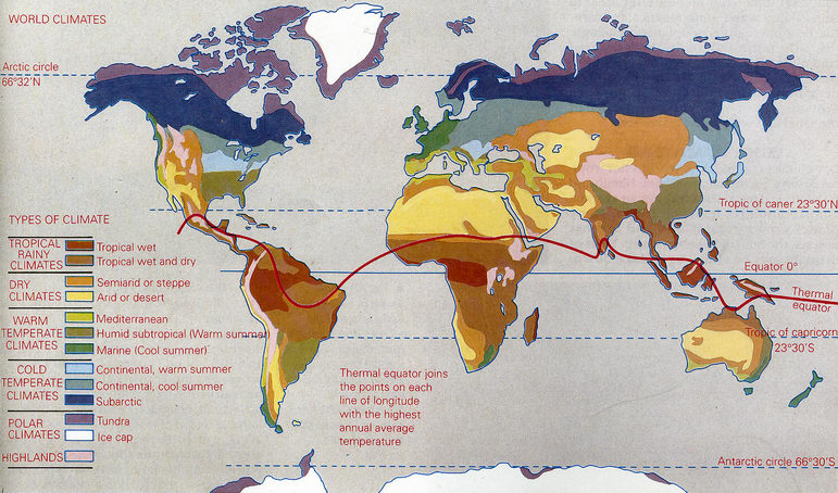
Aristotle's map was very oversimplified, although the general idea was correct. Today, the most commonly used climate map is one developed by German climatologist and amateur botanist Wladimir Köppen (1846-1940) which divides the world into six major climate regions, based on average annual precipitation, average monthly precipitation, and average monthly temperature.
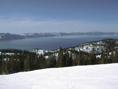
Oceanic climate
An oceanic climate (also called marine west coast climate and maritime climate) is the climate typically found along the west coasts at the middle latitudes of all the world's continents, and in southeastern Australia; similar climates are also found at high elevations within the tropics.
Oceanic climates are characterized by a narrower annual range of temperatures than are encountered in other places at a comparable latitude, and differ from Mediterranean climates in that significant amounts of precipitation are received in summer. This means that precipitation is both adequate and reliable at all times of the year in oceanic climates, except in certain tropical highland areas, which would have tropical savanna climates (with a dry season in winter) if not for the high altitude making them cooler.
Overall temperature characteristics vary among oceanic climates; those at the lowest latitudes are subtropical from a thermal standpoint, but more commonly a mesothermal regime prevails, with cool, but not cold, winters. Poleward of the latter is a zone of subpolar oceanic climate, with a summer growing season of less than four months; examples of this climate include much of coastal Iceland in the Northern Hemisphere and extreme southern Chile in the Southern Hemisphere (the fact that this form of climate exists in both hemispheres ruling out the use of such terms as subarctic or boreal to denote it; even though these terms are used to refer to climates characterized by short summers, they are also synonyms for "northern" and therefore inappropriate).
With one significant exception, oceanic climates are classified as humid with respect to precipitation, the only major example of a dry oceanic climate being that of Patagonia.
Notable cities which have oceanic climates include London, England, Paris, France, Sydney, Australia, Vancouver, Canada, and Auckland, New Zealand.
Continental climate
A continental climate is the climate typical of the middle-latitude interiors of the large continents of the Northern Hemisphere in the zone of westerly winds; similar climates exist along the east coasts (but not the west coasts) of the same continents, and also at higher elevations in certain other parts of the world. This climate is characterized by winter temperatures cold enough to support a fixed period of stable snow cover each year, and relatively low precipitation occurring mostly in summer - although east coast areas (chiefly in North America) may show an even distribution of precipitation. Only a few areas in Iran, adjacent Turkey and Central Asia show a winter maximum in precipitation, which typically melts in early spring to give short-lived floods.
These regions generally have either forest or tall-grass prairie as natural groundcover and include some of the most productive farmlands in the world. All such climates have at least three months of temperatures in excess of 10°C and winters with at least one month below 0°C (although some classifications have a lower threshold for winter based on snow cover, in the Köppen climate classification -3°C is used).
Most such areas fit Köppen classifications of Dfa, Dwa (cold winters, long hot summers; "w" indicating very dry winters characteristic especially of China) or Dfb or Dwb (cold winters and long, mild summers, same distinction for winter dryness).
Continental climates exist where cold air masses infiltrate during the winter and warm air masses form in summer under conditions of high sun and long days. Places with continental climates are as a rule either far from any moderating effects of oceans (example: Chicago, Illinois, USA) or are so situated (example: Boston, Massachusetts, USA) that prevailing winds tend to head offshore. Such regions get quite warm in the summer, achieving temperatures characteristic of tropical climates but are much colder than any other climates of similar latitude in the winter.
These climates grade off toward subtropical climates equatorward where winters are less severe, hemiboreal climate poleward where summers are shorter and winters are more severe, semiarid climates where precipitation becomes inadequate for tall-grass prairies. In Europe these climates may grade off into oceanic climates in which the influence of moderating air masses is more marked toward the west.
The Midwestern United States, parts of China, and most of Russia are examples of areas of the world with continental climates, which do not exist at all in the Southern Hemisphere due to the lack of broad land masses at middle latitudes, the southernmost parts of Africa and Australia being under marine influences and southern South America being too narrow in breadth to allow air masses as cold as those in corresponding latitudes in North America and Asia to form in the winter. Antarctica, of course, lies completely outside the middle latitudes.
Alpine climate
Alpine climate is the average weather (climate) for a region above the tree-line. The climate becomes colder at high elevations—this characteristic is described by the lapse rate of air: air will tend to get colder as it rises, since it expands. The dry adiabatic lapse rate is 10°C per km of elevation or altitude. Therefore, moving up 100 meters on a mountain is roughly equivalent to moving 80 kilometers (45' or 0.75° of latitude) towards the pole. This relationship is only approximate, however, since local factors such as proximity to oceans can drastically modify the climate.
There have been several attempts at quantifying what constitutes an alpine climate.
Climatologist Wladimir Köppen demonstrated a relationship between the Arctic and Antarctic tree lines and the 10°C summer isotherm; i.e., places where the average temperature in the warmest calendar month of the year is below 10°C cannot support forests. See Köppen climate classification for more information.
However, Otto Nordenskiöld theorized that winter conditions also play a role: His formula is W = 9 - 0.1 C, with W denoting the average temperature in the warmest month and C the average of the coldest month, both in degrees Celsius (this would mean, for example, that if a particular location had an average temperature of -20°C in its coldest month, the warmest month would need to average 11°C or higher for trees to be able to survive there). Nordenskiöld's line tends to run to the north of Köppen's near the west coasts of the Northern Hemisphere continents, south of it in the interior sections, and at about the same latitude along the east coasts of both Asia and North America. In the Southern Hemisphere, all of Tierra del Fuego lies outside the polar region in Nordenskiöld's system, but part of the island (including Ushuaia, Argentina) is reckoned as being within the Antarctic under Köppen's.
In 1947, Holdridge improved on these schemes, by defining biotemperature: the mean annual temperature, where all temperatures below 0°C are treated as 0°C (because it makes no difference to plant life, being dormant). If the mean biotemperature is between 1.5°C and 3°C [2], Holdridge quantifies the climate as alpine (or subpolar, if the low temperature is caused by latitude).
Sub arctic climate
Regions having a subarctic climate (also called boreal climate) are characterized by very cold winters, and brief, warm summers. This type of climate offers some of the most extreme seasonal temperature variations found on the planet: In winter, temperature can drop to -40°C and in summer, the temperature may exceed 30°C (86°F). The subarctic climate is a subset of the continental climate.
Vegetation in the subarctic climate is generally sparse, as only hardy species can survive the long winters and make use of the short summers. Trees are mostly limited to ferns and evergreen conifers, as few broadleafed trees are able to survive the very low temperatures in winter; this type of forest is also known as taiga, a term which is sometimes applied to the climate found therein as well.
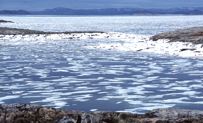
Polar climate
Regions with a polar climate are characterized by a lack of warm summers (specifically, no month having an average temperature of 10 °C or higher).
Types of polar climate
There are two distinct types of polar climate. The less severe of the two is the tundra climate, where at least one month has an average temperature of above freezing, while the colder one — known by various names including the ice cap climate and the perpetual frost climate — features sub-freezing average temperatures year-round.
Effects
Polar climates result in the absence of trees in such places, which may also be covered with glaciers or a permanent or semi-permanent layer of ice.
Examples
On earth, the only continent where the polar climate is predominant is Antarctica. All but a few isolated coastal areas on the island of Greenland also have a polar climate.
The northernmost part of the Eurasian land mass, from the northern tip of Scandinavia and eastwards to the Bering Strait, large areas of northern Siberia and Northern Iceland have tundra climate as well. There are large areas in northern Canada and northern Alaska with tundra climate, changing to ice cap climate in the most northern parts of Canada.
In other parts of the world, many mountains have a climate where no month having an average temperature of 10 °C or higher, but as this is due to elevation, this climate is referred to as Alpine climate. Polar climates have also been observed on other planets, such as Mars, which has noticeable ice caps on both poles.Climate of Antarctica
Surface temperature of Antarctica in winter and summer
The climate of Antarctica is the coldest on earth, with the lowest temperature ever recorded on earth being -89.4 °C (-129 °F) at Vostok Station. It is also extremely dry, with only an average of 166 mm of precipitation per year, although ice there can last for a long time. Weather fronts rarely penetrate far into the continent.
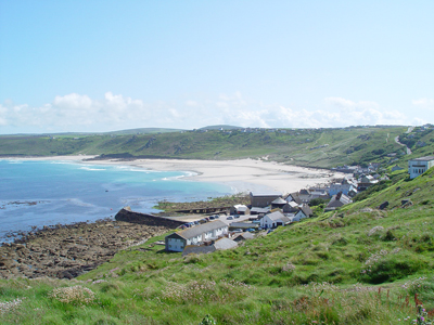
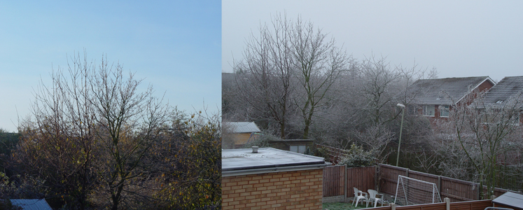
The current climate of the United Kingdom is classified as temperate, with warm summers, cool winters and plentiful precipitation throughout the year. The principle factors of influence on the climate include the UK's northerly latitude (which ranges from 50° to 60° N), its close proximity to the Atlantic Ocean and, especially, the warming of the waters around the British Isles by the Gulf Stream. The weather can be notoriously changeable from one day to the next but temperature variations throughout the year are small.
The climate of the United Kingdom is significantly influenced by the maritime tropical, maritime polar, continental polar and continental tropical air masses.A deep depression near Iceland on 27 October 2000The UK is at the boundary of convergence between the warm tropical air to the south and the cold polar air to the north. In this area, the large temperature variation creates instability and this a major factor that influences the notoriously changeable and often unsettled weather the UK experiences, where many or all types of weather can be experienced in a single day.Seasons
Winter
Winter in the UK is generally a cool, wet and windy season. Temperatures at night rarely drop below -10 °C and in the day rarely rise above 15 °C. Precipitation is plentiful throughout the season with occasional snow.
Towards the later part of the season the weather usually stabilises with less wind, precipitation and lower temperatures. This change is particularly pronounced near the coasts mainly due to the fact that the Atlantic is often at its coldest during this time after being cooled throughout the autumn and the winter. The early part of winter however is often unsettled and stormy; often the wettest and windiest time of the year.
Snow can fall occasionally and mainly affects northern and easterly areas and chiefly higher ground, especially the mountains of Scotland where the amount of lying snow may be significant enough on occasions to permit skiing at one of the five Scottish ski resorts. Snow however rarely lasts more than a week in most areas as the cold air brought by northerly or easterly winds, or sustained under high pressure system, gives way to mild southerly or westerly winds (normally introduced by North Atlantic depressions). Low pressure systems move in from the Atlantic ocean frequently throughout the season, often bringing strong winds and heavy rain along with mild temperatures. However, on rare occasions some potent depressions may move in from the north in the form of 'Polar Lows', introducing heavy snow and often blizzard-like conditions to parts of the UK, particularly Scotland.
During periods of light winds and high pressure frost and fog can become a problem and can pose a major hazard for drivers on the roads.
SpringSpring is generally a rather calm, cold and dry season, principally since the Atlantic has lost much of its heat throughout the autumn and winter. However, as the sun rises higher in the sky and the days get longer, temperatures can rise relatively high and thunderstorms / heavy showers can develop.
There is a fair chance of snow earlier in the season when it is cooler.
SummerSummer climatic differences are more influenced by latitude and temperatures are highest in southern and central areas and lowest in the north. Generally, however, summer temperatures rarely go much above 30 °C, although temperatures have soared as high as 38 °C.
The north west and north east has cool summers, the south west has rather warmer summers (average 17 °C) and the south and south east have the warmest summers.
Summer is a rather dry season on average but rainfall totals can have a wide local variation due to localised thunderstorms. These thunderstorms mainly occur in southern, eastern and central areas and are less frequent and severe in the north and west.
North Atlantic depressions are not as frequent or severe in summer but increase both in severity and frequency towards the end of the season.
AutumnAutumn in the UK is notorious for being extremely unsettled. As cool polar air moves southwards following the sun in the sky, it meets the warm air of the tropics and produces an area of great disturbance along which the United Kingdom lies. This combined with the warm ocean, which due to heating throughout the spring and summer, produces the unsettled weather of autumn. In addition, when the air is particularly cold it may actually be colder than the ocean and this can result in significant amounts of condensation, producing clouds which eventually condense and bring rain to the UK.
Atlantic depressions during this time can become intense and sustained winds of hurricane force (greater than 74 mph) have been reported. One such intense depression was the great “hurricane” of 1987.
Western areas, being closest to the Atlantic, experience these severe conditions to a significantly greater extent than eastern areas.
As such, autumn, particularly the latter part, is often the stormiest time of the year.
(c) 2007 Forestville: Media