| Mapping Island Nations |
| Students used modeling dough (flour, salt, and water) to make many different kinds of maps. |
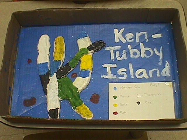 |
| Kentubby Island is a Resource Map with each color symbolizing a different region that shares a common resource. EX: Black = Diamond |
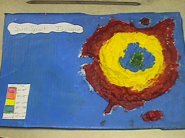 |
| Sun Spot Island is Climate Map. Each color representing a different climate. |
 |
 |
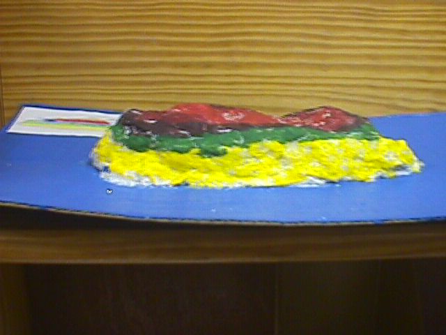
| This is an elevation map. Each color representing a different elevation above sea level. |
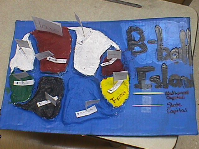
| B-Ball Island is a Physical map where rivers separate the island into states. |