|

Conference News
Xtra
Goodbye
Amsterdam, Hello Istanbul!
Despite some
unseasonable July weather, it proved a memorable event for the
estimated 3,000 visitors that flocked to Amsterdam for the XIXth
Congress of the International Society for Photogrammetry and Remote
Sensing. GEOEurope tagged along ...
"We've never known
anything like it," said my cab driver. I cringed, thinking he was
alluding to the mayhem visited on Belgium and the Netherlands by
English hooligans during the EURO 2000 football fest. He gestured at
the leaden sky. "It's rained for days and there's no end to it," he
added with a grimace. I sat back with relief, spared the
embarrassment of having to excuse the inexcusable. But then, the
Dutch are infinitely forgiving.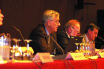
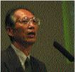
(left) ISPRS
President Larry Fritz welcomes delegates
They are also great
hosts, and Professor Klaas Jan Beek and his team from the
Netherlands Society for Earth Observation and Geoinformatics are to
be congratulated on mounting the latest in a series of quadrennial
events. Efficient yet relaxed, and with an accompanying trade
exhibition professionally stage-managed by Congrex Holland, its
atmosphere was entirely in keeping with Amsterdam's now ageing but
still imposing RAI Congress Centre
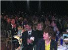
Gruelling
schedule
Completing the business
of the Congress in a week rather than the fortnight traditionally
allocated imposed a gruelling schedule on the 1,700 delegates that
represented affiliated bodies from every continent. However, most
found time to sample the variety of off-site excursions on offer.
With many ITC alumni attending, trips to Enschede were particularly
popular - and for all the right reasons, one hastens to
add.
A key function of the
Congress is to elect officers who will lead the Society and its
various Commissions over the next four years and, of course, to
thank those handing on the baton. A special vote of thanks went to
Larry Fritz of the United States, whose presidency has been
characterised by much greater outreach to non-specialists and
acknowledgment of the convergence between remote sensing,
photogrammetry and the spatial information sciences.
Those elected to take
the reins for the forthcoming term were: President: John Trinder,
Secretary-General: Ian Dowman, 1st Vice-President: Larry W Fritz,
2nd Vice-President: Gerard Begni, and Treasurer: Ammatzia
Peled
Planning
ahead
Another requirement of
the General Assembly is to vote on the venue for the next Congress,
to be held in 2004.
With Brisbane,
Australia, dropping out of the running, the final run-off was
between Beijing in China, Istanbul in Turkey, and Barcelona in
Spain. All candidate cities received backing from their respective
governments and mounted persuasive arguments, but the vote went to
Istanbul by a comfortable margin on the second ballot. Delegates
also approved the appointment of Professor Orthan Altan as director
of this, the XXth Congress.
Awards
Among the awards
bestowed during the Congress was that of 'Honorary Member' to 1st
Vice-President, Shunji Murai; the Brock Gold Medal to ESRI
president, Jack Dangermond, and the Otto von Gruber Award to H Mayer
and George Vosselman.
Special mention goes
here to Parviz Tarikhi of the Iranian Remote Sensing Centre (and
GEOEurope's Middle East correspondent) who scooped the Eduard
Dolezal Award, sponsored by Austria's Society of Surveying and
Photogrammetry and presented to individuals from developing
countries who have contributed to successful
applications.
Show
snapshots
For those with the
fortitude to enter ESRI's labyrinthine midnight black stand, talk
was of the company's bold move in launching the Geography Network, a
global Web resource for all. Certainly, it was receiving a lot of
local support, with the Dutch national mapping agency, TDN, being
among the first to pledge its support - and data.
Can such resources
overcome language barriers when text search entries are made in
languages other than English? The latter may be the lingua franca
for professionals, but a resource intended for popular use,
particularly by youngsters, needs local servers, multi-lingual
interfaces or translation software if it is to fulfil its global
promise. ESRI says it is addressing the problem
Emerging into the
light, one was drawn to Leica's futuristic tableau. This formed the
backdrop for a laser spectacular in which two silver-clad figures
gyrated around in slow motion, clutching at projected images that
flickered and pulsed in time to the musical accompaniment.
Mmm...
With Christmas
beckoning, I counted my pennies and went in search of suitable
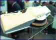
gifts. It was obvious that Rollei's enticingly displayed d7 metric
mega-pixel camera was way beyond my reach. Even so, something
usually materialises at such events. My vote goes to a mysterious
brown paper package that was being discretely ferried around by Dr.
Ammatzia Peled, senior lecturer in the department of geography at
Israel's Haifa University and newly-elected ISPRS
Treasurer.
Curiosity is a terrible
thing ... matched only by my atrocious Hebrew. Simultaneously
inflicting both on this eminent academician was, perhaps, too much
and he relented by revealing all.
What emerged was a
beautifully photographed set of anaglyphs. Published as a coffee
table-size book and supplied with red-cyan 3-D glasses by RJB Three
Dimensional Ltd of Haifa, "The Jesus Continuum" contains 400
stunning 3-D portraits of biblical artefacts and pilgrimage sites in
the Holy Land. "It was meant to be printed in time for the
Millennium celebrations, but there were problems," he said sadly.
But as we all know, the new Millennium really only starts in 2001,
so no problem! At US$67.95 (EUR 75.29) incl. p&p to Europe and
the Middle East, it's a bargain and definitely worth a visit to http://www.rjb-3d.com/for more
details.
For a
full round-up of products and services introduced at the show, look
out for our next issue.
|