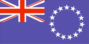
Cook Islands
 The Cook Islands, an island group in the South Pacific Ocean, achieved
self-government in 1965. The islands were proclaimed a British
protectorate in 1888, which passed to New Zealand in 1901. The
administration centre is the port of Avarua on the island of Rarotonga.
The islands cover an area of 237 sq km (91 sq mi) and have a population
of 19,776 (1997). The Cook Island inhabitants are Polynesians, related to
the Maori's of New Zealand. The islands are located north-east of New
Zealand and south Hawaii.
The Cook Islands, an island group in the South Pacific Ocean, achieved
self-government in 1965. The islands were proclaimed a British
protectorate in 1888, which passed to New Zealand in 1901. The
administration centre is the port of Avarua on the island of Rarotonga.
The islands cover an area of 237 sq km (91 sq mi) and have a population
of 19,776 (1997). The Cook Island inhabitants are Polynesians, related to
the Maori's of New Zealand. The islands are located north-east of New
Zealand and south Hawaii.
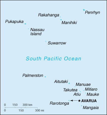
The Cook Islands
Where are the Cook Islands? To find where the Cook Islands are located
in the South Pacific, just click on this link to the Map of Oceania and
look up longitude 160°W and latitude 15°S.
Displacement (tons): 162 Full Load
Dimensions (feet): 103.3 x 26.6 x 6.9 (31.5 x 8.1 x 2.1m)
Propulsion: 2 x Caterpillar 3516TA diesels, 2,820 hp, 2 shafts
Max. Speed (knots): 20
Armament: none carried
Complement: 17
No. Name Commissioned Notes/Fate
-- Te Kukupa 1/9/89 Active, Avarua.
(The Dove)
Note: Built as hull number 7 by Australian Shipbuilding Industries (WA)
Pty Ltd, for the Australian Government, as part of the South Pacific
Forum's Defence Co-operation Programme.
(Back To Top)

Fiji 
Back to Main Page
Copyright � 1 January, 2003,
Terry M. Walsh,
All rights reserved.