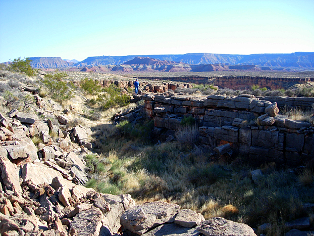
H17: Fissures in Kaibab Limestone (Virgin-adjacent) - S29 & 30 T41S R12W
(1/11/06)
S29
& 30 T41S R12W has linear fissures present in the flat surface (Kaibab
Limestone), which are adjacent and also distant from the Virgin Canyon (some
200 meters), running parallel to the canyon in places and also at other
angles to the 300 feet deep linear walls of the canyon. These are called
sinkholes by some observers, but the features are linear- running at three
different fracture angles:
1.
The fractures trace N-S at significant distances
from the canyon, parallel to the Hurricane Fault, but not generally to
either of the perpendicular turns of the river;
2.
The large fissures have both N-S fractures in the
blocks bordering them, at angles of 20 degrees (which exhibit orthogonals to
these), and have NW-SE regional fractures bordering them
also;
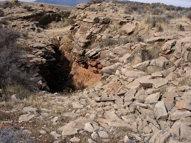
3. The failure fissures appear to be
gravity-dominated, creating large blocks of limestone slowly rotating toward
the canyon- opening up the fissures greatest at the ground surface. These
blocks are not parallel to the fractures crossing them, but appear to be
assisted by the fractures which weaken the rock beforehand;
4. The fractures and fissures exist at the top
of a mound, and are not rounded as with a sink hole. The whole appearance of
the limestone country is one of dipping up-to-the-west, as is the Kaibab
near the Town of
Toquerville;
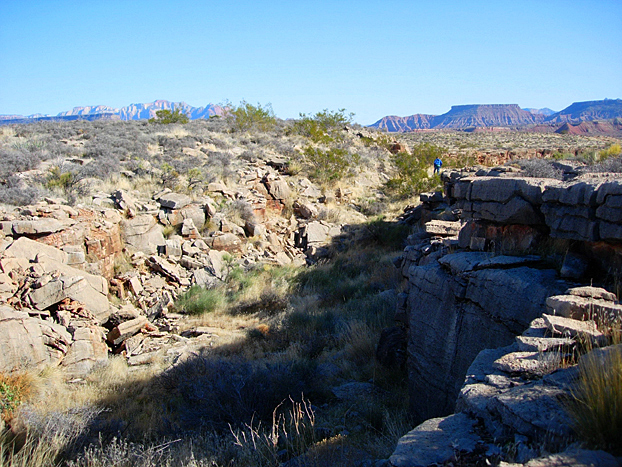
5. The fractures and fissures are generally
linear in presentation, as with
regional stresses, not as with dissolution of deep carbonates which would
create subsurface caverns causing sinkholes;
6. The Virgin River makes perpendicular turns,
tracing either N-S or E-W in this Section 29, but further east, makes NW-SE
or NE-SW channels; and
7. There appears to be an angular distortion
and wrenching of the Kaibab, yielding surface blocks of limestone at the
surface- which are separate from the others and which have soil between
them. This is true far away (.5 km) from the canyon, as well as close
by.
CONCLUSIONS;
A.
The coincidence of River location and up-dipping
and wrenching of the Kaibab, here and west of 3 Falls near Toquerville,
indicates that there is a local anomaly in the crust, causing unusual
fracturing and breakage of the Kaibab so as to allow the Virgin to create a
channel through the rim of the Hurricane scarp (even though it is
structurally and topographically high relative to the drainage of the Virgin
to the east;
B.
The occurrence of the Pah Tempe hot springs,
several clustered dormant volcanoes, spreading fractures, fissures, and
faulting, and accentuated up-dipping of the stratigraphy in this region
indicates an unusual crustal anomaly;
C.
The linear nature of the fissures and fractures
indicates that these are the result of accentuated stresses locally,
not caused by solution caverns and cave-roof collapse in the Redwall
or its equivalent some 300 meters deeper;
D.
The capture of local drainage by the Virgin,
superceding the Ash and Laverkin Creeks, indicates that there has been a
major change in the local stresses in Pleistocene time, offsetting the
previous NW-SE strains to allow N-S strains to become dominant;
and
E.
The Virgin River outlet through the Hurricane
scarp represents a regional boundary to the Hurricane linear, where there is
uplift of the Colorado plateau
more in the south than in the north- this could happen because there
is more unloading to the south, but also because of a re-directing of stress
direction at the River.