CHILIKA
Nesting in the heart of coastal Orissa, Chilika is India's biggest inland lake. Spread over 1,100 square kilometers, stretching across the length of the three districts of Puri , Khurda and Ganjam, it joins up with the Bay of Bengal through a narrow mouth, forming an enormous lagoon of brackish water.
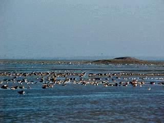
Dotted with many emerald green islands with colorful names such as Honeymoon Island and Breakfast Island, Chilika is home to a rich variety of aquatic fauna. It is the largest wintering ground for migratory waterfowl found anywhere on the Indian sub-continent. Its a sanctuary and winter resort for migratory birds, some coming from as far as Siberia.
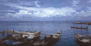
Containing a large variety of fish, the lake provides a livelihood to thousands of fishermen. hundreds of boats sail out daily on the lake's blue expanse in search of mackerel, prawn and crabs, the sight providing an insight into the pageant of rural India at its colorful best.
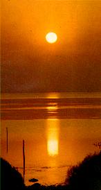
Encircled by hills all along all along its arched shape, Chilika lake's colour changes with passing clouds overhead and the shifting sun. The water ripples languidly, occasionally rippling with a gentle breeze across from the Bay of Bengal.
Details about Chilika
The vast and dream like Chilika Lagoon is situated on the east-coast of India. It is the largest brackish Water Lagoon with estuarine character that sprawls along the east coast. It is the largest wintering ground for migratory waterfowl found anywhere on the Indian sub-continent. It is one of the hotspot of biodiversity in the country, and some rare, vulnerable and endangered species listed in the IUCN Red List of threatened Animals inhabit the Lake area for
at least part of their life cycle. The total number of fish species are reported to be 225 (Dean and Saaltink, 1991). Along with a variety of phytoplankton, algae and aquatic plants, the Lake region also supports over 350 species of non-aquatic plants (Panda and Pattnaik, 1988). A survey of the fauna of Chilika Lake carried out by the Zoological Survey of India in 1985-87 recorded over 800 species in and around the lagoon. This list includes a number of rare, threatened and endangered species, including the Barakudia limbless skink. On account of its rich bio-diversity, Chilika was designated as a "Ramsar Site", i.e. a wetland of International Importance. The Nalaban Island within the Lake is notified as a Bird Sanctuary under Wildlife (Protection) Act, the lagoon is also identified as a priority site for conservation and management by the National Wetlands, mangroves and coral reefs Committee of Ministry of Environment & Forests, Government of India. The Lagoon is a highly productive ecosystem, with rich fishery resources. The rich fishing ground sustain the livelihood of more than 1,00,000 fisher folk who live in and around the Lake.
 The waterspread area of the Lake varies between 1165 to 906 sq.km during the monsoon and summer respectively. A 32 km long, narrow, outer channel connects the main lagoon to the Bay of Bengal, near the village Arakhakuda. The mouth connecting the channel to the sea is close to the north eastern end of the Lake. High tides near this inlet mouth drive in salt water through the channel during the dry months, from December to June. With the onset of the rains, the rivers falling into the northern zone are in spate, causing fresh water currents which gradually push the sea water out. As a result of these dynamics the inlet mouth constantly changes position.
The Lake itself can be broadly divided into four natural sectors based on salinity and depth: the southern zone, central zone, northern zone and the outer channel. Numerous islands are present in the Lake, prominent among which are Nalaban, Kalijai, Somolo, Honeymoon, Breakfast and Birds.
Chilika supports some of the largest congregation of aquatic birds in the country, particularly during the winter. Flocks of migratory waterfowl arrive from as far as the Caspian Sea, Lake Baikal, Aral Sea, remote parts of Russia, Kirghiz steppes of Mongolia, Central and South East Asia, Ladakh and the Himalayas, to feed and breed in its fertile waters. In 1989-90 an estimated two million birds visited the Lake.
Based on its rich biodiversity and socio-economic importance, Chilika Lake was designated by the Government of India as a Ramsar Site in 1981, under the Convention of Wetlands of International Importance especially as Waterfowl Habitat, popularly known as the Ramsar Convention. It is also included in the list of wetlands selected for intensive conservation and management by the Ministry of Environment and Forests, Government of India.
LOCATION
Chilika Lagoon is situated between 19028’ and 19054’ North latitude and 85005’ and 85038’ East longitudes. It extends from Southwest corner of Puri and Khurda districts to the adjoining Ganjam District of Orissa State. It is well connected by Air, Rail and Roads. It is 100 km away from Biju Patnaik International Airport, Bhubaneswar and 2 km from Balugaon Railway Station.
Flora : Phytoplankton flora – 43 sp, algal communities – 22 sp, Vascular plants 150 sp.
Fauna: Fishes – 225 sp, Protozoa – 61 sp, Platyhelminthes- 29 sp, NematodesNematodes – 37 sp, Polychaetes –31 sp, Mollusca – 136 sp,– Crustacea m- 28 sp., Decapoda – 30 sp., Amphibian & Reptile – 37 sp, Birds – 156 sp, and Mammals – 118 sp.
An Overview of Chilika
AJIT KUMAR PATTNAIK I.F.S
Chief Executive C.D.A
CHILIKA is the biggest lagoon in the East-coast of India, situated between latitudes 190 28' and 19054' "N" and longitude 850 05' and 850 38' "E" (Fig-1). It covers the Puri, Khurda and Ganjam districts of Orissa. It is separated from Bay of Bengal by a sand bar whose width varies from 100 MTS to 1.5 Kms. A 32 Kms long narrow outer channel connects the main lagoon to the Bay of Bengal near village Arakhakuda. The lagoon can be broadly divided into four Natural sectors, the southern zone, the central zone, the Northern zone and the outer channel
The water-spread of the lagoon varies between 1165 Sq.Kms to 906 Sq.Kms during monsoon and summer respectively. The lagoon is pear shaped, with a linear maximum length of 64.3 Kms and the average mean width of 20.1 Kms, the mean width during summer and monsoon is 14.08 Kms and 18.10 Kms respectively. The vegetation free area of the Lagoon is 726 Sq.Kms where as the area covered with macro-phyte and micro-phyte is 179 Sq.Kms (varies seasonally). The Lagoon is an estuarine one and it supports a unique assemblege of marine, brackish water and fresh water species. Over one million migratory Water-fawl, Shore-birds and resident birds winter here.The Lagoon supports many endangered and endemic species of flora and fauna, thus it is a hot-spot of Biodiversity and a wetland of International Importance.
ORIGIN OF CHILIKA
LAGOON
There are a number of schools of thought about the origin of Chilika Lagoon. According to Dr. Hunter, the renowned Historian, the Lake originated due to raise of bed by deposition of silt brought by the rivers and it is probable that the low mud-flats which were pushing their way south-ward from the mouths of these rivers extended over the whole lake.
Blanford in his Book titled "Sketch of the Geology of Orissa" (1872), had mentioned that the Lake was a part of the sea, at an early stage rendered shallow due to the deposit of silt carried up the bay round the hills near Ganjam by the violent southernly winds of the monsoon and then entirely cut off by a spit, formed by the same agency, of sand, drifted along the coast.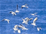
According to Venkatarathnam (1970) the occurance of shells, on the steep cliff facing the sea in the Palur hills located on the southern zone of the Lake, and the shell bed of OstreaVirginiana found in the coarse sediments and the corals at Ghantasila hill is dated at 3,750 + 200 B.P. This is the time when the sea is presumed to have attained the present level. At the time of coastal transgression, the entire Lagoon must have became a "Bay" with a wide-mouth limited by the Palur hill in the south. Because of the north-ward long-shore littoral drift and wave action, spit building might have started and it might have gradually proceeded towards north leading to formation of the bar and em-bayment. Continuous deposition of sediments through the Mahanadi distributories on the one hand and piling of sediment due to littoral drift by tidal action on the other hand helped in closing the bay to attain the present configuration.
Limnlogical feature of the Lagoon
Limnology, the inter-relationship of an organism and their environment, plays a vital role in Lagoon ecology. This information of biotic and abiotic factor is quite fascinating so far as Lagoon ecology is considered.
ABIOTIC FACTORS:-A number of studies are being carried out on the abiotic factor of Chilika Lagoon.
Temperature: Temperature is a vital parameter which influences the growth of organism. The water temperature variation of the Lagoon reported by ORSAC (1988)is 23.50C. Kemp and Annandale (1915) had reported the variation of water temperature of Chilika from 25C0 - 35C0. The temperature variation during the year 1997-98 is recorded to be
24 C0 to 32 C0 by Chilika Development Authority (surface water).
Transparency: The entire aquatic vegetation and phytoplankton depend upon the illumination, which in turn is dependent on the transparency. Pattnaik, 1978 has recorded a minimum of 4.0 Cm to a maximum 20 cm of water transparency in the Northern Sector. Chilika Development Authority during the year 1997-98 recorded the maximum and minimum variation of 9.0 cms to 155.0 cms transparency by Sechi Disc method.
Hydrogen Ion concentration: The Lagoon ecosystem is influenced to a great extent by the hydrogen Ion concentration, particularly on the nutrion uptake of the macrophytes and phyto-planktons. Suba Rao et al (1981) have reported the variation of the pH from 6.8 at Arakhakuda to 9.7 at Balugaon. Mohapatra et al have recorded the variation of pH in Chilika from 7.8 to 9.2. The variation of pH is recorded to be 7.1 to 9.6 during 1997 & 1998 by Chilika Development Authority.
Alkalinity: The alkalinity influence the growth of phyto-plankton to a great extent. Mohapatra et al (1988) recorded the variation of total alkalinity to be 33.0 to 189.0 mg/L. The total alkalinity variation recorded by Chilika Development Authority to be 44.0 - 224 mg/L in 1997-98.
Dissolved Oxygen: The dissolved oxygen plays a vital role on the growth of the fauna. The variation of dissolved oxygen as reported by Das and Samal (1988) is 3.3 mg/L to 11.2 mg/L. The variation of D.O as recorded by Chilika Development Authority is 2.4 to 12.6 mg/L in 1997-98.
Salinity: Salinity greatly influences the Bio-diversity of the lagoon. There is a distinct salinity gradient along the Lake, with remarkable seasonal variation. This is due to the influx of fresh water by river like Daya, Bhargavi, Nuna, Ratnachira and the various rivulets from the water-sheds during monsoon and due to the inflow of salt water through the outer channel from Sea to the lagoon through Magarmukh. The salinity level in outer channel, Central and Northern sector fall drastically during monsoon and the salinity fall moderately in Southern Sector. The salinity level rise steadily after post-monsoon period and attains it's peak in summer month. It is observed that there is a gradual fall in salinity level in all the Sectors of the Lagoon, when compared with old data. The maximum and minimum salinity level during 1997-98 was recorded to be 0.1 ppt and 37.2 ppt by Chilika Development Authority.
Biotic factors: Flora and fauna are the principal components of an ecosystem, both the components are inter-dependent at trophic level.
Flora : Phyto-planktons, algal communities and
vascular plants constitute the flora of the lagoon. The phytoplankton grow Luxuriantly in the lagoon, Devasundaram and Roy (1954) have reported two species of Chlorophyceae thrity species of
 Bacillariophyceae, seven sp. of Dinophyceae one species of Rhodophyceae and
three species of Myxophyceae. Asterionella japonica was found to be most dominant species contributing to 49.92% of total phytoplankton flora. Other dominant species were Anabaena, Coscinodiscus, Rhizosolenia sp. and Spirogyra sp. Pattnaik and Sarkar (1976) have reported three peaks in Central Sector i.e., in the month of April, August and December. They have reported four peaks in southern sector i.e., in January, May, July and October.
Bacillariophyceae, seven sp. of Dinophyceae one species of Rhodophyceae and
three species of Myxophyceae. Asterionella japonica was found to be most dominant species contributing to 49.92% of total phytoplankton flora. Other dominant species were Anabaena, Coscinodiscus, Rhizosolenia sp. and Spirogyra sp. Pattnaik and Sarkar (1976) have reported three peaks in Central Sector i.e., in the month of April, August and December. They have reported four peaks in southern sector i.e., in January, May, July and October.
Algal communities: Biswas reported 22 species of algae, representing 13 genera and eight families. Pattnaik (1978) has reported on the distribution and seasonality of algal form in the lagoon.
Vascular plant : Panigrahi (1988) reported 150 species of vascular plants in Chilika. There is a marked change both in distribution pattern and density of the vegetation in the lagoon during the years. Some of the Islands are excellent sites for speciation as some endemic species are reported from the Islands. Some species which were earlier casual visitors, are now established in the Lake (Patnaik 1973).
Fauna: The pioneering work on the lagoon was carried out by Kemp and Annandale (1915-1924). They have recorded their findings in 13 Volumes published in form of Memories of Indian Museum.
Choudhury (1916, 1917 and 1923) and Hora (1923) reported 118 species of fishes. The recent survey by Zoological Survey of India (1995 ) recorded 217 sp. of fishes. In addition to this 61 species of Protozoa, 29 species of
Platy helminthes, 37 species of Parasitic Nematodes, 31 species of Polychaetes, Ghose reported 3 species of Stomatopada, 28 species of Brachyura Crustacea, 30 species of decapoda, 136 species of Mollusca, 3 species of echicurans, one species of Protochordata, 37 species of amphibians & Reptiles, 156 species of Birds, 118 sp. of mammals. Two major sp. of crab of commercial importance i.e., Scylla serrata and Neptunus pelagicus are found in Chilika. The crab landing is alarmingly declining in Chilika Lagoon.
Chilika is the paradise for the migratory birds during winter, millions of migratory as well as residential birds adorn the lake, Dev - 1989 reported 151 species of Birds in Chilika lagoon, out of which 94 species belonging to 15 families are reported to be migratory.
PROBLEMS OF THE LAGOON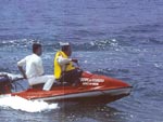
The lagoon is at present facing the problems like - siltation, shrinkage of area, chocking of the inlet as well as the outer channel connecting the sea, decrease in salinity, weed infestation, decrease in fish productivity, increase in aquaculture, and an overall loss of Biodiversity.
Siltation: Siltation of Chilika Lake is atributed as one of the principal factor endangering the Lake. No reliable estimates of sedimentation rate are available. There are 52 No. of rivers and rivulets draining into Chilika. High volume of sediment is pumped into the lagoon by the tributaries of Mahanadi on the Northern side and by the rivers and rivulets on western side. The catchment of the lagoon (excluding the Mahanadi drainage) is estimated to be 3,21,189 ha. out of which 37% is arable land, 32% is fallow land, 26% is forest land and 5% is waste land.
The catchment on the western side of the Chilika is being treated by Soil Conservation Department. There is a programme for long term Hydrological monitoring - by Chilika Development Authority. The Department of Water Resource, under the Naraj Barrage Project, plan to divert the early monsoon flow of July and August in Mahanadi arm, so there will be minimum flow in Kathajori arm, thereby the silt load in Daya and Bhargabi will be reduced. The Orissa Remote Sensing Application Centre is at present preparing a catchment Management Plan based on the IRS IC, ID data, based on which catchment treatment on the western side of the Lake would be carried by Soil Conservation Department, which will be supported by Chilika Development Authority.
Choking of the inlet and outer channel Various studies indicate that about 1 million Cum of drift is prevailing in this region of the cost. This leads to shifting of the mouth in North Eastern direction. The cross section of the outer channel is also significantly reduced due to shoal formation, along the outer channel which leads to considerable hydraulic head loss and poor flushing
action .
.
The recent bathymetry of the Magarmukh (the gate-way between Lake and outer channel) indicates that the summer depth is alarmingly low i.e., only 0.3 meter, this is preventing the discharge of fresh water and sediment during monsoon to sea through outer channel, thereby causing flood in the Northern Sector, similarly the Nalabana Bird Sanctuary is also remaining submerged during October causing management problems of the Bird Sanctuary. At the same time the tidal ingress in to the Lake is also prevented. This is also reducing the prospect of migration of the animals from Sea to Lake thereby reducing the prospect of capture fishery. To mitigate this problem, the Central Water and Power Research Station, Pune have recommended to develop a lead channel near Magarmukh to establish the link between outer channel and the main lagoon based on their mathematical model studies. Accordingly, a lead channel of 1500 MTS is dredged during 1998 near Magarmukh. The National Institute of Oceanography is doing the EIA to know the impact of this lead channel, on the Lagoon system.
Shrinkage of water-spread area:
The water-spread area as calculated from Survey of India Topo-sheet (1972-73 was 824 Sq.Kms. - (Summer). The Land Sat-5, data dt. 25.5.1986 indicates the water-spread area to be 790 Sq.Kms. The shrinkage of water-spread from 1973 to 1986 is from 824 to 790 Sq.Kms. The Orissa Remove Sensing Agency is carrying out a detail Land-use/Land cover and geomorphological mapping of Chilika Lagoon catchment by use of IRS-IC, ID Satellite data, sponsored by Chilika Development Authority.
Weed infestation
Analysis of Satellite data reveal that during the years 1973, 1977, 1985 and 1993 the weed covered area in the lagoon were 20, 60, 200 and 398 Sq.Kms respectively. The weeds are emergent, floating and submerged type. The predominant weed are Potomogeton pectinatus mostly found in Central and fringes of Southern Sector. Scripus littoralis, predominant in Northern Sector. The Orissa Renewable Energy Development Agency have patented the biogas plant with Patamogeton as raw-material. The Chilika Development Authority is planning to sponsor the community biogas plant using Chilika weed with the help of OREDA in the peripheral village of Northern and Southern Sector of Chilika Lagoon.
Gracillaria verrucosa is a dominate algae in Chilika Lake (Mohanty - 1981). Gracillaria can be cultured in Chilika Lake for at least six months of the year between January to June.
Decrease in fish-landing:
The species composition of fish in Chilika Lagoon is complex in the sense that it includes fresh water, brackish, catadramous and anadromous fish species. A large percentage of the commercial fish species are migratory (either catodromous or anadromous). Jhingran (1963) estimated that 63-75% of the annual fish production was contributed by migratory species. This percentage is reduced to 30% due to relative increase in fresh water species (Biswas). A large percentage of the fish species feed off plant material and detritus, because of this trophic charcteristic the Chilika Lagoon fish population are highly productive (Grams of Carbon fixed on an aerial basis). As per calculation of Biswas, the annual fish production from Chilika average about 90 Kg/ha during the 1980's (Range - 65-122 Kg/ha).
The total fish landing on an average was 6,000 Mts but it is gradually declining (Table A), the fish landing of 1997-98 is 1641.5 MTS. (Source - Fishery and Animal Resource Development Dept.) This decline can be attributed to composite factors like over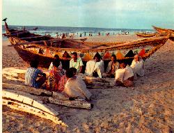 fishing beyond carrying capacity, obstruction of migratory route of economic species (due to chocking of mouth and outer channel as well as at Magarmukh). The Orissa Marine Fisheries Regulation Act, prevents operation of off-shore vessels within 5 Kms of coast as the fish recruitment into Chilika Lake is mainly by spawners which concentrate within 5 Kms of restricted fishing zone. There is also provision for restriction of fishing in Palur Canal and outer channel, but it is observed that the regulation is very poorly enforced. The decline is also attributed to decrease in salinity level of Lagoon. The existing procedure adopted by the Fishery and Animal Resource Department for fish landing data acquisition and analysis need to be streamlined by way of improvement and innovations.
Shrimp pond aquaculture is gradually increasing along the periphery and outer channel of Chilika, though no intensive shrimp farming operations are prevalent. The potential environmental impacts that may result from the shrimp pond aquaculture can be, it's effect on land-use,
aesthetics, habitat reduction, water quality and circulation changes, construction impact, reduction of wild populations because of their capture for brood stock. The shallow bathymetry makes virtually the entire lagoon capable of supporting aquaculture excepting southern zone. The shallow areas of lagoon provide feeding and spawning ground for both resident and migratory fish species, thus the productivity will be affected if the accessibility to these shaallow habitat is infringed.
Certain steps like ban/restriction on fishing in certain vulnerable areas like the Lake outlet and Palur canal, some areas within the Lake known to be spawning ground need to be included. A systematic fishing resource survey, establishing migratory route to know the recruitment of fish and prawn juvenile in to the lagoon is essential. There is a proposal to support State Fishery Department for the above measures by Chilika Development Authority.
Dolphin - Ecology:
Irrawaddy dolphins Orcaella brevirostris are commonly sighted within the Lagoon and along the outer channel but their life-history detail is not studied, similarly the habitat utilisation by the dolphin is also not known. Annandale (1915) was first to record O.brevirostris in Chilika Lake. It is listed as an endangered species in the I.U.C.N list of threatened Animal.
Nalaban Sanctuary
Chilika Lagoon is one of the most important wintering grounds for the resident as well as migratory birds. As per the last census of Asian Waterfawl total 1,484,186 waterbirds of 85 species were counted in 1996. It is one of the six Wetlands of International importance designated by India under Ramsar Convention due to migratory species of Arctic and Central Asian water fawl. The Nalabana Island was notified as a Sanctuary considering it's unique features as a habitat for the avifauna. The avifauna of Chilika is diverse, and includes 151 species belonging to 26 families. The avifauna is predominated by 22 species of ducks and geese, 52 species of plovers and Sand pipers belonging to 8 families, 14 species of gulls and terns, 13 species of eagles and 11 species of herons and egrets. Out of 151 species, 92 species are considered to be resident or local migrant. At present the Nalabana Sanctuary is managed by the wildlife wing of Forest Department, with an objective to improve the habitat, protection to the avifauna and other allied management practices. The Chilika Development Authority is supporting the wildlife Division for restoration of Ecosystem of Nalabana Island.
Social and Economic issues
There are 132 No. of fisherman villages with 12,363 active fisherman families. Traditionally the caste factor used to decide the occupation, i.e., those who belonged to the "Fisherman" community, used to do fishing in the Lagoon by use of traditional techniques. The upper caste used to do cultivation and trading and the tribal people used to depend on forest. After mid-80s there is a remarkable - transformation of traditional caste-linked occupation, (due to steep rise in prawn price, the non-traditional fisherman, particularly the farmers have entered in to fishing and prawn culture). This has enabled them to become more stronger socially and economically and reinforce their social as well as physical power against the fisherman community, such as forcibly occupying and farming in new lands formed due to sedimentation and also using the shallow waters for prawn culture. The traditional caste linked occupation structure is changing, for example some upper caste farmers around Northern side of the Lake, who are affected by flood in
perpetuity have entered into fishing and prawn culture. Similarly, because of the poverty the non-tribals are now entering the forest to make a living. Thus the over
dependency has led to depletion of fishery resources because it has gone beyond carrying capacity. Traditionally and legally the fisherman community have a right over the lagoon water, but at present the non-fisherman community are encroaching upon the traditional right of the fisherman. There have been constant opposition to this sub-ordination and efforts for regaining control over their traditional rights, this has led to physical conflicts and to law and order problems. In most of the Developmental Programme the gender issue is not addressed. There has been no attempt to assess and quantify the economic contribution of women to their families and communities, even though woman play a major role in economic production, bringing in income, child rearing, food preparation, firewood collection and other house-hold chores. Women in fishing communities do marketing of fish, salting even at times involved in catching of fish. The status of woman can be examined from two perspectives, fisher-women as a group and as individuals. As a group their status is determined by their involvement in fish marketing, net making etc. As an individual, their status is determined by their age, sub-caste, marital status and type of employment. By custom women do not inherit any assets including capital assets.
Due to poverty, and nutritional deprivation, the health problem are acute. The poor medical and sanitation facilities coupled with poor personal and house-hold hygene lead to many water-borne infectious diseases; Various skin diseases, cholera, typhoid, diarrhea and Vitamin 'A' deficiency are widely prevalent among the community. The women commonly suffer from diseases like Leucorrhea and malnutrition. Poor sanitation is the major cause of unsafe drinking water. Most of the tube-wells are normally non-functional due to poor maintenance.
Eco-tourism
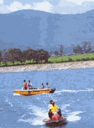
The vast diversity of dream like Chilika Lagoon offers ample scope for regulated Eco-tourism. The inviting Islands of Southern Sector with vast stretch of blue water, the end-less, un-explored stretch of empty beach across the sand-bar separating the Lagoon from Sea, the million of brilliant migratory birds during winter; the Irrawaddy dolphins are some of the unique feature of the Lake and are potential for development of Eco-tourism.
The entire tourism in Chilika is now in an un-organised form. It has got vast potentiality to generate employment for the un-employed villagers living around the Lagoon, however, it should be regulated and compatible with the carrying capacity of the Lagoon.
"CHILIKA DEVELOPMENT AUTHORITY'
Chilika Development Authority was created in the year 1992 by the Government of Orissa with the following principal objectives: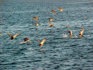
i) To protect the lake ecosystem with all its genetic diversity.
ii) To execute various multidimensional and multi-disciplinary developmental activities either itself or through some other agency.
iii) To cooperate and collaborate with other institutions of the State, National or International Institutions for all round development of the lake.
iv) To establish Management Information System and data-base of the Lake.
v) To promote long term multidisciplinary research, prepare environment, status report and establishment of a research centre for the lake.
Since from its creation, under the auspicies of Chilika Development Authority, a number of studies are being carried out on the lake, by commissioning the services of premier institutions.
In addition to this Chilika Development Authority is coordinating and liasing with various State Departments, agency and premier Scientific Institutions. At present the Authority is implementing a Work Programme under Special Problem Grants, recommended by the Tenth Finance Commission, with the following components:-
(i) Treatment of catchment of the lagoon (through Soil Conservation Department of the State).
(ii) De-siltation of outer channel of Chilika Lagoon to improve the water exchange and salinity gradient.
(iii) Restoration of Eco-system of Nalabana Island (through the Wildlife wing of State Forest Department).
(iv) Creation of mass awareness and publicity programme including environmental awareness.
(v) Upliftment of socio-economic condition of peripheral villages through economic activities.
(vi) Improvement of road network of peripheral villages.
(vii) Fishery Resource development (through Fishery Department).
(vii) Fishery Resource development (through Fishery Department).
(viii) Development of a wetland Centre.
(ix) Weed management.
This programme is envisaged to be completed within 2000 AD. In addition to this Chilika Development Authority is envisaging for a long-term monitoring programme of the Lagoon on various physico-chemical, Hydrological and Biological parameter. Development of a Long-term Integrated Management Development Plan for the Lagoon. A database on the Lagoon etc.
A long term multi-disciplinary investigation of entire ecosystem of the Lagoon is necessary to determine the intricate and fragile Chilika Eco-system. The range of the seasonal and annual variability in population of organisms, and other key parameters in the habitat. The long term objective is to formulate a Management Development Plan, for resource management with effective evaluation mechanism to determine the management effectiveness in conserving the ecosystem with all it's diversity.
MORE FACTS ABOUT CHILIKA
LOCATION AND TOPOGRAPHY
Lake Chilika ( ) lies in the districts of Puri and Ganjam in the state of Orissa,m on the eastern coast of India. Chilika lies on the main Madreas-Calcutta highway (National Highway 5) and the Madras-Howrah rail line passes along the western bank, the Balugaon, Chilika and Rambha being the main stations along the western bank, with Balugaon, Chilika and Rambha being the main stations along the lake. Chilika lies about 50 km southwest of the city of Puri from where a fair weather road goes tot he village of Satpara on the eastern bank. The entire area influenced by Chilika covers about 2,343 sq. km, of which some what less than half is covered by water during the high water levels of the monsoon.
The "lake" is a actually an estuarine lagoon, shallow throughout its spread of 1,165 sq. km (maximum) to 790 sq. km (minimum). The lake may be thought of as comprised of four sectors: the Northern, Cental, Southern and Outer Channel sectors (Figure 1) (Jhingran 1963). The major part of the lake (the Nothern sector) has a depth of less than 50 cm, while the maximum of 3.7m is seen in the Central sector. The lake mouth (MuggermukhO) is usually only 20cm deep and cannot be navigated even by flat-bottomed country boats. The pear-shaped lagoon is about 64.5 km long and its width varies from 18 km to 5 km (Das and Samal 1988). The lake is connected to sea by a 29 km long, irregular channel with several small sandy and usually ephemeral islands. About 1.5 km wide, the channel runs parallel to the Bay of bengal and is separated from it by a narrow spit, 183-274m wide, locally known as Magarmatha Muhan (Sahu 1988). The channel is connected to the sea by an extremely narrow mouth close to its northeastern end.
Numerous islands are present in the lake, specially near the channel. Best known among them is Nalbana, a low, flat marshy island 35 sq. km long, covered with low vegetation. Nalbana has been designated as a bird sanctuary since 1973 and represents the only protected part of Chilika lake. Several rocky islands in the Southern sector, such as Kalijai, Somolo, Dumkudi, Honeymoon, Breakfast and Bird island represent the inundated remains of the Eastern ghats (Bandyopadhyay and Gopal 1991). Along the channel and between the channel and the lake proper are many islands made up of entrenched sand dunes, known collectively as Garh Krishnaprasad Block. These islands covers as area of about 728 sq. km. (Bandyopadhyay and Gopal 1991).
The lake is surrounded by a strip of silted and reclaimed land. On the northeast margin lies an extensive area of marshy land, some of which has beeen reclaimed for agriculture. Other silted up land around the Northern and Central margins has been reclaimed for agriculture and is separated from the lake by bunds (dykes). The margins are steeper in the Central and Southern sectors, and rocky promontories jut out into the lake at several places. The land is less flat and somewhat rocky, being part of the Eastern ghat. The estuary of the Rishikulya River lies about 18 km down the coast, and is separated from Chilika by lowlands, some of which are used as salt pans (Rao et al. 1986). The Palur canal connects the Righikulya estuary to the lake.
 The drainage basin of Chilika covers an area of over 4,300 sq. km (Das and Samal 1988), including about 1,100 sq. km of the lake itself . the watershed boundaries lie between water flowing into the Mahanadi and Chilika in the north, while in the northeast, areas draining into the Bhargavi river make up the watershed. In the west and southwest, the watershed boundary lies between stream flowing into the Rishikulya river and those flowing into Chilika.
The drainage basin in the northeast consists of a large tract of alluvial land with elevations less than 30m above sea level. In the north lies an area of rolling plains which lie mostly between 30-150m above sea level. Some higher hills in the north and west reach up to 600m. In this area of predominantly laterite soil, hill streams have cut deep gullies and ravines, interspersed with fertile depressions filled with alluvium. To the west and southwest lie parts of the eastern ghats which come right up to the lake. Here the hills reach over 600m in some parts, and are forested with sal (Shorea), Dillenia and Pterospermum species. These hills form the headwater region of several streams flowing into the lake (Asthana 1979; Sharma 1978).
The drainage basin of Chilika is quite heavily populated for the most part and the population is estimated to reach 200,000 by 2000 A.D.. About 718 sq. km is covered by forests (529 sq. km) and other permanent vegetation like plantations. However, 58 per cent of the vegetation is regarded as degraded and a lot is classified as wasteland. Agricultural area (mostly dryland) accounts for 2,325 sq. km. Swamps (71 sq. km) and wetland with grassy mud flats (91 sq. km) occcur mainly in the northeastern part of the drainage basic. About 52 sq. km are occupied by human settlements, roads, railways etc. (ORSAC 1988). The degraded forest areas suggest themselves as likely sites for watershed conservation efforts to reduce silt inputs to Chilika.
CLIMATE
Chilika's location on the coast in the tropical zone spares it from extreme temperatures. The mean annual temperature is about 26.6-27.7 C, with a winter minimum of 21 C (December-January) and a summer maximum of about 35 C (March-April) (ORSAC 1988). In rains about 1,450 mm per year at Chilika (mean annual average rainfall) and the rainfall over the area varies from 1,200-1,600 mm, increasing towards the northeast. Most of the rain (80 per cent) occurs during the monsoon season of June-September. The lake area proper experiences mean wind speeds ranging from 5 kmph (winter) and 10-15 kmph in the summer. However, the coastal areas, experience higher average wind speeds up to 25 kmph. Being on the Bay of Bengal,Chilika is also subjected to cyclonic activity during May-December. Such storms have a strong effect on the coastal areas and have caused changeds in the number and position of openings to the sea in the past. However, they dissipate fairly rapidly as they cross the coast (Bandyopadhyay and Gopal 1991)
HYDROLOGY
Water - its quantity, quality and distribution over time is the single most important factor affecting Chilika. Though the drainage basin of Chilika is stimated to be about 4,300 sq. km (Das and Samal 1988), a significant part of the freshwater and silt input to the lake comes from the Mahanadi river system. The Daya and Bhargavi, which are distributaries of the Mahanadi, bring vast quantities of silt-laden water into the northern part of Chilika during the monsoon. In addition, the rivers Nana, Ratnnachira and Kani in the north and Malaguni, Dhanua and Sulia and sumerous smaller streams enter the lake all along the western margin (Sahu1988). The total silt added to the lake has been estimated to be 13 million tonnes every year. The lake shows an overall increase in depth of about 50 cm due to the monsoon (Patnaik 1971), and freshwater flows towards the sea, overcoming the weak tidal currents at the lake mouth. The Chilika drainage basin is estimated to send 1,660 million cubic metres (MCM) into the lake every year, while the Daya and Bhargavi rivers are believed to contribute a much larger quantity of freshwater annually.
Direct rainfall on the lake surface also makes a significant contribution to the freshwater input to Chilika due to its relatively large size. Direct precipitation has been estimated at about 870 MCM annually. By the same token, the size and shallowness of Chilika also makes evaporation from the surface a major cause of the gradual reduction in water depth after the monsoon. Total eveporative loses from Chilika are estimated to total 1,286 MCM (ORSAC 1988). As the water decreases, the salt content of the water changes too.
SALINITY
Chilika undergoes a cyclical variation in salinity through the year, with different patterns seen in separate sectors. This cycle is worth understanding in some detail, as it is extremely important for maintaining the high biodiversity of the area. It is this periodicity in salinity that allows freshwater as well as marine and estuarine species to thrive in the lake.
Salinity is measured in parts per thousand(ppt) and 10 ppt is equal to 1 per cent by weight. Thus a salinity of 10 ppt implies one gram of salt for every hundred grams of water. During the monsoon, the Northern and Central sectors show low salinity (1.8-2.0 ppt) as does the outer channel (3.5 ppt). In the Southern sector, salinity remains higher (6-10 ppt) as the freshwater input is much lower in this part of the lake.
Evaporation causes a slight increse in salinity in the Northern sector (1.8-4.5 ppt) and the Central sector (5 ppt) during the post-monsoon period (Ovtober to December). The Southern sector shows a slight decrese in salinity (7-8 ppt )due to slow mixing with the rest of the lake (Ramanadhan et al. 1964; Banerjee and Roychudhuri 1966). The outer channel shows the lowest salinity as freshwater from the body of the lake continues to flow through it (Mohhanty 1975a)
During winter (January-March), almost no freshwater enters the lake. Northerly winds send tidal water into the outer channel, increasing the salinity. In the body of the lake, a fairly small range of low salinity exists, ranging from 2-4 ppt (Northern sector), 4-6 ppt (Central sector) and 6-7.5 ppt (Southern sector). During the summer, evaporation and prevailing southern winds cause greater salinity all over the lake. The Northern and Central sectors turn mesohaline (medium range of salinity), with salinity ranging from 5.5-33 ppt and 7.5-27ppt, respectively. The Southern sector shows a slight increse (10-11 ppt) (Ramanadhan et al. 1964; Banerjee and Roychudhuri 1966). The outer channel is practically like seawater at this point, with salinity at 34-35 ppt (Mohanty 1975a)
Due to increased silt load, narrowing of the lake mouth and other factors, the overall average salinity for the whole lake has dropped from 22.31 ppt in 1957-58 to 13.2 ppt in 1960-61 and to 9.14-11.83 ppt in 1961-64, but appears to have stabilized after the rapid drop (Sarkar 1977). Such a decrease in salinity would obviously have grave implications for the biodiversity as well as fisheries of Chilika.
WATER AND SEDIMENT QUALITY
Apart from salinity, several other aspects of the water in Chilika lake have an important bearing on the health of the ecosystem. All species can survive only within certain limited ranges of variables such as dissolved oxygen, nitrogen in different forms, the degree of acidity or alkalinity, metal concentrations etc. Though Chilika has not been exhaustively studied with regard to such aspects, enough work has been done to allow as to assess the water quality of Chilika lake at a primary level.
Lagoon water is usually well exygenated almost throughout the year as seen bny the very high productivity of the ecosystem. Dissolved oxygen (DO) content of the lake water varies from 1.3 mg/1 (quite a low avalue, which cannot be tolerated well by most fauna) to a high of 13.4mg/1 (more than adequate for life) Mohapatra etal.(1988). DO is lowest in the Northern sector during the summer and early monsoon due to high temperatures, salinity and Biological Oxygen Demand (BOD) (Banerjee and Roychaudhuri 1966). The high BOD is due to the decomposition of the organic detritus -as the huge amout of surface vegetation dies, it sinks to the bottom and is degraded. The degrading organisms consume a lot of oxygen. This is a feature common to all eutrophic ecosystems.
The Central and Southern sectors show less variation in DO values. Peak values are observed twice yearly, in May (6.42-6.62 mg/1) due to higher photosynthesis and in October (6.37-6.66 mg/1) due to a bloom of winter phytoplankton. Slow mixing of oxygen depleted water from the bottom of the lake cauuses low values of 3.3 mg/1 to be seen in January-February (Misra 1988b). The outer channel has high DO level during the monsoon and post-monsoon periods. Daily variations due to tides can also be seen here (Mohanty 1975a).
Acid or alkaline character is measured by the pH scala. A pH of 7 is regarded as neutral water. Acidity increases as the pH decreases from 7 to 0, whereas alkaline character increases as the pH goes from 7 to 14. The pH value of a lake incluences the chemical states of nutrients such as phosphate and ammonia, and the form in which metals will be found. Most lagoons have pH in the range 6-9, whereas pH values below 4-5 cannot be tolerated by most lifeforms.
The Chilika lagoon is always alkaline-observed pH values range from 6.8 to 9.6 (ORSAC 1988). Generally, lower values are observed during the rainy season, whereas higher values are seen in summer and winter. The Nothern and Central sectors show higher overall values, attributed to the abundance of algae. Alkalinity, or the presence of ions such as calcium and magnesium, is closely related to pH values for most ecosystems. Ovserved alkalinity values range from 27 189 mg/1. Alkalinity is usually high during summer, and starts decreasing with the advent of the monsoon Average alkalinity values are realtively higher in the Southern sector. The variation in total alkalinity has been observed to flow the tread of salinity changes the lagoon (ORSAC 1988).
The transparency of Chilika lake water is very low during the monsoon due to the entry of silt-lader water, though the Southern sector shows relatively greater transparency due to less silt input and its relatively enclosed position. The Northern sector has low transparency even during summer due to the mixing of bottom sediments with water caused by strong southerly winds (Banerjee and Roychudhuri 1966). In contrast, the greatest transparency sector during summer. A strong phytoplankton bloom during October-November also lowers transparency (Misra 1988a)
Nutrients such as nitrogen, phosphorus and silica are important for life in lagoon. Nitrogen present in the form of nitrate (called nitrate0N) varies from traces to 0.19 mg/1. High nitrate-N concentrations are seen in October-November due to land drainage following rains (nitrates are washed down from the soil and the use of agricultural fertilizers also contributes to both nitrate and phosphate in the runoff). Summer phytoplankton blooms in April-May coincide with lowest nitrate-N levels at the surface as the phytoplankton take up large quantities of nitrogen from surface water (Patnaik and Sarkar 1976; Misra 1988b). Similarly, phosphate available ranges from traces to 0.4 mg/a; lower peak in February due to release of phosphate from bottom sediments (Banerjee and Roychudhuri 1966; Misra 1988).
The mean monthly concentrations of dissolved silica range from 0.1 to 6.0 mg/1. Silica is present at its highest concentrations during the monsoon, decreases during winter and is lowest during the summer. The decrease from February-May is attributed to the abundance of diatoms: diatoms are phytoplankton which have cell walls containing silica. Diatoms appear in February, attain a maximum in April and decrease sharply in May. They take up silica from the water during their bloom, accounting for decreased silica concentrations (Roy 1954).
Concentraions of some other elements have been measured in Chilika water (Table 1) (Asthana 1979; Banerjee and Roychaudhuri 1966; Katre and Das 1988). Several elements showed much higher levels in the Southern and Outer channel sectors than in the Northern and Central sectors. However, only seven sites were covered by Katre and Das (1988), so the levels are merely indicative.
Sediments of lake Chilika have been studies exhaustively by Asthana (1979). The sediments are predominantly sandy at the mouth, Outer channel sector, and along the marshy islands between the channel and the lake proper. Clayey sediments are seen in the Central sector, and coarse grained sediments are seen along the western margins. Chilika sediments have a higher organic content that seen in most lagoons: Asthana (1979) reported values ranging from 2.57 to 16.4 per cent with an average of 10.7 per cent within the main body of the lake. The high organic content is due to the high productivity of Chilika and soil carried by freshwater input. As phytoplankton and other vegetation die, they sink to the bottom and are decomposed, which contributes to the organic content. In turn, the high organic content encourages bottom-dwelling life to proliferate.
The amounts of some heavy metals in the Chilika sediment have been analysed by Asthana (1979). Fairly high amounts of nickel were found (average 1956 mg/kg; range 135-250 mg/kg), indicating that there may be nickel ore deposits somewhere in the Mahanadi catchment area. Lead (average 91 mg/kg; range 72-122 mg/kg) seems to be fairly evenly distributed in the lake, but the levels are much higher than average levels found in the earth's crust (16 mg/kg). Chromium levels (average 188 mg/kg; range 30-270 mg/kg) are comparable to average crust levels, but the Southern sector shows much higher levels that other parts. A similar pattern appears to exist for coper: though average levels are 37 mg/kg (range 5-64 mg/kg), the Southern sector has much higher levels (55 mg/kg) that the rest of the lake (23 mg/kg). Interestingly, high metal concentrations are well correlated to areas with high organic content.
A cause for alarm is the relatively high levels of mercury (2.65-9.35 mg/kg) seen in the sediment and water in the Southern sector. Mercury was found at 5.6 mg/kg in the Palur canal and 3.6 mg/kg near Rambha. Mercury was present at 0.8 mg/kg even at the lake mouth near Arkhakuda. The source of mercury has been identified as the Jayshree Chemicals factory on the Rishikulya river, and mercuty enters Chilika through the Palur canal connecting the Rishikulya estuary to the lake (ORSAC 1988). The higher levels of chromium and copper seen in the Southern sector may also be related to pollution from the Rishikulya estuary.
References for information on Chilika:
Annandale, N and
S.Kemp 1915. Introduction : In Fauna of the Chilika Lake, Mem.Ind Mus. 5(1):,
1-20.Blanford, W.T. 1972 Sketch of the Geology of Orissa, G.S.I. Records, 5(2):
41-72.Choudhuri, B.L.1916 Fauna of the Chilika Lake: Fish Part IV Memo Ind.
Mus.5(4): 403-439.
1917, Fauna of the Chilika Lake: Fish Part III. Mem. Ind Mus.5(6): 491-508.
1923. Fauna of the Chilika Lake: Fish Part-IV. Mem.nd. Mus.5 (11): 711-736.
Das, N.K. and R.C.Samal, 1988. Environmental Survey of Chilika. In Chilika. The
pride of our Wetland Heritage, Orissa Env. Soc., 96-103.
Dev, U.N.1989 Data book of birds of Chilika. Asso.Project Bihang, Bhubaneswar,
1-64.
Devasundaram, M.P.and Roy, J.C.1954. A preliminary study of the plankton of the
Chilika Lake for the year 1950 and 1951. IPFC Proc.Symp.Mar.and Fres. Water
Plankton in India-Pacific. Bngkok, June,25 & 26, 48-54.
Hora, S.L.1923 Fish Part-V. In: Fauna of the Chilika Lake. Mem.Ind.Mus.5(11)
737-769.
Jhingran, V.G.1963.Report on the fisheries of the Chilika Lake 1957-1960. Bull.
Cent. Island Fish. Res.Inst. 1-113.
Mohapatra, P., N.C.S. Samant, D.C.Mohanty and K.S.Bhatta, 1988. A study of
physico - chemical observations of three stations in Chilika Lagoon during the
year 1985-1987. National seminar on Conservation and Management of Chilika,
Bhubaneswar, p.28 (Abstract).
ORSAC, 1988. Interim report on study of Chilika Lagoon. Resources and
Environment, ORSAC, Bhubaneswar, 1-95.
ORSAC,1998. Report on Environmental Monitoring of Chilika lagoon 1995-1996.
ORSAC, Bhubaneswar, 1-10.
ORSAC,1998. Report on Environmental Monitoring of Chilika lagoon 1995-1996.
ORSAC, Bhubaneswar, 1-10.
Panigrahi,G. 1988. Vegetation and flora of the Chilika Lagoon. In Chilika. The
pride of our Wetland Heritage. Orissa Env.Soc., 63-80.
Patnaik, S. 1979 Distribution and seasonal abundance of some algal forms in
Chilika Lake. J.Inl.Fish.Soc.India, 10:56-67.
Patnaik, S. and S.K.Sarkar,1976. Observation on the distribution of
phytoplankton in Chilika Lake. J.Inl.Fish.Soc.India, 8: 38-48.Subba Rao,M.V,
B.M.G.Rao, B.R.Rao and N.K.Nanda,1981. Hydrobiological studies of the brackish
water Chilika lagoon, Orissa.J.Env.Biol.2(1):59-62.
Venkatarathnam, K.1970.Formation of the barrier spit other sand ridges near
Chilika Lake on the east coast of India. Marine Geo 9:101-116.ZSI,1995.
Fauna of Chilika Lake,
Wetland Ecosystem series 1. Zoological Survey of India,