 |
|
 |
 |
| Dr. Slyvia Earle's Journey |
 |
 |
 |
 |
 |
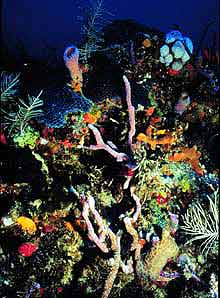
| Part of the Sustainable Seas mission is to explore and assess any damage at reefs in the National Marine Sanctuaries. The Dry Tortugas, 80 miles west of Florida's Key West, contain some of the most pristine coral habitat in the continental United States. As of July 2001, all fishing or taking of marine life is banned in the area. Photo: NOAA |
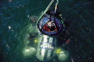
| Using the Deepworker submarine, marine biologist Sylvia Earle dived hundreds of feet under the ocean surface to take a firsthand look at creatures inhabiting the sea floor along the northern Gulf of Mexico and western Florida. |
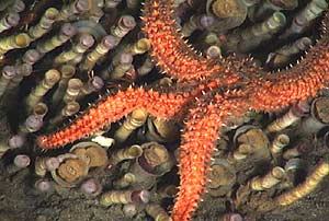
| From inside Deepworker, Earle captured this image of a deep sea starfish. Photo: Sylvia Earle/National Geographic Society, 2001 |
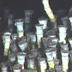
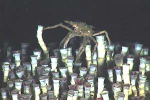
| Giant tube worms, shown here with a wandering crab, colonize around areas where hydrocarbon seeps through the sea floor in the northwestern Gulf of Mexico. At depths of up to 1,800 feet under the ocean surface, the worms live in temperatures around 6 degrees Celsius, absolute darkness and tremendous water pressure. Photo: Sylvia Earle/National Geographic Society, 2001 |
| Anchored to rocks on the muddy bottom, the worms can grow up to 8 feet in length. They're also some of the oldest creatures on Earth, with some living for more than 240 years. Photo: Sylvia Earle/National Geographic Society, 2001 |
| Expedition researchers explored the offshore reefs of Belize and Mexico along the Yucatan Peninsula, and then headed to the Flower Garden Banks National Marine Sanctuary off coastal Texas. They made stops at the Pinnacles, a series of deep-water reefs in the northern Gulf of Mexico, and at several sites along the west Florida continental shelf, including the Florida Middle Grounds and the Tortugas. Photo: NOAA |
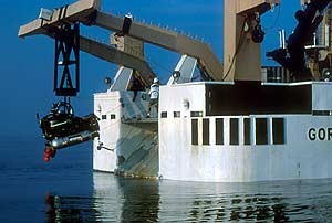
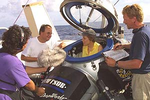
| Radio Expeditions correspondent Alex Chadwick, left, and Earle aboard the NOAA ship Gordon Gunter. Photo: Kip F. Evans/National Geographic Society, 2001 |
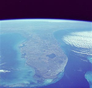 |
| A team of contributors, led by Earle, took advantage of NASA and NOAA's satellite and imaging technology to create the National Geographic Atlas of the Ocean. The satellites' remote sensing capabilities made for an atlas more accurate than ever before. Astronauts snapped this picture of the Florida peninsula from outer space. Photo: NASA |
| Article by Christopher Joyce |
| More information at: |