 |
|
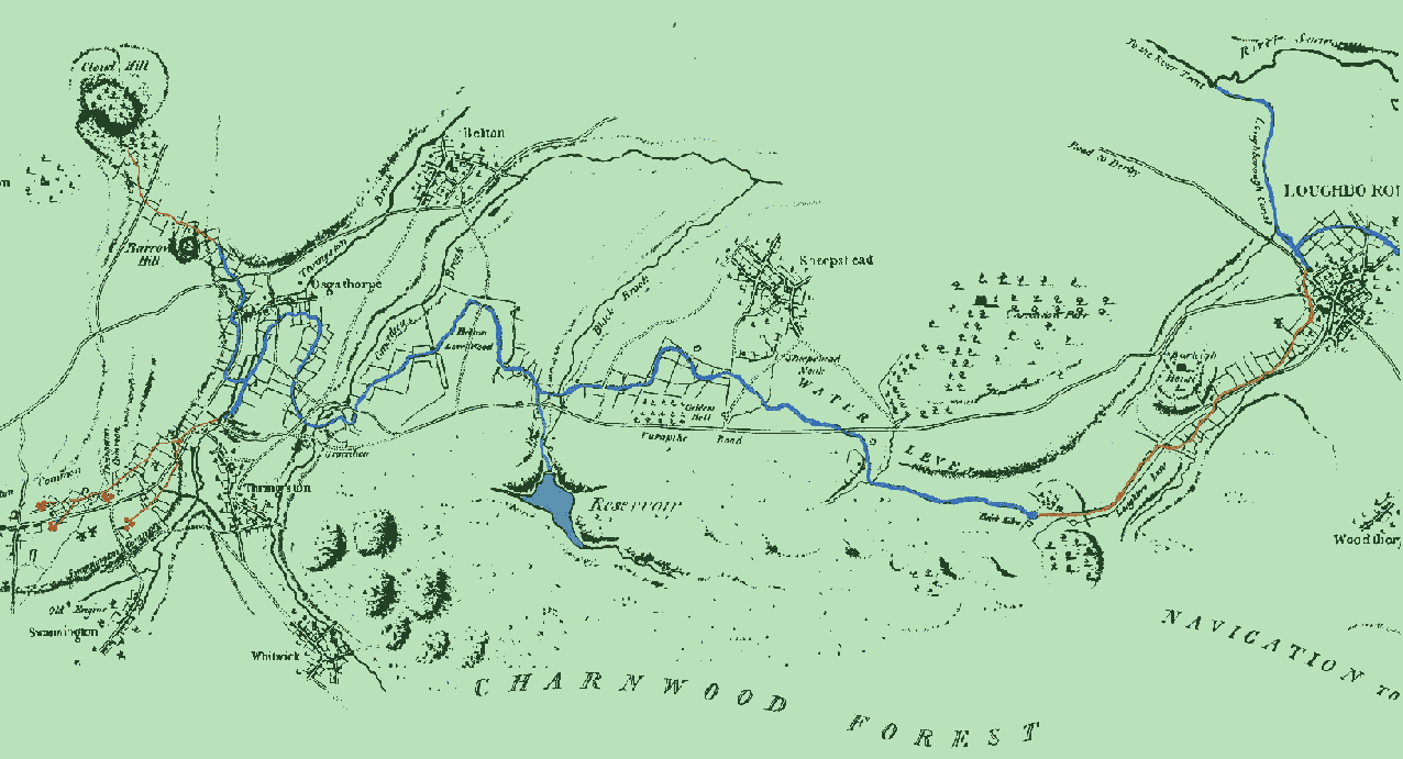
This map was produced in 1791 by the canal's engineer, Christopher Staveley. Note the tramroads (traced over in brown), which connected the collieries at Swannington and Thringstone Common and the lime quarries at Cloud and Barrow Hill. A tramroad also linked the canal terminus at Nanpantan to the main Navigation at Loughborough. This tramway is said to have been the first in the world to use the standard gauge.
Obviously, the purpose of commissioning this map was to show the proposed route for the canal and tramroads, though it is of additional interest to us in that it is also possibly the earliest map to show Thringstone in any sort of detail,(albeit very basic indeed). Interestingly, Brook Lane (now an unadopted track) seems to be a main road into the village. 'The Old Manor House', a low, rambling seventeenth-century cottage still stands here.
Back to Maps Index