 |
Inclosure Award Map,
1807
|
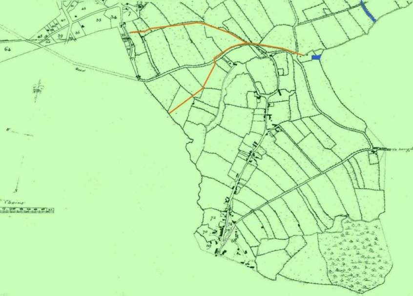
'Plan referred to in the Award made by the COMMISSIONERS of THRINGSTONE and PEGGS GREEN Inclosure; William Henry Smith, surveyor, 1807'.
(Leicester Record Office, ref 13D40/3/12; restored for 'TOL' by M.A.Redfern). Here showing 'South Thringstone' only.
The tramroads linking the Charnwood Forest Canal are traced in gold; the canal is coloured in blue. By comparing this plan to later nineteenth century Ordnance Survey maps, we are able to identify the properties remaining in the village which are of a likely pre-nineteenth century origin. Hopefully, we will be able to add a programme which brings up the identity of buildings as the cursor is moved around with the mouse.
The local coal mining industry has not yet boomed and the hamlet of Thringstone is a very sparse scattering indeed.
Note that Thringstone House exists as a farm dwelling.
Back to Maps Index