Thringstone Contour Map
Three Dimensional Thringstone
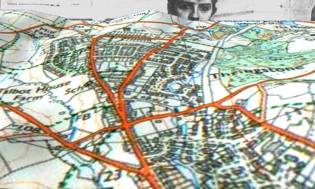
Martin Bulmer devised this rather surreal 3d map of Thringstone, which he
describes as 'the work of weeks'. The face in the background is Steve Badcock !
Note the central hill at the top of the map (Cinder Hill), between the George
and Dragon and Gracedieu Priory. This illustrates wonderfully why the Charnwood
Forest Canal, opened in 1794, ran in a great horseshoe loop through Osgathorpe
before passing by the Priory ruins - all efforts being made to avoid
excavations and minimise construction costs by adhering to the contour.

Back to Maps Index