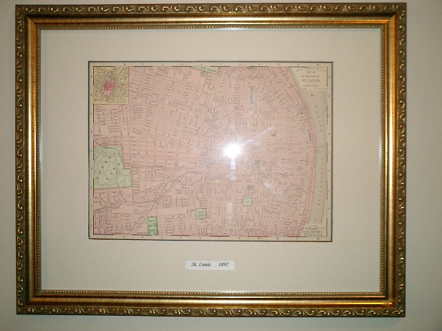
| St Louis 1897 | |||||||||||||||||||||||||||||||||||
| This map is from the 1897 Rand, McNally & Co. Atlas. The map is copyrighted by Rand, McNally & Co. 1895. This map has extraordinary detail showing all streets, railroads, streetcar tracks, parks and points of interest existing in 1895. | |||||||||||||||||||||||||||||||||||
|
|||||||||||||||||||||||||||||||||||
| Dimensions | |||||||||||||||||||||||||||||||||||
| The map measures: 11" X 14" | |||||||||||||||||||||||||||||||||||
| The Frame measures: 14" X 18" | |||||||||||||||||||||||||||||||||||
| Click to Enlarge | |||||||||||||||||||||||||||||||||||
|
|||||||||||||||||||||||||||||||||||
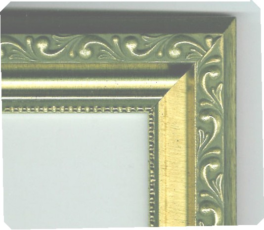
| Frame | |||||||||||||||||||||||||||||||||||
| Antique Embossed Gold | |||||||||||||||||||||||||||||||||||
| 1 1/2" wide | |||||||||||||||||||||||||||||||||||
| Click to Enlarge | |||||||||||||||||||||||||||||||||||
| $65.00 | |||||||||||||||||||||||||||||||||||
| Price | |||||||||||||||||||||||||||||||||||
| Plus Shipping and Handling | |||||||||||||||||||||||||||||||||||
| Back to Menu | |||||||||||||||||||||||||||||||||||
| HOME | |||||||||||||||||||||||||||||||||||
| Questions about the Map? | |||||||||||||||||||||||||||||||||||