| WEATHER BULLETIN FOR TUESDAY 13TH OCTOBER 2009
Valid up to 8 am tomorrow Wednesday 14th October 2009. Today's Temps High 31�C 88�F Low 23�C 73�F PRESENT WEATHER: PARTLY CLOUDY WIND: Easterly @ 09 knots TEMPERATURE: 29C or 84F RELATIVE HUMIDITY: 74% SEA LEVEL PRESSURE: JUST ABOVE NORMAL @1014.1 MBS or 29.94 inches 24-HOUR RAINFALL UP TO 8:00 A.M: 3.8MM SUNSET TODAY: 5:51 pm. SUNRISE TOMORROW: 6:04am. THE FORECAST FOR THE NEXT 24HRS: Winds: ENE - E 8 - 14 KTS BECOMING LIGHTER OVERNIGHT Seas: SLIGHT TO MODERATE WAVES 1.2 TO 1.5 M OR 4 TO 5 FT. The Local Forecast for St Kitts and Nevis: GENERALLY FAIR TO PARTLY CLOUDY TODAY AND TONIGHT. THERE IS ALSO A CHANCE OF FEW SCATTERED SHOWERS DEVELOPING. The Eastern Caribbean Forecast: A SURFACE HIGH PRESSURE OVER THE WESTERN ATLANTIC WILL CONTROL WEATHER CONDITIONS OVER THE EASTERN CARIBBEAN FOR THE NEXT FEW DAYS. THE HIGH WILL MAINTAIN A LIGHT TO MODERATE WIND FLOW OVER REGION FOR THE NEXT COUPLE OF DAYS. SKIES ACROSS THE LEEWARD, VIRGIN AND WINDWARD ISLANDS WILL BE MAINLY FAIR TODAY AND TONIGHT. FEW CLOUDY PERIODS AND SCATTERED SHOWERS COULD ALSO DEVELOP OVER THE ISLANDS TODAY AND TONIGHT. PUERTO RICO AND HISPANIOLA WILL BE PARTLY CLOUDY WITH A CHANCE OF FEW ISOLATED THUNDERSTORMS. |
| WEATHER BULLETIN FOR WEDNESDAY 14TH OCTOBER 2009
Valid up to 8 am tomorrow Thursday 15th October 2009. Today's Temps High 31�C 88�F Low 24�C 75�F PRESENT WEATHER: PARTLY CLOUDY WIND: South Easterly @ 08 knots TEMPERATURE: 28C or 82F RELATIVE HUMIDITY: 80% SEA LEVEL PRESSURE: Below Normal @1012.3 MBS or 29.89 inches 24-HOUR RAINFALL UP TO 8:00 A.M: 0.1MM SUNSET TODAY: 5:50 pm. SUNRISE TOMORROW: 6:04am. THE FORECAST FOR THE NEXT 24HRS: Winds: ENE-E at 8-12kts; becoming light and variable or even calm overnight. Seas: Slight, waves not exceeding 4ft or approximately 1m. The Local Forecast for St Kitts and Nevis: Today: Some cloudy spells with scattered showers, becoming a bit brighter this afternoon. Tonight: partly cloudy with a chance of some isolated showers. Synopsis: A weak moisture line across the northeast Caribbean will increase the chances of showers over the Islands today. The Eastern Caribbean Forecast: The weak moisture line which is lingering over the northern half of the Eastern Caribbean will increase moisture levels and instability across the area today. As a consequence, skies over the Leewards, Virgin Islands, Puerto Rico and Hispaniola, will be partly cloudy with a chance of scattered showers. Some localized afternoon thunderstorms could also develop across Hispaniola and Puerto Rico due to local effects around those islands. The atmosphere over the southern islands will remain a little dryer, therefore skies around them will be mostly fair, with the chance of some localized partly cloudy spells with isolated showers developing. |
| WEATHER BULLETIN FOR THURSDAY 15TH OCTOBER 2009
Valid up to 8 am tomorrow Friday 16th October 2009. Today's Temps High 30�C 86�F Low 25�C 77�F PRESENT WEATHER: CLOUDY WIND: North Easterly @ 05 knots TEMPERATURE: 28C or 82F RELATIVE HUMIDITY: 88% SEA LEVEL PRESSURE: above normal @1012.3 MBS or 29.89nches 24-HOUR RAINFALL UP TO 8:00 A.M: 3.1MM SUNSET TODAY: 5:49 pm. SUNRISE TOMORROW: 6:04am. THE FORECAST FOR THE NEXT 24HRS: Winds: E-ESE at 06-12kts.. Seas: Slight to moderate waves 1.2-1.5m or 4-5ft. The Local Forecast for St Kitts and Nevis: This morning skies over St Kitts and Nevis will be partly sunny to sometimes cloudy with widely scattered to scattered showers. By this Afternoon and tonight, mostly fair skies will prevail with only light and isolated showers possible. The Eastern Caribbean Forecast: line of clouds and showers from the remains of a frontal trough along with a weak tropical wave will continue to affect Hispaniola, Puerto Rico, the Virgin Islands and the Leewards today. By this afternoon and tonight, showers are expected to diminish across the Leewards and hence giving way to mostly fair skies. Meanwhile a mid to upper level trough lingering over the Southern Caribbean will give rise to cloudy skies, scattered showers and isolated thunderstorms across Trinidad and Tobago and Grenada today. Later tonight and early Friday morning, some of the clouds and showers could spread to Barbados and the Northern Windwards. |
| WEATHER BULLETIN FOR FRIDAY 16TH OCTOBER 2009
Valid up to 8 am tomorrow Saturday 17th October 2009. Today's Temps High 31�C 88�F Low 27�C 81�F PRESENT WEATHER: CLOUDY, Brief passing showers likely WIND: Easterly @ 13 knots TEMPERATURE: 30C or 86F RELATIVE HUMIDITY: 74% SEA LEVEL PRESSURE: Near normal @1013.4 MBS or 29.92nches 24-HOUR RAINFALL UP TO 8:00 A.M: nil SUNSET TODAY: 5:49pm. SUNRISE TOMORROW: 6:04am. THE FORECAST FOR THE NEXT 24HRS: Winds: E-ESE at 8-16kts increasing slightly tomorrow. Seas: Slight to moderate: waves 1.2-1.5m or 4-5ft. The Local Forecast for St Kitts and Nevis: Sunny to partly sunny with brief isolated to possible widely scattered showers likely The Eastern Caribbean Forecast: Moisture associated with a trough of low pressure will continue to affect the Windwards and islands further south today. Skies over those islands will be mostly cloudy with scattered showers and a possibility of a few isolated thunderstorms. A gradual improvement is expected over those islands later tonight. However, moisture associated with the Inter-Tropical Convergence Zone will keep skies over Trinidad and Tobago mostly cloudy. Weather conditions over the rest of the islands from the Leewards westwards to Hispaniola will be influenced mainly by a ridge of high pressure. Skies over these islands will be partly sunny to and Partly cloudy tonight with few widely scattered showers. A few afternoon thunderstorms are likely over the interior portions of Hispaniola and Puerto Rico later today as weak unstable conditions still persist over those islands |
| WEATHER BULLETIN FOR MONDAY 12TH OCTOBER 2009
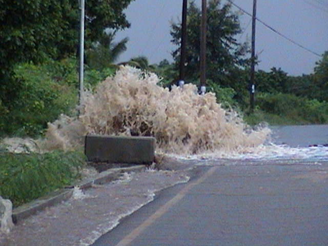
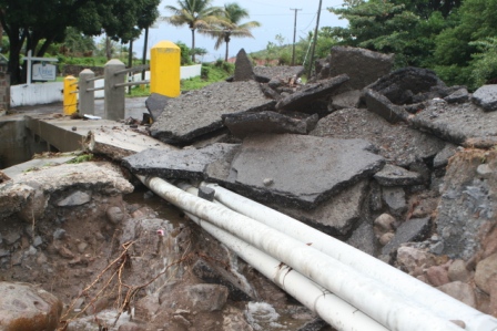
Valid up to 8 am tomorrow Tuesday 13th October 2009. Today's Temps High 30�C 86�F Low 24�C 75�F PRESENT WEATHER: PARTLY CLOUDY , scattered showers WIND: Easterly @ 10 knots TEMPERATURE: 30C or 86F RELATIVE HUMIDITY: 65% SEA LEVEL PRESSURE: BELOW NORMAL @1013.1 MBS or 29.91 inches 24-HOUR RAINFALL UP TO 8:00 A.M: NIL SUNSET TODAY: 5:51 pm. SUNRISE TOMORROW: 6:03am. THE FORECAST FOR THE NEXT 24HRS: Winds: ENE at 6-14kts becoming lighter tonight. Seas: Slight with moderate: waves 1.-1.5m or 3-5ft. The Local Forecast for St Kitts and Nevis: Today: Mostly sunny at first but becoming partly cloudy to cloudy with few widely scattered showers later today Tonight: Partly cloudy to cloudy with a few widely scattered showers decreasing overnight into early tomorrow. The Eastern Caribbean Forecast: The axis of a weak shear line in association with a deep low pressure area in the central Atlantic, is located over the islands from British Virgin Islands westwards to Hispaniola and this feature will continue to generate partly cloudy to cloudy skies accompanied by light to moderate rain over those islands today. There is also the possibility that a few isolated thunderstorm occurring over the more mountainous islands. This feature is expected to drift southwards today and stall in the vicinity of the Leewards islands and generate an increase in clouds accompanied by few light showers today and into the early tonight before gradually weakening into tomorrow. The rest of the islands from the northern Windwards southwards to Trinidad and Tobago will continue to have sunny conditions today and fair conditions tonight due to low moisture levels over those islands. |
| WEATHER BULLETIN FOR SUNDAY 11th OCTOBER 2009
The Eastern Caribbean Forecast valid up to 8am Monday 12th October 2009. A high pressure ridge will be the dominant feature over the area for the next few days. This system with support at the middle and upper levels,will maintain a stable atmosphere across the region,where skies will be generally fair to partly cloudy and hazy with isolated showers. However,the tail end of a frontal system just north of P/rico along with local effects, will maintain partly cloudy to sometimes cloudy conditions and isolated thunderstorms over P/rico,Hispaniola and to a lesser extent some of the V.I. THE FORECAST FOR THE NEXT 24HRS: Winds: Light and variable at first ,but becoming ENE-E 5-12kts today. Seas: Slight-moderate,waves 1.2-1.5m/4-5ft. Barometric Pressure: Above normal. Antigua and Barbuda Meteorological Services Patrick Christian-Forecaster |
| WEATHER FORECASTS |
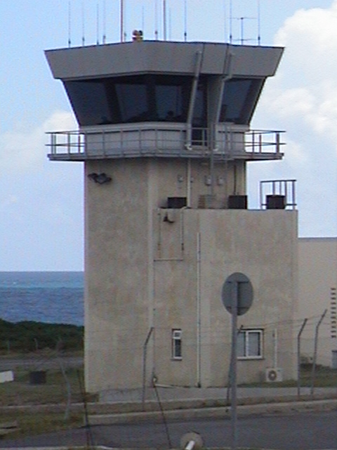 |
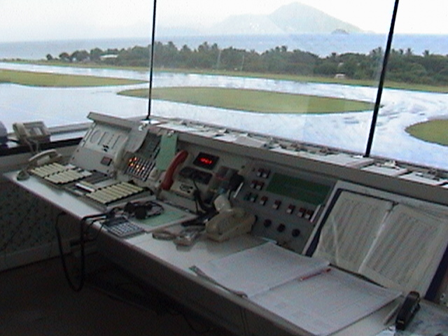
| courtesy of CONTROL TOWER VANCE W. AMORY INTERNATIONAL AIRPORT NEVIS , WEST INDIES TEL. 869-469-8460/8463 FAX. 869-469-8459 |
 |
 |
 |
 |
 |
 |
 |
 |
 |
 |
| WEATHER BULLETIN FOR Saturday 17th OCTOBER 2009
Valid up to 8 am tomorrow Sunday 18th October 2009. Today's Temps High 31�C 88�F Low 24�C 75�F PRESENT WEATHER: CLOUDY WIND: Easterly @ 11 knots TEMPERATURE: 29C or 84F RELATIVE HUMIDITY: 76% SEA LEVEL PRESSURE: Above [email protected] MBS or 30.01nches 24-HOUR RAINFALL UP TO 8:00 A.M: 0.3mm SUNSET TODAY: 5:47pm. SUNRISE TOMORROW: 6:04am. THE FORECAST FOR THE NEXT 24HRS: Winds: ENE-E 10-16kts. Seas: Slight-moderate, waves 1.5m/5.0ft The Local Forecast for St Kitts and Nevis: Sunny today and fair to partly cloudy tonight. Scattered showers mostly of short duration will occur at times. The Eastern Caribbean Forecast: A moderate surface high pressure ridge at the surface to the mid and high levels of the atmosphere will maintain a generally dry and stable air mass across the region over the next few days. This system will suppress any widespread shower activity over the islands in general, but local conditions and lingering moisture will still still produce periods of cloudiness with a few showers over some of the larger and more mountainous islands. |