
October 18, 2003
http://ridgwaydb.mobot.org/resbot/Niag/Proposal/Proposal.htm
Patricia M.
Eckel
Missouri Botanical
Garden
P.O. Box
299
St. Louis, MO
63166-0299
Res
Botanica
http://ridgwaydb.mobot.org/resbot/index.htm
E-mail: [email protected]
 I would like to propose a new forest type for
New York State (as in Reschke's 1990 publication on ecological communities) as
the Reschke forest designations do not seem to cover a wet Oak-Hickory forest
type that exists adjacent to the river in New York and probably across the river
in Ontario. This is a wet Oak-Hickory assemblage, not dry, as in "oak opening"
types of woods that are well known and seem to be perched on sand or elevated up
onto mountain (hill) tops in New York State. The Ash-Silver/Red Maple wet
woodland designations for some of the woods on Grand Island and other areas
along the Niagara River do not seem to describe very well the actual woods or
woods elements in these wet areas.
I would like to propose a new forest type for
New York State (as in Reschke's 1990 publication on ecological communities) as
the Reschke forest designations do not seem to cover a wet Oak-Hickory forest
type that exists adjacent to the river in New York and probably across the river
in Ontario. This is a wet Oak-Hickory assemblage, not dry, as in "oak opening"
types of woods that are well known and seem to be perched on sand or elevated up
onto mountain (hill) tops in New York State. The Ash-Silver/Red Maple wet
woodland designations for some of the woods on Grand Island and other areas
along the Niagara River do not seem to describe very well the actual woods or
woods elements in these wet areas.
These wet Oak-Hickory woods have a soil type
peculiar to themselves, and clay seems to be a significant factor in the sense
that this soil type seems to control a spring-wet, autumn dry regime. The
Ash-Maple swamps do not vary very much or as much in this respect, and the water
there seems to be deeper or more long-standing - at least without the autumn dry
regime. The wet Oak-Hickory woods exist right beside the wet Ash-Maple woods,
and both exist right beside the Red Oak-Sugar Maple-Beech upland type. In an
area just upstream from Niagara Falls, in an arc from the Tonawandas on the New
York State mainland, across the northern part of Grand Island and into Navy
Island (Ontario), occur wet Oak-Hickory woods that are distinctive enough to
warrant their own community-type designation, in my opinion, at least for
describing these woods.
Recent correspondence with individuals studying
the clay plain forests in the St. Lawrence River valley indicates that that
forest type, itself perhaps undescribed, has a very species rich assemblage
including a well developed herbaceous layer of forbs, especially spring
wildflowers such as Trillium, which are not present in the wet Oak-Hickory
assemblage at Niagara. The forest type on the clay plain is an upland
woods.
The species along the Niagara River include
some that do not appear to occur downstream in the St. Lawrence: for example,
Pin Oak (Quercus palustris) is not supposed to occur in northern New York
according to the Flora North America treatment for that species (Jensen 1997),
yet in western New York State, it occurs in a corridor along the eastern shore
of Lake Erie right through the Niagara River section, but not east and north of
it except in the area of New York City. This tree is typical of the
wet-Oak-Hickory woods I am describing.
Also, the two stations recorded so far for the
Shumard Oak (Quercus shumardii) both occur in these Niagara River woodlands, and
across the river in Ontario. This is an Oak of wet soil, as is Swamp White Oak
(Quercus bicolor), which is rare in Ontario.
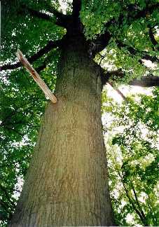
The other conspicuous tree species in this
assemblage, and perhaps the most typical are the Hickories. We have the rare, I
think, Carya laciniosa association with the two trees just mentioned. Other
Hickories that hover about are Carya ovata, Carya ovalis-glabra, Carya
cordiformis (everything but C. tomentosa). In one place (Tuscarora Indian
Reservation) the entire canopy was Carya ovata - quite an
experience!
A typical geomorphological feature of this
forest type is "vernal pools", typically craters of black soil with a ring of
graminoids around the elevated rim, typically with Carex lupulina there.
Otherwise, these black areas occur in linear or curving swathes absolutely
sterile of any vegetation, as though what was killed by drowning in spring was
finished off later by soils, sometimes so dry in drought years the surface is
cracked into polygons. Exposed, black (reduced) vegetationless soil in troughs
and depressions amid the roots of the Pin Oak is very
typical.
The clay surface prevents spring precipitation
from percolating. I think another essential characteristic is how close the
limestone pavement is to the bottom of the clay horizon. This closeness may
account for the special hydrology in these woods. A variant of this forest,
where the Hickory element is pronounced is where this clay is very thin. The
clay seems to grade into karst, which I am aware is developed very nicely
further downstream in the Great Lakes in both Ontario and New York but I am
unfamiliar with the forest composition on these substrates - I might guess they
are dry in character, not wet as in the woods I am describing. A vivid example
of this wet-woods type at Niagara where the limestone is actually exposed at the
surface, but which still bears the wet Oak-Hickory type is on the Tuscarora
Indian Reservation on the edge of the north-facing Niagara limestone escarpment
in Niagara County.
Another element that distinguishes the wet
Oak-Hickory woodlands down here from the Ash-Maple wet woods is the predominance
of graminoids on the ground layer: grasses and sedges in the Oak-Hickory
assemblage. In the Ash-Maple wet woods later in summer occur lush swathes of
urticaceous species: Boehmeria cylindrica and Pilea pumila being very
conspicuous. These forbs are not typical of the wet oak hickory woods and occur
in their adjacent association with the Maple-Ash
element.
Spicebush, Lindera benzoin, where it is a
monoculture, appears to be an indicator of the wet oak-hickory woods assemblage
as well - this as distinct from drier woods where Witch Hazel occurs (Hamamelis
virginiana).
The only moss species that seems typical of
this element is Atrichum altecristatum.
It may be that this undescribed (in New York
State) forest type occurs further west and upstream in the Great Lakes. It would
seem to be closely associated with post-glacial drainage patterns as the
geomorphology of some of these little woods I've been looking at seem directly
derived from the history of the adjacent river. I would imagine this woods might
occur for example, around the Detroit-Windsor
area.
Currently, the standard reference to ecological
community types and associated vegetational characteristics in the state of New
York is that authored by Reschke (1990). An updated version is currently in
press (2002). After examination of several small forests in the vicinity of the
Niagara River over several years, I thought it timely to advance an apparently
distinctive community type whose definition may be useful in local forest
studies in western New York and perhaps adjacent peninsular Niagara in Ontario,
Canada.
Ecological community types in New York State
are presented by Reschke as a series of seven systems with subsets (subsystems).
The community type presented here would fall under Reschke's Palustrine System,
subsystem C: Forested Mineral Soil Wetlands. In this subsystem are included
various forest and swamp types and a type associated with vernal pools. The
communities are developed on seasonally flooded, permanently flooded or
saturated soils.
Work over several years conducted by myself in
the area from Buffalo, New York, north to the Niagara Escarpment involved the
study of a kind of forest that was either unique to the community list or a
pastiche of various intergrading subsystem types. However, the various forests
examined seemed to present a consistent set of characteristics to describe them,
explain their presence and persistence, and define their substrate type. The
extent of the distribution of this wet new forest type in the region and details
as to its floral and faunal character remain to be explored.
The type or subsystem proposed here for western
New York would be an Oak‑Hickory forest and, although such forests occur as the
Oak opening community type in the Terrestrial Community System as well as the
Appalachian oak-hickory forest, Allegheny oak forest, Chestnut oak forest or
Appalachian oak-pine forest of the Forested Uplands subset, non of these is a
wetland forest. All are associated with porous soil and good drainage. One
palustrine forest type that may be comparable is the Perched swamp white oak
swamp situated above the water table on forested hillsides with poor
drainage.
THE OAK-HICKORY SWAMP FOREST
TYPE
The word swamp is problematical because
although moisture exists all year round, for an important part of the year, this
moisture is enough below the soil surface as to be available to the deep roots
of trees, but not available to germinating seeds and herbaceous vegetation,
which is suppressed, producing a characteristic bare earth with such vegetation
as exists occurring on low hummocks, fallen logs and the roots of trees where
they are elevated above the spring-wet
substrate.
These forests appear to be closely associated
with ancient drainage patterns centered around the Niagara River. Several of
these forest types occur up to a mile inland from that river and in some
instances far enough inland to appear developmentally independent of it. The
Niagara River, a strait between Lakes Erie and Ontario, might be said to be a
post-glacial relict of the poor drainage characterized by lowlands with gentle
undulations, heavy clay near or at the soil surface, this thinly overlaying
calcareous bedrock, which is known to expedite drainage, contributing to an arid
regime wherever this jointed bedrock is exposed at or near the surface. That this forest type is probably the
result of factors associated with post-glacial drainage history (fine soil
deposition associated with quiet water and scour of sediments away from bedrock)
in the Great Lakes, this forest type is probably well known in the Great Lakes
bioregion. It would be most likely closely associated with the lowlands
associated with the Erie and Ontario Lake Plains and matching forest communities
should occur in the peninsular Niagara region of the Province of Ontario,
Canada.
Physical characteristics of this forest type
include poor drainage in the spring, such that water stands in shallow
depressions long enough to kill off any germinating seeds or seedlings, leaving
throughout the summer and into winter patches, often extensive, of black soil
with no vegetation of any kind, including bryophytes except on low mounds that
perhaps represent fallen tree boles rotted beyond recognition as such and mounds
occurring from the gentle uplift of roots at the tree bases. Rainfall during the
growing season would serve to exacerbate this drowning.
Sporadic mosses, ferns and various herbs may be
seen on fallen logs, fresh as well as punky, in stark contrast with the black
soil on which the logs lay.
Another physical characteristic of this forest
is the occurrence of vernal pools, areas of limited extent, somewhat deeper than
the surrounding black soil, with a rather prominent lip on which Carex lupulina
is characteristic. No vegetation grows in the center of the pit, which is often
dry at the end of summer.
Paired with vernal moisture is autumn aridity,
which also may suppress the establishment of vegetation, especially of maples,
such as Acer rubrum and Acer saccharinum, ash, such as Fraxinus pensylvanica and
elm, Ulmus americana, U. rubra. The maples are noted for their extraordinary
seedling success during years when these trees are stressed when the forest
floor is blanketed with sprouts, all of which are exterminated by the ensuing
summer. In autumn the soil may be riven with cracks and claylike plates of dried
earth.
Perhaps the type bryophyte for such a forest is
Atrichum undulatum var. altecristatum, for this moss was found in nearly all
sites in small mounds amid the blackened patches. Other woodland species become
present when conditions are ameliorated.
Four natural areas have been identified during
several recent field seasons in which this forest type may be described growing
adjacent to well described and acknowledged forest types: Buckhorn Island State
Park, a designated wilderness area in New York State, Navy Island, part of the
semi‑public areas administered by the Niagara Parks Commission in Ontario,
Canada, and Klydel woods, an Audubon Preserve in North
Tonawanda, New York and a piece of undisturbed woods on the Tuscarora
Indian Reservation in Niagara County adjacent to the lip of the Niagara
escarpment. All three woods are separated from one another by the channels of
the Niagara River, Klydel being several miles inland and
surrounded by urban development and the fourth far from the Niagara
River.
In all of the forest communities described by
Reschke (1990), hickories (Carya spp.) have always formed a subordinate element
to communities dominated by Maples, Oaks or evergreen trees. In the proposed
community, although there is a significant representation of Oak species, it is
the Hickory presence that seems the more significant, specifically Carya
laciniosa, although by far the most conspicuous hickory is Carya ovata (Mill.)
K. Koch (Shagbark Hickory). Carya cordiformis (Wang.) K. Koch is always present,
but sparse; Carya glabra-ovalis (Pignut or Small-fruited Hickory) may or may not
be present. No species of Carya tomentosa (Poir.) Nutt. (Mockernut Hickory) has
yet been detected in the areas examined.
By far, the most extensive areas with this
forest type occur on Grand Island, New York, and most are in imminent danger of
development as a real estate boom is occurring on the
island.
Intimately associated with this forest type is
Pin Oak (Quercus palustris Muenchh.). Evidence suggesting this is not a typical
element comes from its occurrence in other local forest associations in which no
hickories occur. That it can thrive in both wet and drier conditions may account
for its use in horticulture for, in addition to its beauty, it is tolerant of a
variety of situations.
Pin Oak is not very common in New York State,
occurring in a narrow strip along the western shore of Lake Erie, parallel to
the New York State Throughway (Interstate 90), disjunct to the lower Hudson
River Valley area (Jensen 1997). It is rare in Ontario, rare in Canada (P. W.
Ball, in Pryer, K. M. & G. W. Argus, eds. 1987). Pin Oak occurs everywhere
in this Oak-Hickory swamp woods, often forming the center of a large round patch
of black earth.
I thank representatives of the Tuscarora Indian
Nation for their kind permission to visit the Niagara escarpment site in company
with Lee Harper, Chuck Rosenberg and Kathy Schneider. I thank the New York State
Department of Parks for permission to study the vegetation of Buckhorn Island
State Park and the Niagara Parks Commission for providing transportation to and
from Navy Island.
Eckel, P. M. 2002. The mystery oak: Quercus
shumardii Buckley at Buckhorn Island. Clintonia 17(4): 8. Click
here.
Jensen, Richard J. 1997. Quercus Linnaeus sect.
Lobatae Loudon. In Flora of North America. Flora of North America Editorial
Committee. Oxford University Press. Pp. 447,468.
McCourt, Shawn C. 2001a. The flora and ecology of Klydel woods, a wetland forest in North
Tonawanda, NY. Part I. Clintonia Vol. 16 (3):
1-4.
McCourt, Shawn C. 2001b. The flora and ecology of Klydel woods, a wetland forest in North
Tonawanda, NY. Part II. Clintonia Vol. 16 (4):
7-10.
Mitchell, Richard S. & Gordon C. Tucker.
1997. Revised Checklist of New York State Plants. N.Y. St. Mus. Bull.
490.
Reschke, Carol. 1990. Ecological Communities of
New York State. New York Natural Heritage Program, N.Y.S. Dept. of Environmental
Conservation, Latham, New York.
Sweeney, Carol R. 2001. Shumard Oak (Quercus shumardii Buckley) Discovered in Western New
York. New York Flora Association Newsletter. 12(4):
3-4.
Waldron, G. E. 1982. Status report on Shumard
oak, Quercus shumardii (Fasgaceae). Committee on the Status of Endangered
Wildlife in Canada. Canadian Wildlife Service. Ottawa. 22 pp.
Unpublished.
Waldron, G. E. 1983. Shumard oak (Quercus
shumardii) new to Ontario. Plant Press 1:
54.
Waldron, G. E. 1987. Quercus shumardii Buckl.
(Fagaceae) Atlas of the Rare Vascular Plants of Ontario. National Museum of
Natural Sciences, Ottawa. (looseleaf).
Waldron, D. E. et al. 1987. Shumard oak,
Quercus shumardii, in Canada. Canadian Field-Naturalist 101(4):
532-538.
by Patricia M.
Eckel
Missouri Botanical
Garden
Res
Botanica
http://ridgwaydb.mobot.org/resbot/index.htm
Electronic publication: October 18,
2003
URL Source: http://ridgwaydb.mobot.org/resbot/niag/Misc/Mystery.htm
P. M. Eckel, Buffalo Museum of Science, June
19, 2002
Just last year (2001) in a fine floristic
evaluation of a native wetland woods located in Niagara
County (North Tonawanda), New York published in Clintonia by Shawn McCourt,
provisional mention was made of a collection of Quercus shumardii, under
the direction of NFBS member Carol Sweeney, a specialist in the study of the
genus Quercus. The specimen was later verified by R. J. Jensen as Shumard's Oak
and she duly published her find in the NYFA newsletter. This tree has recently
been regarded as absent from New York State by Mitchell (1997) and Jensen
(1997), although known from peninsular Niagara (Ontario) (Waldron 1982 &
etc.). Dr. Sweeney shared her find with myself and Richard Zander of the Clinton
Herbarium. From the experience gained in hunting for the species at
Klydel, I found additional Shumard oaks in Buckhorn Island State
Park on the East-West River Parkway east of the I-90 expressway, their
identity verified also by Dr. Jensen. As in Klydel
woods the trees were associated with a soil regime that is wet in spring,
dry in autumn, with sparse vegetation, that mostly graminoids, with Lindera
benzoin the dominant shrub species. The woods is also characterized by
numerous mature individuals of Carya laciniosa, C. ovata, C. glabra, C.
cordiformis, Quercus palustris, Q. bicolor, Q. macrocarpa with scattered
individuals of Fraxinus pennsylvanica, Ulmus americana, and occasional Acer
rubrum and A. saccharinum.
Quercus shumardii at this
site, as at Klydel, is somewhat atypical in its very red coloration (not
yellowish gray in twigs and terminal buds). Tomentum in leaf axils may or may
not be a good character in our area, due to the genetic contributions of
conspicuously hairy Quercus velutina to both Q. rubra and Q. shumardii in this
northern part of the ranges of these oaks. The Pin Oak (Q. palustris) was for me
the most difficult to distinguish from Shumard Oak at both
Klydel and Buckhorn. Pin Oak usually has a skirt of branches coming
out of the trunk starting at ground level; it has fewer lobes (to around 7)
whereas both Red and Shumard Oak have more: 9 to 11 lobes. The acorns of Pin Oak
are very uniform in size: small, their caps as thin and flat as a dime. Acorns
of Shumard and Red Oak are larger and variable with bigger, deeper caps. Leaves
of Red Oak are distinguished by their dull (not shiny) upper surface, by being
long-rectangular in outline with lobes that are very shallow. Shumard Oak leaves
are shiny (as is Pin Oak) with lobes as deep as long-rectangular Black Oak
(Quercus velutina which has completely tan-hairy buds) and Pin Oak. Very many of
the variable leaves of Shumard Oak are square to short-rectangular in outline,
many with a little "bow-tie" pair of lobes at the leaf base. Another curiosity
is that in numerous leaves the empty space between the lobes is 0-shaped (a
closed loop) whereas in the other species it is U-shaped (open at the
top).
Although Buckhorn has a good representation of
a Red-Silver Maple swamp woods in the east section of the park on the north side
of the East-West River Pkwy, the seasonally wet woods in which Shumard's Oak was
found on the south side of the Parkway have the same vegetational character as
Klydel woods and the two are probably ecologically related. A similar
Oak-Hickory wet woods occurs on Navy Island, Ontario, where it is likely that
Shumard Oak may also be found.
Grateful acknowledgement is made to Carol
Sweeney for drawing attention to this most interesting tree, and to Richard
Jensen for kindly verifying the Buckhorn specimen during the excitement of final
exam week, 2002.
Jensen, Richard J. 1997. Quercus Linnaeus sect.
Lobatae Loudon. In Flora of North America. Flora of North America Editorial
Committee. Oxford University Press. pp.
447-468.
McCourt, Shawn C. 2001a. The flora and ecology of Klydel woods, a wetland forest in North
Tonawanda, NY. Part I. Clintonia Vol. 16 (3)
pp.1-4.
McCourt, Shawn C. 2001b. The flora and ecology of Klydel woods, a wetland forest in North
Tonawanda, NY. Part II. Clintonia Vol. 16 (4)
pp.7-10.
Mitchell, Richard S. & Gordon C. Tucker.
1997. Revised Checklist of New York State Plants. N.Y. St. Mus. Bull.
490.
Sweeney, Carol R. 2001. Shumard Oak (Quercus shumardii Buckley) Discovered in Western New
York. New York Flora Association Newsletter. 12(4):pp.
3-4.
Waldron, G. E. 1982. Status report on Shumard
oak, Quercus shumardii (Fasgaceae). Committee on the Status of Endangered
Wildlife in Canada. Canadian Wildlife Service. Ottawa. 22 pp.
Unpublished.
Waldron, G. E. 1983. Shumard oak (Quercus
shumardii) new to Ontario. Plant Press 1:54.
Waldron, G. E. 1987. Quercus shumardii Buckl. (Fagaceae) Atlas of the Rare Vascular Plants of Ontario. National Museum of Natural Sciences, Ottawa. (looseleaf).
Waldron, D. E. et al. 1987. Shumard oak,
Quercus shumardii, in Canada. Canadian Field-Naturalist 101(4):
532-538.
_____________
* Originally published as Eckel, P. M. 2002.
The mystery oak: Quercus shumardii Buckley at Buckhorn Island. Clintonia 17(4):
8. Reprinted with kind permission of Irene Wingerter, Editor, and the Board of
the Niagara Frontier Botanical Society.
FORESTED WETLANDS
What are forested wetlands?
Forested wetlands are highly productive and dynamic environments are known as swamps, floodplain forests, riparian areas, bottomland forests, bogs, and pocosins. Characterized by the presence of woody vegetation at least 20 feet tall (Cowardin et al. 1979), they are found in the eastern United States and moist parts of the West, especially along rivers and in the mountains. Forested wetlands, covering fewer than 50 million acres, comprise 50% of all remaining wetlands in the U.S., the single largest category of wetland type (USFWS undated).
Swamps, one of the more common types of forested wetlands, are divided into two types. Northern boreal swamps predominantly have evergreen species, such as cedars, firs, and spruces. Red maple swamps are found slightly more southerly and deciduous hardwood trees (such as red maple, gums and ashes) dominate. Swamps range throughout the East, into the Appalachians, north into Canada, and west to the Great Lakes. They are also found in the northern portions of several Western states.
Floodplain forests occur along larger northern rivers on areas that are flooded during part of the year. In the north, spring flooding produces forests with silver maple, willows and cottonwoods,. In Western states, cottonwood and willow also line riverbanks in important riparian areas.
In the south, bottomland forests develop along repeatedly flooded waterways. They include red maple, cottonwood, bald cypress, black gum, and various oaks and willows. Bottomland forests occur along major rivers from Virginia south to Florida and west to Texas. Extensive annual flooding brings nutrient-rich soils into these areas, making them highly productive when drained, timbered, and replaced by farm crops. In fact, at least 60% of the 30 million acres of historic bottomland forests have been converted to farmland (Niering 1985). Some estimate that only 20% of the bottomland forested wetlands remain (Tiner 1984).
Within the northern latitudes, some forested wetlands are classified as bogs. Bogs generally formed as shallow glacial lakes filled with slow growing sphagnum moss. With little nutrient input from surrounding areas, bogs contain several northern conifers (such as tamarack, white cedar, balsam fir, and black spruce) and shrubs. Not all bogs are forested; some are more shrubby or open. Bogs are found in glaciated areas of North America and scattered in the western mountains and Pacific Northwest.
Along the Atlantic Coastal Plain, pocosins, forested wetlands found on broad flats between rivers in the southeastern coastal plain, also are nutrient-poor, acidic, and peat-based. Plants in pocosins are typically evergreen shrubs such as pond pine, shortleaf pine, magnolias, and holly. Pocosins once covered 2.5 million acres in North Carolina; 60% have been slated for development or converted to agriculture (Niering 1985).
Why are they important?
Forested wetlands benefit both the natural and human world. Forested wetlands contain a number of diverse habitats and support high numbers of plants and animals species. They provide vital breeding, feeding, and resting grounds for numerous waterfowl and other animals. Forested wetlands are important fish and shellfish nursery and feeding areas also (Tiner 1984).
For example, over 85% of the Mississippi flyway's Mallards and nearly all of its Wood Ducks winter in southern bottomland hardwood forests. In Massachusetts, over forty different species of birds breed in red maple swamps (Swift 1980). The mesic conditions of riparian areas amidst arid uplands attract large numbers of animals, in addition to unique plant associations. Wauer (1977) found 94 bird species nesting in riparian vegetation along the Rio Grande. Bottomland forests are important bird nesting areas, particularly for colonial nesters such as heron species (Wharton and Kitchens 1982). Bird densities in bottomland forests are two to four times those of adjacent uplands (Dickson 1997). Some animals, such as bog turtles and certain butterflies, are found only in bogs.
In recent history, bottomland forest bird species have declined in number and a few have become extinct (Dickson 1997). Other species, such as Swainson's Warbler, are included on the Watch List due to loss of bottomland hardwood forests. Kilgo et al. (1998) found that areas wider than 1500 feet were necessary to maintain the complete group of birds characteristic of bottomland forests. Destruction of vast areas of forested wetlands and the fact that only small unconnected fragments remain has a profound impact on associated plants and animals, as they are isolated in smaller and smaller pockets of suitable habitat (Harris 1989).
Forested wetlands filter nutrients (especially nitrogen and phosphorus), wastes, and sediments from water flowing within them. Thus the quality of water leaving a forested wetland is higher than that entering it (Clairain and Kleiss 1989). Forested wetlands also provide flood control by stabilizing soils with their extensive root systems and absorbing excessive water.
Forested wetlands provide numerous recreational opportunities such as nature photography and observation, hunting, fishing, hiking, and boating. In 1996, a third of the US population took special trips to observe, photograph or feed wildlife (US Fish & Wildlife Service 1996). Forested wetlands also provide resources that are harvested for timber and are converted to farm land.
A History of Wetland Use
Forested wetlands have a long history of exploitation and destruction that continues today. Large-scale destruction of forested wetlands began around the time of the Civil War. During that period, most virgin stands of bald cypress and Atlantic white cedar in the southern US were clear-cut. In the mid-1800�s, state and local governments encouraged drainage projects within "swamplands" for agriculture. Logging, livestock overgrazing, and water management projects negatively impacted forested wetlands throughout most of the twentieth century
The primary wetlands protection legislation, Section 404 of the Clean Water Act (1977), established controls over dredging and filling within wetlands and authorized establishment of the National Wetlands Inventory. In 1985, Congress passed the "Swampbuster" provision within the Food Security Act to deny federal subsidies to any farmer who intentionally converts wetlands into farmland. During the National Wetlands Policy Forum in 1988, a policy of "No Net Loss of Wetlands" was instituted.
Despite increased environmental awareness and laws, forested wetlands continue to be destroyed at a rate of almost 5% each decade (USFWS undated). Forested wetlands loss has increased annually since 1950 particularly in the southeastern states, where 95% of the land is in private ownership (Dahl and Johnson 1991; SELC 2000),).
What Can Be Done to Protect Forested Wetlands?
Individuals can:
� Use recycled products and limit use of materials that necessitate the harvesting of timber
� Don�t use cypress mulch. Buy certified wood products. Wood marked with appropriate labels has been harvested in environmentally sensitive ways. Additional information can be found at: http://www.certifiedwood.org/
� If you live near a national forest, get involved in the forest planning process. Each forest�s plan that is updated every 10-15 years. Contact your local office to see where they are in the planning process. Ask what protection their current plan provides to forested wetlands. Ask that your concerns be included in the next revision of the plan.
� If there is an approved timber sale within a national forest that impacted forested wetlands, you can appeal the sale. For help, contact the Wilderness Society for their booklet, "How to Appeal Forest Service Project and Activity Decisions: A Citizen Handbook to the 1993 Rules (36 CFR215) (June, 1994). " Current cost $5. See http://www.wilderness.org/newsroom/publicationslist.htm#howto.
� Check your local wetland ordinances to see what protection is given to forested wetlands. Work to get protection increased if necessary. Monitor permits to see if current restrictions are being implemented.
� Write your legislator if there are threats or improvements proposed to the Clean Water Act
Conclusion
Forested wetlands are a valuable resource that has been exploited and degraded. Our remaining forested wetlands need protection and appropriate management. We have the choice of altering these remnant wetlands for personal gain or reversing the destruction currently taking place. As global citizens, it is our obligation to try to understand the dynamics that influence these ecosystems and to advocate for their protection.

This report and references were compiled on Dec. 15, 2000, by National Audubon Society, 1901 Pennsylvania Avenue NW #1100, Washington, DC 20006, (202) 861-2242
Clairain, EJ and BA Kleiss (-she visited the Klydel Wetland and wrote a report on it in Sept. 2000). 1989. Functions and values of bottomland hardwood forests along the Cache River, Arkansas: implications for management. In: Hook, DD and R Lea, editors. Proceedings of the symposium: the forested wetlands of the southern United States. US Forest Service Gen Tch Rep SE-50. 168 p.
Cowardin, LM, V Carter, FC Golet and ET LaRoe. 1979. Classification of wetlands and deepwater habitats of the United States. US Fish and Wildlife Service Publication FWS/OBS-79/31. 131 p.
Dahl, TE and C Johnson. 1991. Status and trends of wetlands in the conterminous United States mid 1970�s to mid-1980�s. US Department of the Interior, Fish and Wildlife Service, Washington, DC. 28 p.
Dickson, JG. 1997. Birds of the southeastern United States: a historical perspective. In: Benz, GW and DF Collins, editors. Aquatic fauna in peril: the southern perspective. Special Publication 1, Southeast Aquatic Research Institute. Lenz Design & Communications. Decator, GA. 554 p.
Harris, LD. 1989. The faunal significance of fragmentation of southeastern bottomland forests. In: Hook, DD and R Lea, editors. Proceedings of the symposium: the forested wetlands of the southern United States. US Forest Service Gen Tch Rep SE-50. 168 p.
Kilgo, JC, RA Sargent, BR Chapman and KV Miller. 1998. Effect of stand width and adjacent habitat on breeding bird communities in bottomland hardwoods. J. Wildlife Management 62(1):72-83.
Niering, W.A. 1985. Wetlands. Alfred A. Knopf, New York. 638 p.
Southern Environmental Law Center. 2000. Chip mills, an increasing harvest on southern forests and their impact on the region�s biodiversity. Unpublished report.
Swift, BL. 1980. Breeding bird habitats in forested wetlands on west-central Massachusetts. MS thesis, Univ. of Massachusetts, Amherst. 90 p.
Tiner, R. 1984. Wetlands of the United States: current status and recent trends. US Fish and Wildlife publication. 59 p.
US Fish and Wildlife Service. Undated. Status and trends of wetlands in the conterminous United States: projected trends 1985 to 1995. Draft.
US Fish and Wildlife Service. 1996. Quick facts from the 1996 national survey of fishing, hunting and wildlife-associated recreation.
Wauer, RH 1977. Significance of Rio Grande riparian system up on the avifauna: 165-174. In : RR Johnson and DA Jones, Importance, preservation and management of riparian habitat: a symposium. USDA Forest Service Technical report RM-43.
Wharton CH and WM Kitchens. 1984. The ecology of bottomland hardwood swamps of the southeast: a community profile. US Fish and Wildlife Service publication FWS/OBS-81/37. 133 p.
Back to our MAIN PAGE.
Please send comments to: [email protected]