| Stetson Meadows |
Description
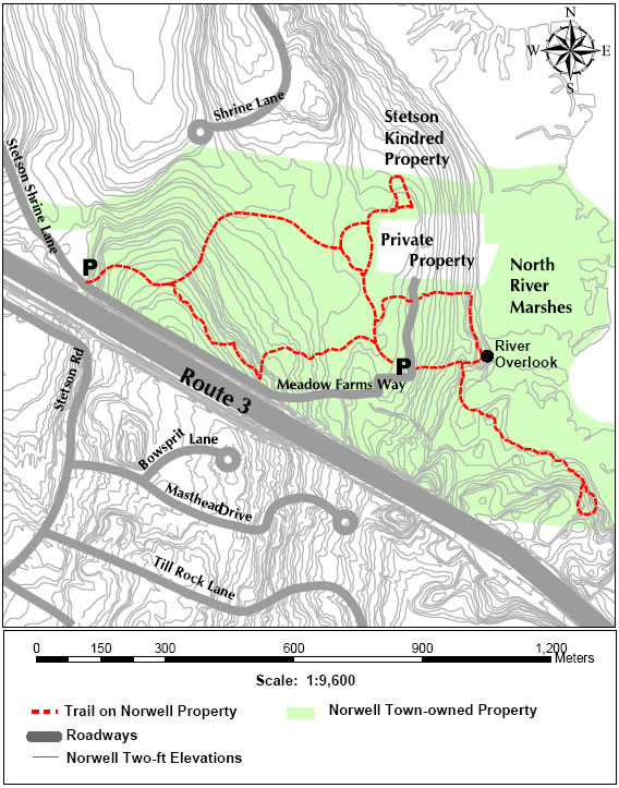
LOCATION: Stetson Meadows is a 116- acre parcel, located along the North River with access from Stetson Shrine Lane.
DIRECTIONS and PARKING: From Norwell Center on Route 123, turn onto River Street. Follow River Street to Stetson Shrine Lane. Turn left onto Stetson Shrine and follow to end of paved road. Parking is available here or one may continue on a narrow gravel road, Meadows Farm Way, to another parking area by the historic Stetson-Ford house. The road is in poor condition. This parking area is in a large, grassy field with plenty of parking.
TRAIL DESCRIPTION: From the field, the River Trail leads down towards the North River and loops back via the Twin Pines Trail across Meadows Farm Way to field. There is a clearing which affords a beautiful view of the North River. The River Trail continues south along the river and marsh before looping back to Meadows Farm Way.
The Stetson Trail connects the parking area at the end of Stetson Shrine Lane with the parking area in the field. This trail is through a mixed pine and hardwood forest.
TRAIL LENGTH: The loop trail is approximately 0.5 mile. The Stetson Trail from field to Stetson Shrine Lane is approximately 0.5 mile one way.
TRAVEL TIME: About 1-1.5 hours for River Trail, Twin Pine and Stetson round trip to field.
AMENITIES: Picnic table, benches
ADA ACCESSIBILITY: None as of 3/06, although accessibility is planned.