
Place of Interests |
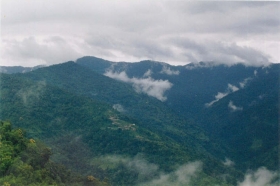
The Changlang district has wide range of altitudinal variation ranging from 200 metre to 4500 metre from sea level sprawling over lush evergreen forests overhauling beautiful hills and rivulets over the Patkai Mountain range in the Myanmar border of northeast corner of India. There are some places, which are situated in beautiful locations. These places are very attractive for seasonal |
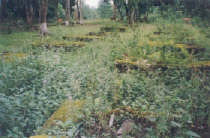
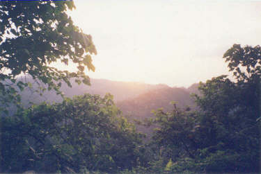 A scenery from Changlang - Margherita road |
||||
| visitors. Seasonal visitors are an important factor
in economic well being source of income for the local people. While
tourists enjoy their visit, the local people can have the chance
of getting a good price for their products and their services. |
|||||
|
|||||
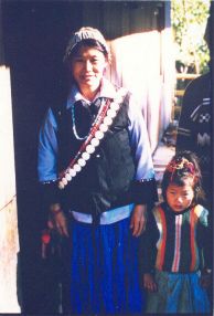
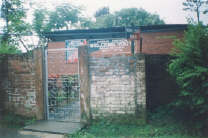
This beautiful and small town is headquarter of Miao sub-division and situated at bank of River Noa-Dehing. The interesting things to see are Mini zoo, museum, Tibetan refugee settlement where colourful woolen carpets of various designs are produced, oil drilling at Kharsang and Manabum. |
 A Tibetan lady selling Carpet at Craft Centre, Tibetan Refugee Camp, Miao, Arunachal Pradesh |
||||
|
|||||
Related Links: |
|||||
|
|||||
| A
true and enchanting wilderness |
|||||
|
|||||
Vijonagar, comprises of sixteen villages having a population of about 4500 people near Indo-Myanmar border which is located in Changlang District and is Air maintained due to non existence of road networks. Fifty five percent of the population belong to retired Assam Rifle personnel and 45 percent is of Civilians comprising of mainly Lisu (Yobin) tribe. |
 Gandhigram Village, Vijoynagar, the last Village of India. |
||||
The settlement of the Assam Rifle personnel began
from 1960 onwards. Prior to 1960, this place was little known to
outside World. The villages have a number of Primary Schools. There
is Arunachal Pradesh Government run Middle School up to eight standard.
There are no roads in the area. There was a motorable road existing
in the area from Miao up to Deban Camping ground, but due to deterioration,
it is no longer used. The telecommunication facilities are not available,
and only Radio Net communications are available in the Assam Rifles
Camp. Detachment of Government Agencies like SIB and Arunachal Pradesh
Police exist in the area. Assam Rifles camp have medical facilities,
but no Doctors are available. The villagers are not covered under
water supply scheme and draw raw water for their consumption. PWD
has installed Generator for Power supply, but due to non availability
of Funds for procuring Diesel, the Generator is not functional. |
|||||
The villagers depend on Jhoom Cultivation for their livelihood, and are dependent on rainfall. The Day to day requirement of Groceries is met by a few Shops; and which bring the Stores from Dibrugarh by Air or from Miao on foot. It takes six days to travel on foot from Vijoynagar to Miao. Civil and Military Helicopters (AN 32) fly from Dibrugarh to Vijoynagar Aircraft Landing Ground. These flights are irregular and have limited haulage capacity, in that they can take up to one ton load with eighteen persons on board. There are two such Sorties for Civilians and three numbers for Assam Rifle personnel. |
 A Lisu Woman with a child, Vijoynagar. |
||||
|
|||||
It is headquarter of Jairampur sub-division. The famous historic 'Stilwell Road' passing through this small town from Ledo, Assam, India to Kunming, Yunnan Province, China via Burma. The World War II cemetery of about 1,000 graves of Allied Soldiers is located 6 Km away from Jairampur at the Nampong road. |
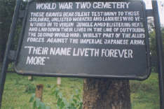 The Sign-board of the Cemetery of World War-II, Jairampur, India |
||||
Related Links: |
|||||
|
|||||
|
|||||
|
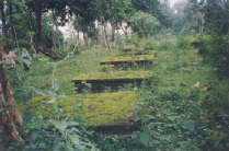
The recently unearthed large Burial-ground with about 1,000 graves of allied soldiers believed to be mostly of Chinese, Kachins, Indian, British and Americans soldiers who died in Second World War is located at Stilwell Road ( Ledo Road ) in the Jairampur-Nampong road, Changlang district, Arunachal Pradesh, India. |
||||
The hidden cemetery covered with thick jungles midst
of the bank of Namchik River and on the Stilwell
Road ( Ledo Road ), 6 km from Jairampur town, 39 km from Ledo
and 24 Km before reaching Pangsau Pass ( Hell Pass ), India - Burma
(Myanmar) border. The Army has cleared the area and found about
1,000 graves within an area of about three acre. The boundary was
enclosed by concrete posts with entrance on three sides. The graves
are arranged in five Lines and several rows. A large grave, possibly
a mass burial, is in the centre. The bricks were from Ledo AR&T
Co's brick fields, and others marked as B&C-119 and IR.N!C9 were
being used. |
|||||
Perhaps, this cemetery might have constructed during the construction of the Stilwell Road ( Ledo Road ) from Ledo, India to Kunming, China via Burma connecting the Burma Road beyond Bhamo by allied forces starting from December 1942 to May 1945 in China-Burma-India (CBI) theatre of military operation against the Japanese forces in North Burma. |
 The Cemetery of World War-II, Jairampur, India |
||||
During the construction of road and fighting against the Japanese forces, numbers of allied soldiers were reported to have died due to malaria, dysentery, land slides, enemy fires and other causes. The Patkai range of Indo-Burma border and Shindbwiyang range in north Burma were one of the most difficult terrains in the World where the road construction was carried out by the allied forces led by General Joseph W. Stilwell while fighting against the Japanese forces who had taken over the whole Burma in their hand in 1942. Perhaps, the cemetery might have used for disposal of dead soldiers from site of war front and calamities out of road construction in India and Burma fronts. While trekking and fighting down the Ledo Road to Myitkyina, Burma, the stronghold of Japanese forces, large number of allied soldiers were reported to have died due to Diseases, calamities and missed in action while fighting.The casualties at war fronts in Burma were reported to have been evacuated by C-47's Ambulance planes and treated at the various base Hospitals at Ledo road and at Ledo, Assam, India and most of the dead soldiers might have disposed off at this cemetery. It is also reported that most of the casualties were treated at the 20th General Hospital, the 14th Evacuation Hospital, or the 111th Station Hospital in the Ledo area. In course of time, those Hospitals have also completely vanished.
|
|||||
| The Excerpt of inscription extracted from the Epitaph of comparatively
larger grave inscribed in Chinese language, shown in right hand
side photo is belongs to Late Major Hsiao Chu Ching, Company Commander
2nd Company, 2nd Battalion of 10th
Regiment, Independent Engineers of Chinese Army stationed in India.
He was born in July 1913 at Wei Country of of Hapeh province, and
died in December 1943. `All officers and men of the Second Company
- January 5, 1944.' |
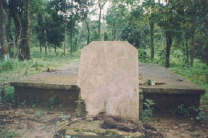 The Memory of Late Major Hsiao Chu Ching Chinese allied soldiers who died in December 1943 during the World War-II, Jairampur, India. |
||||
Related Links: |
|||||
|
|||||
The historic Stilwell Road (Ledo Road) passing through the Nampong and goes down to Burma from here. It is threshold of the Indo-Burma (Myanmar) border. The Pangsau Pass, the Indo-Burma (Myanmar) border is just 12 Km away from Nampong where the famous the Lake of no Return can be viewed from the Pass. |
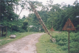 The Hell Gate - installed during the World War II, Nampong, India |
||||
Nampong and Pangsau Pass were considered to be "Hell
gate" or "Hell Pass" due to difficult terrains in
the Indo-Burma Patkai mountain Range. Crossing these places toward
Burma were considered to be dangerous and hazardous as Hell during
the World War II. |
|||||
Related Links: |
|||||
|
|||||
| The famous lake called The Lake of no Return in Myanmar side which can be viewed from Pangsau pass is 12 Km away from Nampong. During World War II, large numbers of Aircrafts were reported to have perished into this lake. Perhaps, the lake served the Allied Pilots for soft landing into the lake water during return mission when the Aircrafts got hit by enemy or out of mechanical snags in the Aircrafts. |
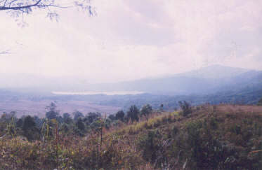 The Lake of no return, near Pangsau pass international border between India and Myanmar |
||||
| The Pilots had chosen this lake for emergency landing
in case of imminent Air crush and therefore, many aircrafts were
reported to have crashed in to the lake. |
|||||
Related Links: |
|||||
|
|||||
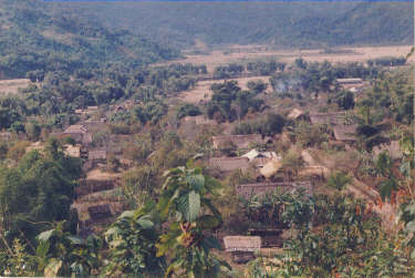
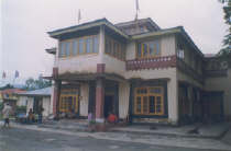
The headquarter of the district. It is well known for two premier institutes namely, State Institute of Education (SIE) and District Institute of Education and Training (DIET) where in-service training is provided to the teachers. The visitors can also see typical Tangsa/ Tutsa villages/ houses and interact with the local people. One can also enjoy fishing in the Tirap River passing through the heart of the town. |
 A scenic beauty of Khimyang circle, Changlang |
||||
Related Links: |
|||||
|
|
|||||


 The Cemetery of World War-II,
Jairampur, India.
The Cemetery of World War-II,
Jairampur, India.