| |
|||
| <<< Back to Articles List |  |
||
| [article - Queen Charlotte Walkway] |
|
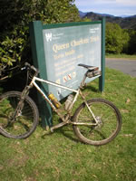
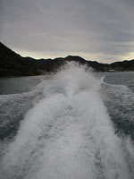
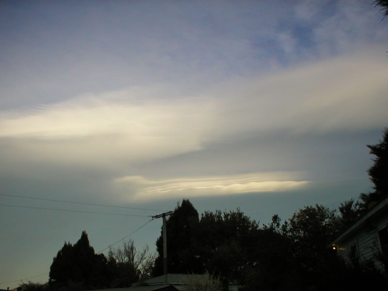
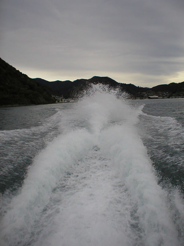
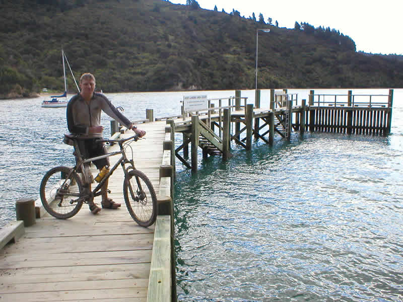
Friday morning, 6:15, I was lying in bed and could hear the tinny echo of rain on corrugated iron. Not the weather I wanted, or was forecast, but I'd arranged the transport, so today was the day. A smile crossed my face, I was going to ride the Queen Charlotte Track. The day before I'd arrived in Picton, nearing the end of this trip to New Zealand, to the sight of glorious sunshine. My hopes were high for a great ride. I spent Thursday afternoon and evening trying to book a place to stay out on the track and arranging the water taxi that will take me to the start. My intention was to ride most of the 72Km track in a day, sleep en-route, and cruise back into Picton a day later, after enjoying some of the peacefulness of the Marlborough Sounds region. Hurridly, I collected my kit, and squashed as much water, food and basic clothes into my rucksack as I could. Via the ATM, I rolled down to the water front to the water taxi rank. Transport around the sounds i almost exclusively by boat - there are very few roads, and with many houses on the water's edge, boats replace cars for local travel. Like a roof-rack for a car, my bike was mounted on the top of the boat, and with a few backpackers, day walkers, and supplies for the local water-front houses and restaurants, we powered away from the port of Picton, towards the isolation of the Sounds.
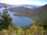
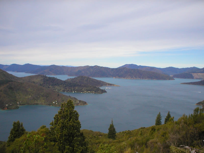
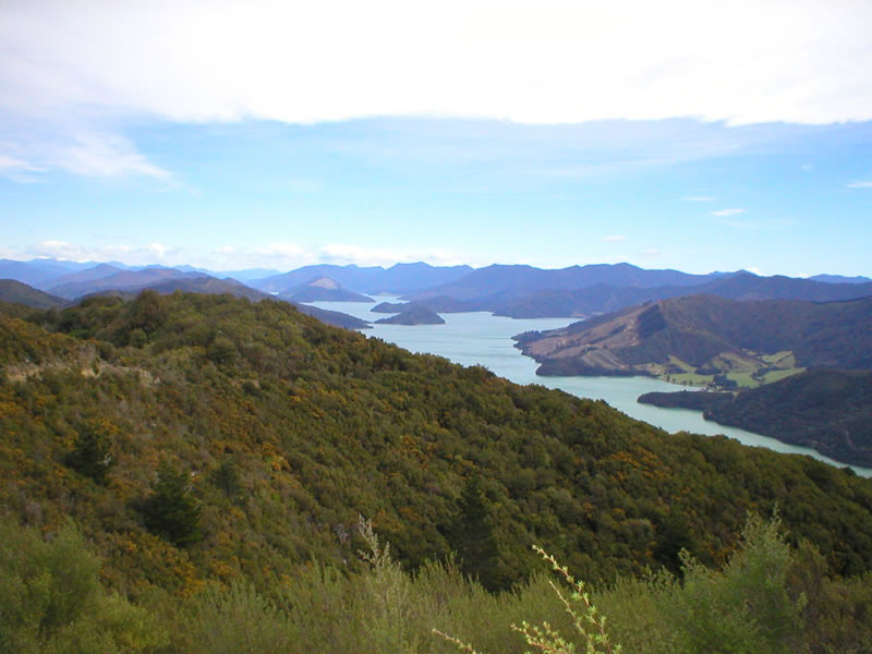
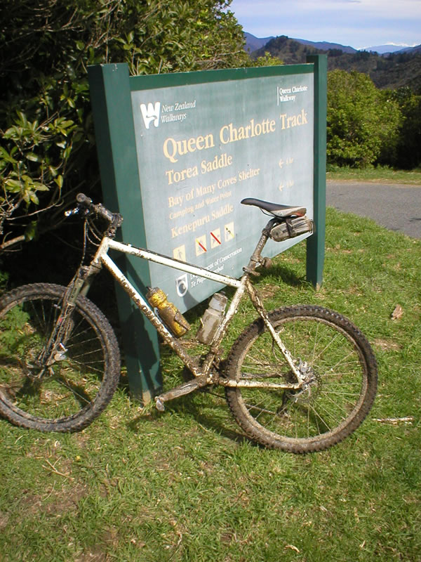
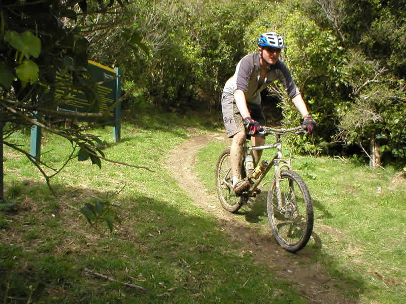
The start of the track is unrideably steep - I elected to start 4km from Resolution Bay. Dropped off outside a house, the track peels away just before their front garden, and rises up a few metres to meet the Queen Charlotte track proper. I feel good, with the weather calm, but overcast, which considering the distance and height gain, will be a good thing in terms of water consumption. The track winds up through trees and across farms to reach the ridge of the first 'finger' out into the sounds. The views open up, spectacularly displaying the magic of this region. Houses dot the waters edge, and the occasional boat slowly floats by. The quietness is immense, with virtually no man made noise at all. Other track users, of which there aren't many at this time of year, wave cheerily as I pedal by. This first real descent is uninterupted by walkers, and with recent rain making this part of the track extremely muddy in some places, and slippy in most, the already fun singletrack is made into a series of drifty corners and sketchy tucking around trees.
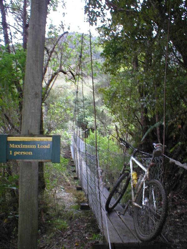
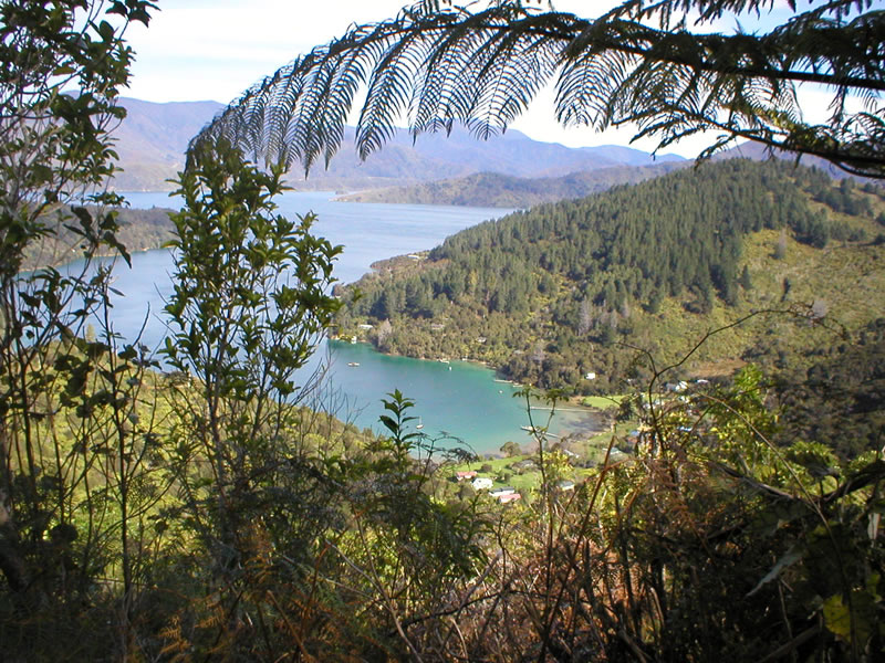
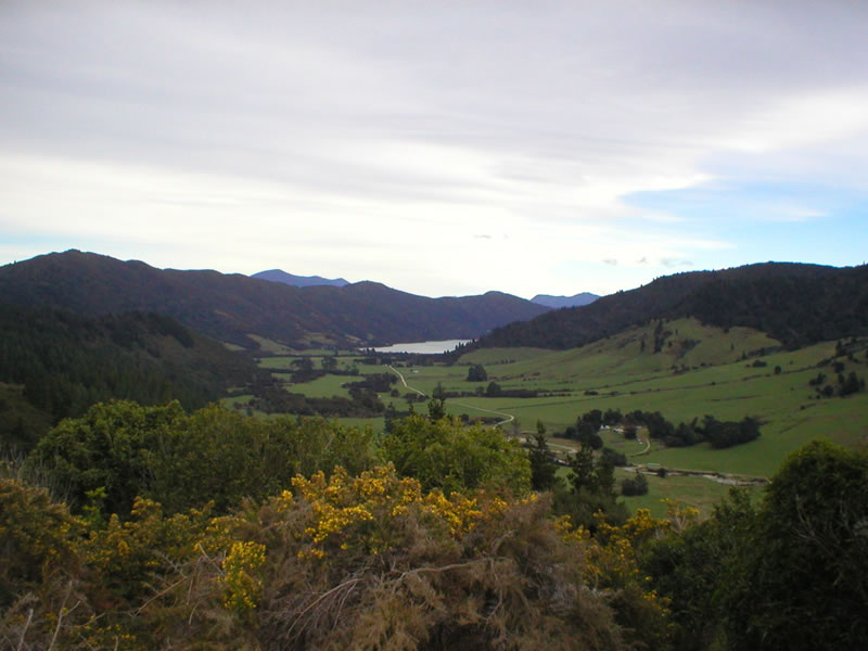
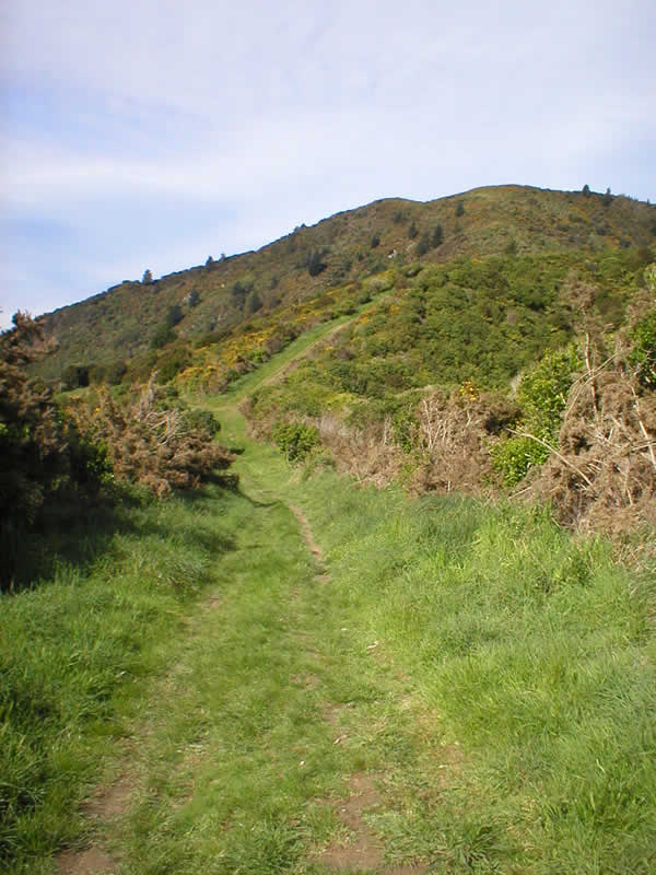
The next few miles are a mixed bag of emotions. I manage to nail most climbs, but there's a ticking in the back of my head... gotta make my destination by 4:30 to get the water taxi to the hostel. After several km's of rolling track, with the occasional technical water crossing, the trail heads skywards quite abruptly, to overlook Queen Charlotte Sound and gain height up to Torea Saddle. Part way up this ascent, I emerge onto one of the few access roads in the region. Views open up over Keneperu sound, and back onto Queen Charlotte Sound and Endeavour Inlet. The sun is trying to break, and in the distance, I can see turqoiuse blue waters. The track I've just ridden north of this point is closed during the summer, so choose your timings carefully if you want the full deal. The track continues, winding up and around the ridge. Height lost on fast descents is made up generally on steep short sections, some zig-zagging, with the occasional glimpses through the dense vegetation cover to sneak views over the sounds. Across the top section, DOC huts and campsites are scattered, offering the opportunity to refill dehydrated water bottles, and give the legs brief respite, whilst feeding the eyes with vistas. An overnighter at one of these would be an awesome. My legs are really starting to suffer now - pain on the climbs, is suitably rewarded with views and descents. Land slips add an interesting trail obstacle, whilst simultaneously dealing with the fact there's a steep, several hundred metre drop down to your left. Once again, the trail drops rapidly but this time it's a long, twisty rocky singletrack. Wahay! Any pain from my legs is forgotten, the sun is finally making an appearance, after teasing me for so long, and there are no other trail users to interupt the flow. Suddenley, I'm at the bottom, and had I not been time limited, would have probably ridden that again! Tick, tick, tick... I suddenley seem to have made good time. After posing for photos, I have an hour and a half to do only a handful of km's. I'm at the Portage Bay road, and this is chicken run time. There's a road, which would whisk me to my destination in a matter of minutes, or there's the off road option - I take the latter. Tyre marks indicate recent passage of off road rubber, and I get a mental boost by the prospect of meeting other like minded souls. So far, I've only met walkers.
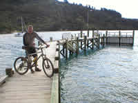
The track climbs steeply, and I'm reduced to walking. There's just no go left for peddaling hard - and the sun is really beating down now, it's a relief to remove the helmet, and let the cool breeze in the shade remove some heat from my fuzzy head. Eventually, I've climbed back to a height very nearly equivalent to before the previous descent. The trail turns quite grassy now, which slows me a little, but with the views back over Picton to encourage me, nothing is going to stop me now! A sitchback descent rolls into the final fast run down to the road. Dissapearing into trees, the trail gets extremeley muddy, and test what balance I have left to the max. I keep composed though, avoid all trees - and suddenley pop out onto tarmac. There's still 12km of trail left, but my accomodation neccesitates a tarmac descent for a couple of hundred metres, back down to sea level. A quick stock up on food supplies for the next two days, and I emerge at the jetty, with the water taxi just coming into view, ready to take me to the remote hostel where I'll be relaxing for the next day or two. Perfect timing.
Half an hour later, I'm sat, chatting to natives, supping a cup of tea, looking back at the sun setting on the ridge I've just traversed. There's a spa right on the water's edge for later too...
IMAGES click to enlarge - opens in new window - close to return here
|
|||||||||||||||||||||||||||||
Site design and content copyright Chris
Harrop 2004 |
|||||||||||||||||||||||||||||
Design by cpdesigned |