If you get to here you are in the wrong place.
I told you it can be hard to find the trail, at least for me.
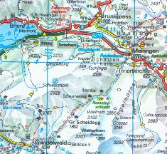
Turn back toward the crossroad just outside Meiringen and head right in amongst the houses up that little path
The path leads off beside some small farmhouses.
The man who owns the little orchard you walk beside is wonderfully friendly.
Unfortunately survival German, the only kind I speak, just doesn't do justice to people this nice.
Continuing up through the trees the path finally intersects the net of trails around the falls.
These lead from the auto access areas served by the road that you've been hitting at every switchback.
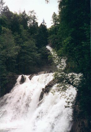
Alas poor Holmes, we knew thee well.
Assuming Holmes escaped this might be his route after he crawled back up the gorge of the Reichenbach.
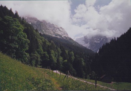
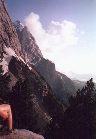
On the left is the Engelhorner ridge, slightly left of center is the Wellhorn EL 3192m.
The trail so far has been playing hide and seek with the road.
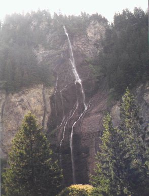
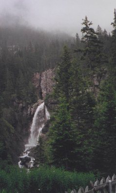
Coming off the cliffs on the North side of the narrow valley
is what I call a spiderfall.
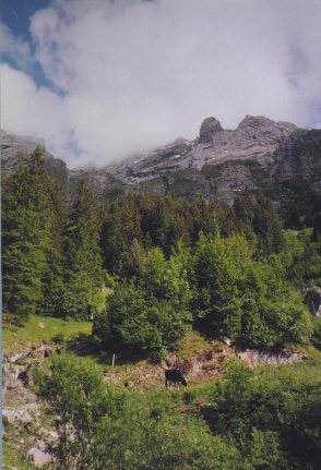
At this point it is about 5PM and I've decided to head for a hut that is shown below the Engelhorner ridge.
The hut is straight up from here right at the timberline.
The signs called it the Engelhut. If you've never stayed in a Swiss mountain hut here's a quick description.
Usually two stories tall the lower story has a small kitchen area with a wood stove and several trestle tables for eating and relaxing. Upstairs there are usually at least two large bunkrooms. The beds are just two layers of shelves with foam mattresses and cotton mattress covers. Each shelf has three or four sleeping places with pillows and two folded wool blankets laid out already. If the hut is not staffed there will be a lock box, fill out a registration slip, fold it up with the requested sum, usually 15-20 francs, and drop it in. Supposedly at least one door on each hut is always left open for emergency use. I've never found one locked up tight so this may be true. Each hut will have a rack of slippers by the door. Please use them when in the hut and clean up thoroughly when you leave. Usually there will be a source of potable water, often a horse trough, just outside the door and an outhouse a few yards from the hut.
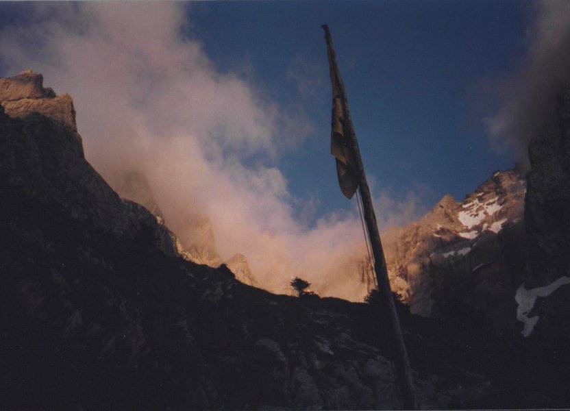
This is the flag of the mountain club that built the hut. That night I shared the hut with a coed class of about twenty teenagers taking a mountain guide course. The teachers were registered mountain guides. The kids were learning mountain climbing techniques the hands on way.
It was humbling to see them trotting up the slopes I was huffing and puffing up.
They were up early, ate a quick breakfast, roped up, and headed up into the fog while I was still sipping tea.
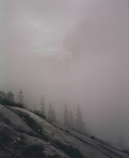
I finished breakfast in splendid solitude, got my stuff together and ventured off into the twilight zone.I picked a track that looked like it headed along the base of the Engelhorner ridge toward the general direction of Gr. Schiedegg and moseyed off.
HINT #1
If you ever come up to two sticks crossed above a trail in Switzerland.
STOP!
Try to remember where your first aid kit is, then proceed with extreme caution. The "X" on this trail marked a right angle turn at the top of a 100 foot high cliff. One of the nice things about the Wanderweg is that it makes it real easy to get to places where uncoordinated idiots like me can do fun things like falling off serious vertical.
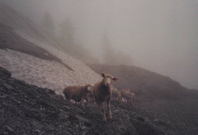
Shortly thereafter I met the first fellow traveler of the morning.
The rest of the flock was sure I was a bear and wanted to "Run Away!Run Away!".
She was trying to decide wheteher to kick me off the trail.
I was charming and she agreed to be petted for a minute or so.
About that time the rocks started falling from above and we all decided there were better places to be.
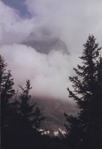
The fog started to lift about 10AM and I could catch glimpses of the glacier on the south side of the Wellhorn.
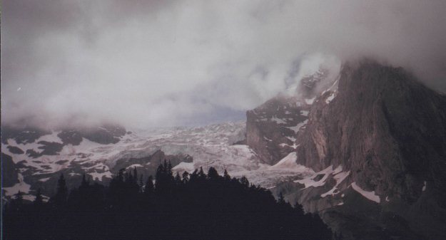
Just before this picture was taken I saw about 100 feet of this glacier slough off and go rumbling down the mountain like a huge waterfall. HINT 2 Stay away from glaciers unless you know what you are doing.
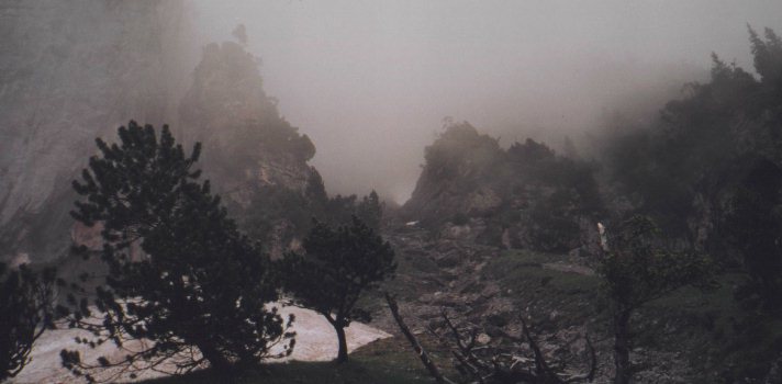
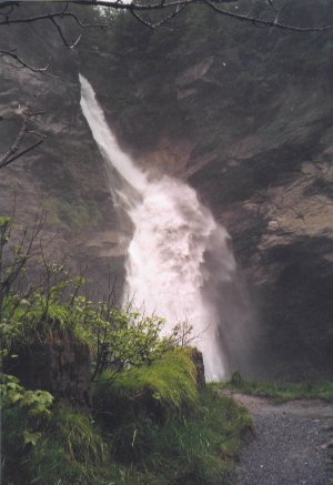
From here I started to drop down toward the Rosenlauischlucht.
I found out this was a two to ten foot wide slit in the rock that has been cut by the glacier runoff. It ends in a waterfall that seems to shoot out of the face of the cliff.It is a tourist attraction and you pay to walk up a extremely narrow set of stairs carved into the rock. Bring a raincoat!
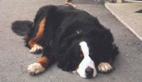
 From there to the top of the pass it is a gentle slope.
There is a ski hotel there with a good restaurant and probably a superb view. Since the clouds were thick right then I settled for a picture of the resident guard dog.
From there to the top of the pass it is a gentle slope.
There is a ski hotel there with a good restaurant and probably a superb view. Since the clouds were thick right then I settled for a picture of the resident guard dog.
From the pass the valley slopes gently all the way down to Gindelwald.
At first the Wetterhorn on the left dominates the scenery.
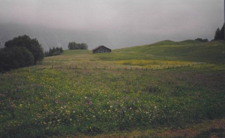
Later on the trees open up into a series of meadows.
Runoff from the mountains cuts deep black gullies through the rocky soil.

The meadows are covered with flowers and there are usually dairy cattle in abundance.
I once spent about 15 minutes watching a bunch of calves playing hide and seek around a hayshed.
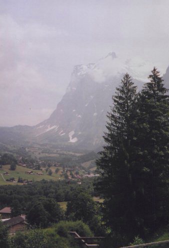
As you enter Grindelwald you can look back toward Grand Schiedegg
and the Wetterhorn.
If you hike at the blazing snails pace I prefer you were probably there about 4 hours ago.
Gridelwald is a small town on the slopes to the North of the river. An excellent camping area is located directly below the center of the town on the banks of the river. It has low rates, excellent facilities, and a wonderful morning view.
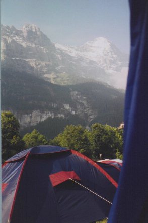
Yes, this is the North Face of the Eiger on the right.
No! I didn't even think about climbing it.
I hope you enjoyed my first attempt at virtual hiking. If you have any questions or comments just send me a message, I'll try to get back to you as soon as possible. Adios!
Ready for more hiking?
Then swim on back to the reef.
TUNA'S REEF
Full to the gills?
This will get you back to the trail head
Thanks for dropping in, come back soon.
Yosemite Trails