|
NEPAL
PART 1 - INTRODUCTION
COUNTRY OVERVIEW
 Location and Physiographic
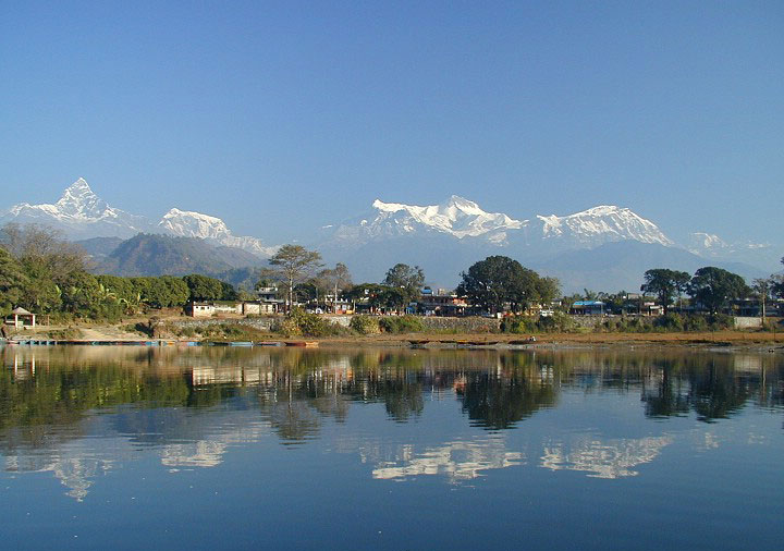
1. Nepal is located
between longitude 80o4' and 88o12' and between latitude 26o22' and
30o27'. It borders the Peoples Republic of China in the north and
India in the east, south and west. Nepal has a breadth east to west
of 885 km, a mean width of 193 km and covers an area of 147,181 sq
km. Topographically the Country is divided into three bands running
the full breadth and comprising the Terai (southern plains), the
Mid-Hills and the Mountains. The Mid-Hills and Mountains together
represent 83% of the total area of Nepal.
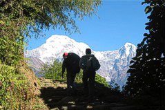
2. The hill areas are geologically very young and active, and are
affected by a constant tectonic uplifting accompanied by
down-cutting of the river systems. This action on the predominately
soft and deeply weathered nature of the rock has produced extremely
rugged topography with local differences in elevation varying from
500 metres to 3,500 metres and rising to 8,848 metres (Mount
Everest) above mean sea level. The resulting steep, unstable and
highly erodible slopes are divided into many gullies and small
valleys and the provision and maintenance of even basic
infrastructure in such extreme conditions is both difficult and
costly.
3. The Country is administered through five development regions:
eastern, central, western, mid-western and far-western. These are
further subdivided into 14 zones, 75 districts, 58 municipalities,
and 3,914 Village Development Committees. Although the declared
policy of Government is to decentralise development responsibility
to the local level, this is proving difficult in practice due, in
part, to the lack of local capability and hence, poor resource
mobilisation.
Climate
4. Nepal lies in the monsoon belt but the climate is dictated by
altitude and varies from sub-tropical on the Terai plains to alpine
and tundra in the Mountains. Annual rainfall differs from place to
place ranging from less than 250 mm in the Mountains to more than
4,000 mm in the Mid-Hills (near Pokhara). Most of the precipitation
occurs during the period June to September and is concentrated in
the Mid-Hills and the Terai. The high concentration during the
monsoon months results in flooding, heavy erosion and triggers
landslips over a wide area.
Demography
5. The
2001 census recorded a population level of 23.2 million. Of
this figure, some 11.20 million are based in the Mid-Hills,
some 2.00 million are in the Mountains, and the remaining 10
million are in the Terai. Outside the Kathmandu Valley, the
eastern and central Terai has the highest population density
ranging from 300 - 1,100 per sq km. Density in the Kathmandu
Valley lies between 1,100 and a maximum of 1,710 in
Kathmandu itself.
6. Major
changes have taken place and are continuing to take place in the
distribution of population among the various parts of the Country.
These changes are largely intra-regional and involve a pronounced
shift of population from the Mountains and Mid-Hills to the Terai.
Zones with the largest exodus have been the eastern Mountains and
Mid-Hills followed by the western and central Mid-Hills. In addition
to these movements, there is a continuing migration from the rural
areas to Kathmandu whose population has increased threefold over the
past 5 years to some 1000,000.
Economy
7. In economic terms Nepal is one of the least developed countries.
44% of the population are below the international poverty line, GDP
per capita is US$240, and illiteracy is 60%. More than 90% of the
total population still live in rural areas and most of them are not
yet receiving the minimum physical facilities necessary to fulfil
their basic needs. A major challenge exists for Government in
providing an appropriate level of infrastructure to these remote and
scattered settlements to support development and reduce poverty.
8. Agriculture has always been and still remains the backbone of the
Nepalese economy, accounting for around 40% of gross domestic
product and about 90% of total employment. Most agricultural
development is concentrated in the central and eastern Terai and the
central Mid-Hills; central region is the main area of agricultural
production accounting for about a third of agricultural output.
Estimates of production and consumption of edible cereal grains
indicate, in general terms, that eastern region and usually central
and western regions produce surpluses while the two extreme westerly
regions are almost invariably in deficit.
9. Although manufacturing has increased in recent years, the fact
remains that it is still a very small part of the Nepalese economy,
contributing only about 6% of total employment. There is, moreover,
evidence to indicate that urban growth in Nepal is strongly linked
to agricultural development rather than to growth in manufacturing.
Despite the recent expansion in industry, infrastructure strategy
for economic development in Nepal will have to be determined in the
medium-term by needs in the agricultural sector. In particular, the
agricultural potential in the Terai, a growing trade in agricultural
commodities and inputs, and the continuing growth of market towns
linked to agricultural development.
*** Click more information about of Nepal to download
Nepal.doc 198 KB
|