|
Raft River Mountains
Clear Creek Campground
 The Raft River Mountains are located in the northwest corner of Utah. They
run east-to-west, and form an area about twenty five miles long by five
miles wide.
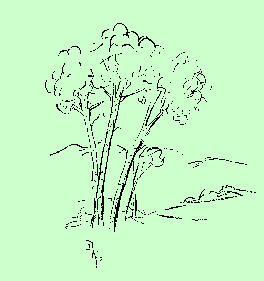
Clear Creek Campground is at the eastern end of these mountains.
Two bubbling streams form the boundaries of this lovely little campground
in the Sawtooth National Forest. The soothing sound of running water can
be heard from every camp site. At the lower end of the campground the two
streams join into one. It then flows through the foothills, through private
farms and ranches, and down into the valley where it runs into the Raft
River. This river drainage system is the only one in Utah which flows north
into the Columbia River. All of our other streams flow either into the
Colorado River System or into the Great Basin.
HOW TO GET THERE:
North on I-15 to Tremonton, then northwest on I-84 to Snowville.
West on U-30 and northwest on U-42 for about 25 miles. Keep going until
you have crossed the Idaho border. Before reaching the tiny town of Naf,
you will see a sign directing you to turn left to Clear Creek Campground.
Follow the dirt road southward for a couple of miles to the camp. The
campground is just south of the Idaho border.
First come, first served -- no reservations.
The Raft River Mountains are located in the northwest corner of Utah. They
run east-to-west, and form an area about twenty five miles long by five
miles wide.
Clear Creek Campground is at the eastern end of these mountains.
Two bubbling streams form the boundaries of this lovely little campground
in the Sawtooth National Forest. The soothing sound of running water can
be heard from every camp site. At the lower end of the campground the two
streams join into one. It then flows through the foothills, through private
farms and ranches, and down into the valley where it runs into the Raft
River. This river drainage system is the only one in Utah which flows north
into the Columbia River. All of our other streams flow either into the
Colorado River System or into the Great Basin.
HOW TO GET THERE:
North on I-15 to Tremonton, then northwest on I-84 to Snowville.
West on U-30 and northwest on U-42 for about 25 miles. Keep going until
you have crossed the Idaho border. Before reaching the tiny town of Naf,
you will see a sign directing you to turn left to Clear Creek Campground.
Follow the dirt road southward for a couple of miles to the camp. The
campground is just south of the Idaho border.
First come, first served -- no reservations.
Many large yellow swallowtail butterflies are flitting about in the
campground. They seem to enjoy the damp areas along the sides of the road,
and congregate on the mud at the edges of puddles. Several of them fly up
each time a person walks past. There are also large bumblebees visiting the
clover and the thistle blossoms. They are no problem to us humans, but some
of the other insects are a nuisance. We are glad to have insect repellant
along to discourage the mosquitoes.
Myriads of wildflowers are in bloom. The fragrance of wild roses fills the
air. Many of the roses are the medium pink color which I have seen
throughout the state, but some bushes have blossoms of a much brighter,
more intense rose color. I also noticed at least one bush which had
bi-colored flowers -- the outer edge of each petal was the lighter pink,
and near the center each petal had the deep rose hue. Are these genetic
variations? All blossoms on the same plant seemed to be alike, but were
often different from the blossoms on a neighboring plant.

- SOME OTHER FLOWERS SEEN NEAR CAMP:
- Sweet peas twining among the roses
- Shooting Stars in shaded areas near the streams
- Bog Orchids in the swampy places
- Yellow Monkey Flowers
- Thistles -- (all had white blossoms instead of purple)
- Geraniums
- Wild Onion
- Yarrow
- Salsify
- Red Clover
- Yellow Clover
- Other legumes -- (some yellow, some purple)
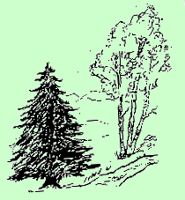
- Single-Leaf Pinyon
- Juniper
- Mountain Mahogany
- Many composites
- Many types of grasses
- Other flowers, forbs, shrubs and trees
On Saturday, on our trip to visit the City of Rocks, we followed a road
which took us to an elevation higher than that of the campground. Here we
enjoyed a beautiful view of the surrounding countryside, and also spotted
many wildflowers which had not been present at camp. A species of gilia was
growing here, different than any I had seen before. I have seen the
Scarlet Gilia (a brilliant red color) in many areas of Utah, but these were
almost white. We also saw blue flax, Indian paintbrush, pentstemon, and
many others.
The City of Rocks
This spectacular natural area is made up of rock pinnacles, many of them
sixty to seventy stories high.
The rocky formations are granitic. Most of the granite is part of a "small"
batholith (a mass of formerly molten rock below the earth's surface)
of the Almo Pluton formation, which covers approximately forty square miles.
Thirty million years ago, this formation intruded much older (2.5 billion
years) granitic rock, the Green Creek Complex, which is some of the oldest
that can be found in the continental United States. The "Twin Sisters" --
a pair of rocks next to each other, which look very similar -- are
actually eons apart in age. One is 2.5 billion years old, the
other only 25 million. The first twin was already over two billion years
old when the second was born!
The area was used by the Shoshone and Bannock Indians,
as well as emigrants traveling the California Trail and the Salt Lake
Alternate Trail, beginning in 1843. About fifty thousand people traveled
these trails through the City of Rocks in 1852 on their way to the gold
fields in California.
This is a beautiful place to visit, with its rocks, vistas and vegetation.
It is the northern extension of the single-leaf pinyon pine.
Uses of the area included farming until the drought of the 1920s and 1930s.
Today, ranching is the main industry.
|
|