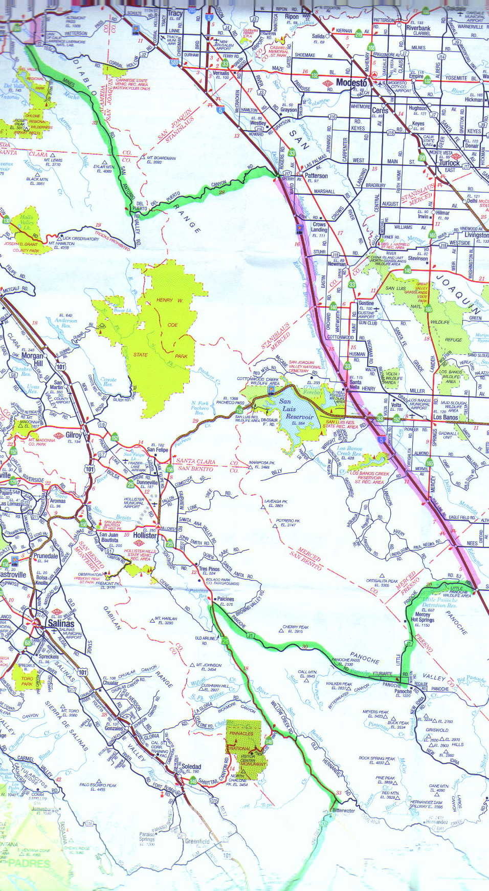

My Day One route south from Livermore
included Mines Road, Del Puerto Canyon Road, Little Panoche Road, and Panoche
Road, with dry creek beds giving way to chaparral, then fertile fields.
Moving south on Highway 25 along the San Andreas Fault, the NSX and I
encountered a group of northbound motorcyclists on Harleys.
I waved to
them. Then there were more, and more, and still more. It turned out
that this was the unofficial bikers’ weekend in Hollister, at the northern
terminus of the very scenic Highway 25.
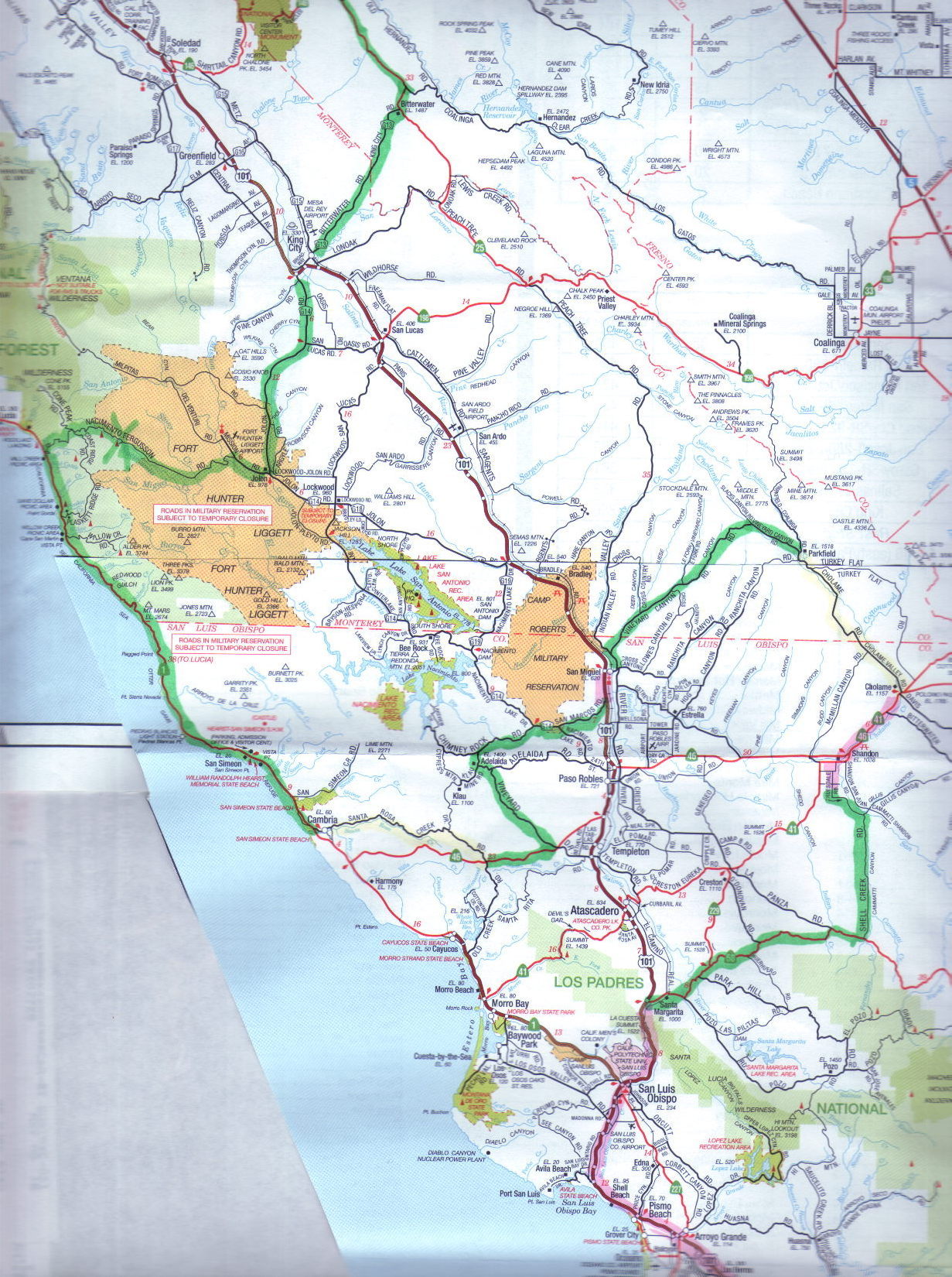
Day One concluded with the superb County Road G14 (Jolon Road) to Nacimiento Road, which crosses some of the prettiest country in all California. There are fertile valleys with grass and scattered live oak trees and almost no sign of man’s presence. No houses, no cows, no fences… just you and your car.
I stopped for the night at the little-known Ponderosa campground, at 1500 feet elevation, seven miles in from the coast. Folks were friendly, even lending me a bucket for my evening ritual of washing the car so I could cover it. They never even questioned my sanity.
My tent was right next to Nacimiento Creek, the sound of which lulled me to sleep. (No photos for Day One.)
Day One
Click on a map for detail (500k bytes each!) Green denotes the nicest roads.