Blue Heron's Nest -
Distances on the Kentucky River
Kentucky River Mouth to End at Three Forks
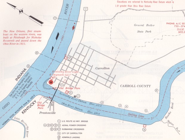
Data Source: Mileages indicated in Navigation Maps of the Kentucky River are in Statute Miles. These distances are taken from the 1987 Kentucky River Navigation Charts prepared by the U.S. Army Corps of Engineers, Louisville District.
If you find any errors in anything presented here, or you use a different method that works, please let me know.
LINKS:
Blue Heron's Nest Home Page

Legal Disclaimer: This site not responsible for accuracy of above distances; Use At Your own Risk
© 2000-2005, Blue Heron's Nest - all rights reserved
direct Comments to the
webmaster
|