Longitude and Latitude
* Measured in "degrees" ( � )
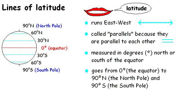
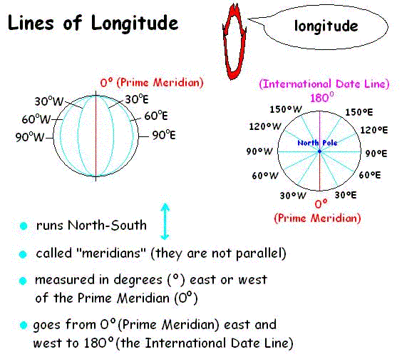
* Remember x and y coordinates in math? Using longitude and latitude coordinates is the same idea.
* You give the longitude and latitude numbers to find a place.
* These are called coordinates.
* For example,
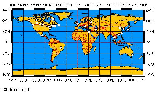
Where is Ottawa? It's 44�N 80�W.
* 44�N 80�W are the coordinates for Ottawa.
* Look on the map below and find 44�N 80�W.
* Look at the white circles on the map. They are cities. Can you guess what cities they are? (Smart guess, please)
* What are the coordinates for Hudson Bay?
* Where are you if you are at 0�, 0� ?
* What place is at 60�N 135�W?
* What country are you in if you are at 30�S 150�E?
* What are the coordinates of the city where you were born?