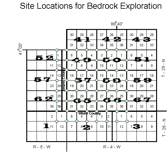
Purpose:
To determine the extent of the limestone bedrock
in the South West part of Pulaski County, extending to White and
Jasper Counties. This information will assist to determine where
detailed mapping may be necessary and the development of map unit
descriptions.
Procedure:
Using the hydraulic probe truck and hand tools,
borings will be made on each section corner extending from 1 to
2 miles south of the White Co. line to North of Francesville and
1 to 2 miles West of the Jasper Co. line to the Big Monon ditch.
These borings will be down to bedrock, a short soil description
will be obtained at each point. The Rockwell GPS receiver will
be used to obtain the X, Y, and Z coordinates at each stop, however,
elevation will probably be obtained from the topography map.
Additional bedrock information will be compiled from transect
data, well logs, and bedrock topography maps. This data will
be summarized by elevation above sea level in Surfer. Surface
diagrams will be constructed of both the soil surface and the
limestone surface.
BACK TO SPECIAL STUDIES
|