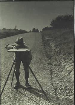
3. Prior to aerial photographs, soil scientists prepared their own base maps or used a few available USGS base maps. In either case the scientist used a plane table and sighted through an alidade to plot soil lines on the base map. The skill is seldom used today by soil scientists. Archeologists and others still use this technique for very detailed areas.
