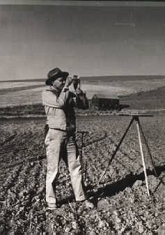
14. The SCS was very interested in erosion by water, and slope became a criterion for conservation surveys done by SCS. The Bureau of Soils later adopted slope as a mapping criterion. Slope was determined using an Abney level.
Next Slide
Back to Centennial Main Page