 |
|
|
|
|
|
|
|
|
|
|
 |
 |
 |
 |
 |
 |
 |
 |
|
|
|


|
 |
 |
|
--------------------------------------------------------------
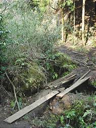
Be sure to bring plenty of water with you to prevent dehydration, especially if it is very hot and humid out. It would be good to bring bug repellent with you to ward off biting insects, particularly mosquitoes. High-energy foods are good to have in case your hiking trip is long or takes longer than you planned. Be sure to bring sunscreen and a hat to procect yourself from getting sunburned. Watch out for poison ivy or poison oak as well and stay on mark trails. Do not venture off unmark trails. A good pair of hiking boots or running shoes is good when going for a hike and try to avoid wearing clothes made from cotton. Check the weather to make sure that no storms are in the area and in case you do still go bring a windbreaker or rain jacket just in case. If you go alone tell others where you are going and when you expect to be back. If there is a registration book to sign at the beginning of the trail sign the book, so rangers will know where to look in case you end up missing. Take your time and rest when needed, never push yourself. It is a good idea to go early in the day so that you have plenty of time to return before it gets dark out, but just in case it might be a good idea to bring a flashlight. Overall have fun and be safe. If something doesn't look right than it's best to avoid it, use common sense. Good luck in all your hiking adventures. |
| Five Mile Mountain Round-trip time: 4 hours and 30 minutes Difficulty: Round-trip distance: 7 miles Location: Take Exit 24 from the Northway and drive east to Route 9N. Go 12 miles north past Clay Meadows to the trailhead at the northern end of Tongue Mountain Range. Parking is available at each location and each trailhead is clearly marked by DEC signs. |
|
|
| This is a list of some of the hiking trails in the state of New York. Information has been gathered from other sources, not my own. Difficulty rating is based on others expertise. The rating is on a scale of one to five. One hiker being easy and five hikers being difficult. You may feel that some trails are easier than their ratings, but the ratings are designed for novice hikers. |
| For more information on Hiking regardless of your state click on any of the links below |
| Fifth Peak Round-trip time: 3 hours and 30 minutes Difficulty: Round-trip distance: 5.4 miles Location: Take Exit 24 from the Northway and drive east to Route 9N. Go 4.7 miles north to Clay Meadows, right after the boat-launching area at Northwest Bay. On the east side of Route 9N is where you will find parking spaces. From the trailhead, follow the blue markers for 0.4 miles, over a bridge til you hit a junction, then continue straight and follow the red trail markers |
|
| Trail information comes from "An Adirondack Sampler: Day Hikes For All Season," a quick reference guide to 50 of the most popular day hikes in the Adirodack Park, by Bruce Wadsworth and publlished by the Adirondack Mountain Club in Lake Georege. |
| Northwest Bay to Montcalm Point Round-trip time: 4 hours and 30 minutes Difficulty: Round-trip distance: 10.8 miles Location: Take Exit 24 from the Northway and drive east to Route 9N. Go 4.7 miles north to Clay Meadows, right after the boat-launching area at Northwest Bay. On the east side of Route 9N is where you will find parking spaces. From the trailhead, follow the blue markers for 0.4 miles, over a bridge til you hit a junction, then continue towards the right as the trail swings downward. |
| Buck Mountain Round-trip time: 4 to 5 hours Difficulty: Round-trip distance: 10.8 miles Location: Take Exit 20 from the Northway and follow Route 9N past the outlet mall and turn right onto Route 149. On your left will be a golf course, just past that turn left onto Route 9L. Follow this to the north until you come to a right hand turn for Pilot Knob and Katskill Bay, this is Pilot Knob Road. Follow it for 3 miles, until you see a large DEC sign and the parking area on your right. From a junction 0.2 miles in follow the yellow markers left to the summit. |
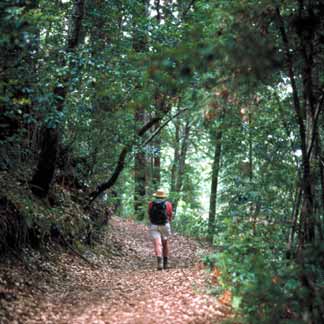
| Hiking Tips |
| Black Mountain Loop Round-trip time: 4 hours Difficulty: Round-trip distance: 6.7 miles Location: Take Exit 20 from the Northway and follow Route 9N past the outlet mall and turn right onto Route 149. Take Route 149 east for 11.7 miles to Route 4. Drive on Route 4 for about 10 miles north to Whitehall. From Whitehall take Route 22 and drive about 4.5 miles north and look for signs to Hullet's Landing. Turn left and drive 2.7 miles to Pike Brook Road. Turn left and drive 0.8 miles along Pike Road. You will see a large DEC and parking area on the left as you head down the hill. |
| Hadley Mountain Round-trip time: 3 hours Difficulty: Round-trip distance: 4 miles Location: Take Exit 21 from the Northway and follow Route 9N west toward Lake Luzerne. Drive over the Hudson River to Hadley via Church, Main and Bridge streets. When you reach Hadley, turn onto Stony Creek Road, which is Route 1 in Saratoga County, and drive north for about 3 miles until you come to Hadley Hill Road on your left. Turn west onto it and go roughly 4 miles to Tower Road. Turn left and go 1.5 miles to the Hadley Mountain trailhead. This will be on your left and marked by a sign. Several cars can park in the area provided. |
| Crane Mountain Round-trip time: 4 hours Difficulty: Round-trip distance: 7.4 miles Location: Take Exit 25 from the Northway and follow Route 8 southwest through Chestertown and head towards Johnsburg. At Johnsburg, turn south onto Oven Mountain Road and continue on South Johnsburg Road to the hamlet of Thurman. Once there take Garnet Lake Road, where you will see a sign for Crane Mountain. Drive west 1.2 miles, and bear a right at the fork and continue west on Ski Hi Road. Use caution when driving on this road as it isn't an easy road to drive on. After 1.5 miles the road takes a left toward the Ski Hi Lodge, however keep heading straight for about 0.5 miles to the trailhead. |
| Pharoah Mountain Round-trip time: 4 hours and 30 minutes Difficulty: Round-trip distance: 9.3 miles Location: Take Exit 28 from the Northway and follow Route 74 east until you get to Route 9. Turn right or south onto Route 9 and drive 0.8 miles and take a left onto Alder Meadow Road. This is about 2 miles north of Schroon Lake Village. Stay on Alder Meadow Road for about 2,2 miles, and bear left at the fork. Drive about 1.4 miles to a parking area near the end. Starting from the trailhead register, head southwest over a large flat boulder and follow the red trail markers. |
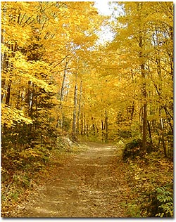
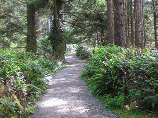
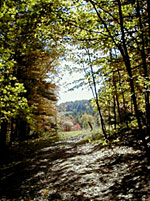
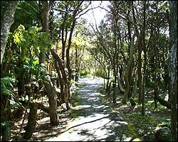
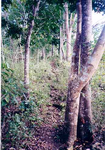
| Hiking Trails |
| Before you go hiking get you weather forecast below. |

|
 |