August 7, 1999
I misread my map yesterday. I was expecting about 100 km and the ride to Asbyrgi was a solid 125 km. The last 20 km was across the Jökulsá á fjöllum river delta and into a bit of a headwind. Carbohydrate replacement was spaghetti, a whole package of chocolate covered oatmeal cookies, tea, cocoa and some hverabraud ( a really heavy rye bread that is cooked in hot soil near Reykalið with jam.I followed the road north for about 10km before turning east to cross the Hólaheiði.
The Hóheiði road was a bit tough. It was loose and rough, although ridable, except for a few steep uphills. The most difficult climbs were, of course, near the end. In the middle of the ride it blew and rained some. It was a 6 hour ride for 80 km. But, I probably saw less than 15 cars all day.
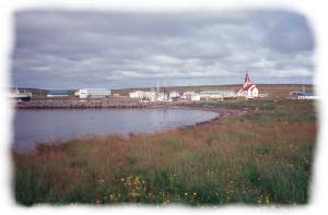
Raufarhöfn, pop. 400 It was windy and cold. There was only one other person in the towns campground, a circular wind bunker near the harbor. The town has been a port since viking times. This turned out to be a pretty good bird watching area.
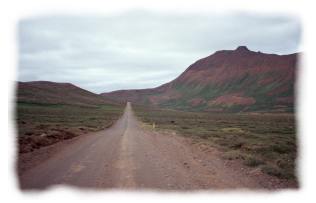
The high point and low point of the day, separated by 3 km of 14% grade.
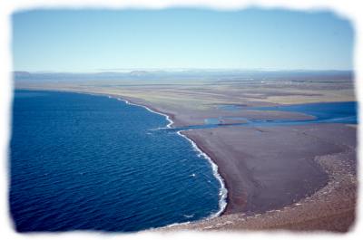
Asbyrgi lies 20km away on the other side of this plain
August 8, 1999
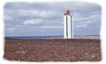
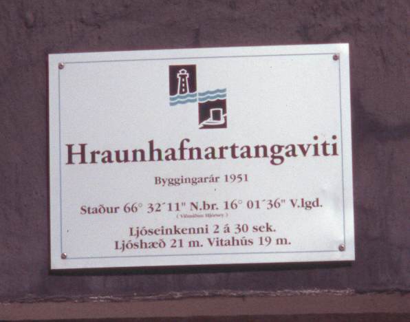
This is it. The northernmost point in Iceland, except for the little island of Grimsey. It
a low rocky pennisula, with a lighthouse and a viking grave mound. The plaque on the lighthouse shows that it is just 2 km south of the Arctic circle. I saw eider ducks,
and some ptarmigan near here. There are some old turf ruins near the lighthouse and hundreds of fishing floats, big steel ones, plastic ones, yellow ones, cork ones, you name it. I was passed by 6 cars in 5 hours. It was calm and peaceful. I loved every minute of this day.


