
The East Fork of the Lewis River in Southwest Washington is currently listed as an "endangered river," by American Rivers. Go to
americanrivers. org to find out more about this beautiful river.
Moulton Falls Park
| Lewis River | ||||||||||||||||||||||||||
|
||||||||||||||||||||||||||
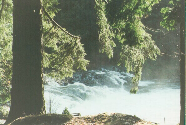
| The Lewis River has two forks, the North Fork and the East Fork. Both forks run from the Gifford Pinchot National Forest to the point where they both join before entering the Columbia River. The North Fork has dams on it that have created lakes, Merwin and Yale ; There are fish hatcheries on the North Fork as well. The East Fork does not have dams. There are some nice parks on the East Fork.. Moulton Falls Park is one of my favorite parks because it has many native plants in it and it is a nice place for short hikes. American Dippers also have their home in this park and they can be seen fishing for insect larvae and other creatures on the bottom of the river. People also swim and fish in this park, but I did not bring my children there when they were very small because the river is too rough. Lewisville Park is a better park for small children. Lucia Falls Park is also beautiful but it does not allow water contact in the park because of endangered fish. Last Spring we saw Steelhead jumping up the falls in Lucia Falls Park. It was very exciting. The East Fork of the Lewis River in Southwest Washington is currently listed as an "endangered river," by American Rivers. Go to americanrivers. org to find out more about this beautiful river. |
||||||||||||||||||||||||||
| East Fork of the Lewis River Moulton Falls Park |
||||||||||||||||||||||||||
|
||||||||||||||||||||||||||
|
||||||||||||||||||||||||||
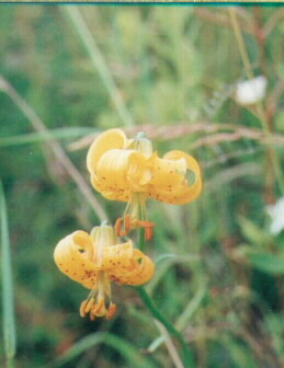
| Tiger Lily (Lilium columbianum) near Yacolt. | ||||||||||||||||||||||||||
| Links | ||||||||||||||||||||||||||
| Lucia Falls Park ( a " Fish Friendly Park") East Fork of the Lewis River | ||||||||||||||||||||||||||
| Floating Down the Lewis River | ||||||||||||||||||||||||||
| American Rivers | ||||||||||||||||||||||||||
| Mount St. Helens(Ape Cave) | ||||||||||||||||||||||||||
| Endangered Fish in Clark County WA | ||||||||||||||||||||||||||
| Grand Floral Parade | ||||||||||||||||||||||||||
| Winter Steelhead on the East Fork Lewis River (map) | ||||||||||||||||||||||||||
| The map is the East Fork of the Lewis River in the vicinity of Yacolt Mountain (north) and Heisson (south). The blue lines represent riparian zones along the East Fork and Rock Creek. Some of the smaller riparian zones are not shown at this scale. Brown lines indicate different watersheds along the East Fork. The red lines indicate known distribution of winter steelhead in the East Fork, Rock Creek, and Bricke Creek. This map can be manipulated by selecting different species or map types. You can also go to www.rtc.wa.gov to have a greater selection and explanation of maps in Clark County WA. | ||||||||||||||||||||||||||
| Photos by B. Maehara | ||||||||||||||||||||||||||